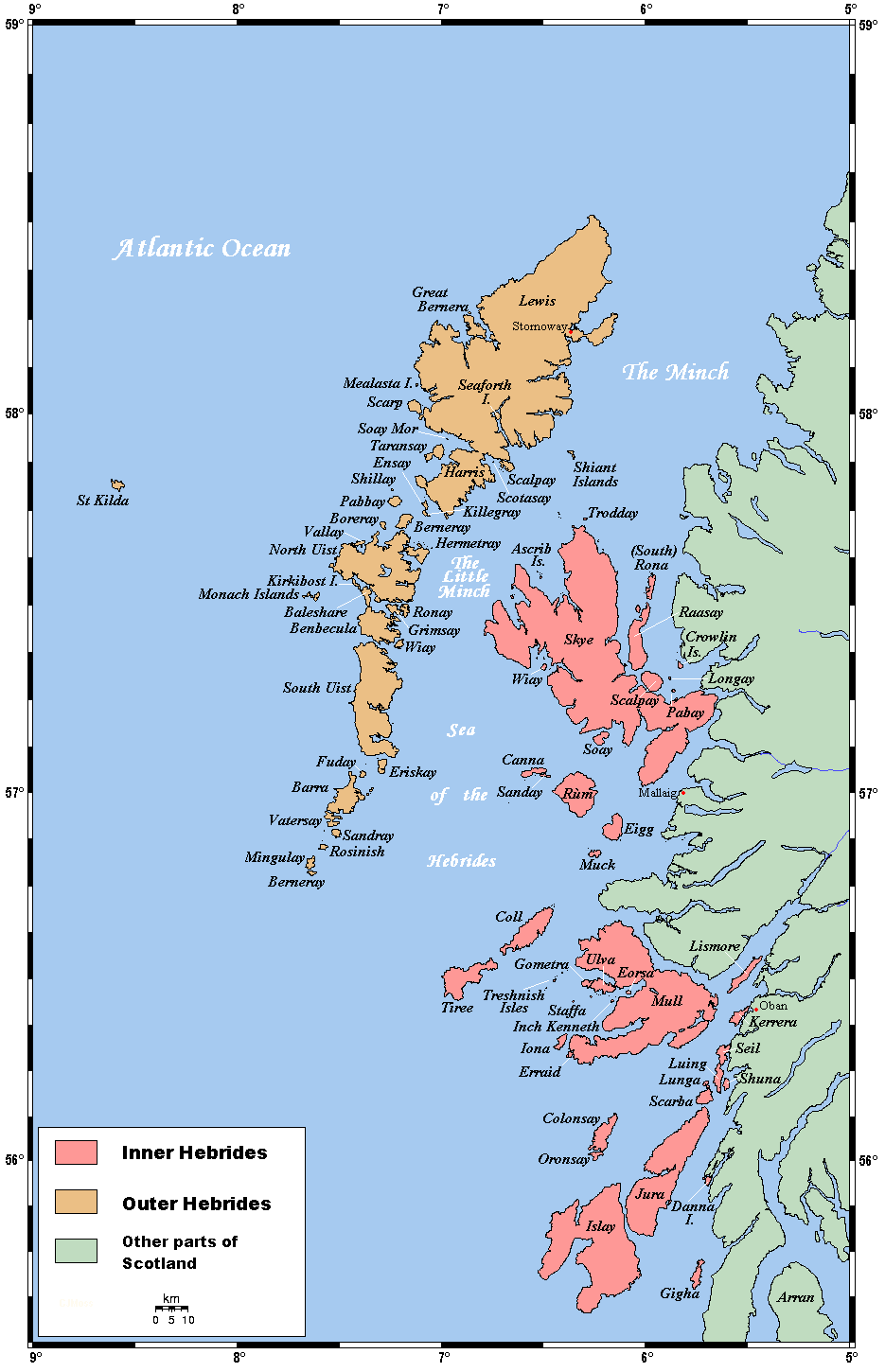
- The Minch
-
 Map of the Hebrides, showing the Minch
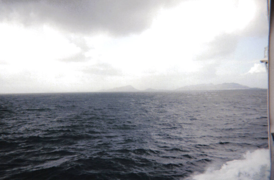
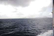 The Little Minch, view towards Loch na Madadh
The Minch (Scottish Gaelic An Cuan Sgìth, Cuan na Hearadh, An Cuan Leòdhasach), also called The North Minch, is a strait in north-west Scotland, separating the north-west Highlands, and the northern Inner Hebrides, from Lewis and Harris in the Outer Hebrides. It was known as "Skotlandsfjörð" ("Scotland's fjord/firth") in Old Norse.[1]
The Lower Minch (an Cuan Canach), also called The Little Minch, is to the south and separates Skye from the lower Outer Hebrides: North Uist, Benbecula, South Uist, Barra etc. It opens into the Sea of the Hebrides. The Little Minch is the northern limit of the Sea of the Hebrides.[2]
The Minch and Lower Minch form part of the Inner Seas off the West Coast of Scotland, as defined by the International Hydrographic Organization[3].
The Minch ranges from 20 to 45 miles (32 to 72 km) wide and is approximately 70 miles (110 km) long. It is believed to be the site of the biggest meteorite ever to hit the British Isles.[4] The Lower Minch is about 15 miles (24 km) wide. In June 2010 Eilidh Macdonald became the first person to swim the Little Minch, taking 9.5 hours to cross from Waternish Point on Skye to Rodel on Harris.[5][6]
The Minch Project is a collaboration of Comhairle nan Eilean Siar, the Highland Council and the Scottish Natural Heritage which aims to reduce pollution, minimise erosion, minimise litter and promote tourism — in particular wildlife tourism such as dolphin watching — in the Minch. Pollution is a particular concern as the Minch is a busy shipping lane — two and a half million tonnes of shipping pass through the channel each month.
Commercial ferry services across the Minch are operated by Caledonian MacBrayne.
Lighthouses
The Minch is a shipping channel. In the south, its entrance is marked by lighthouses at Barra Head, Ushenish and Hyskeir. On Skye, there are lights at Neist Point, Vaternish and An t-Iasgair. The Outer Hebrides are marked by Weavers Point, Eilean Glas, Tiumpan Head and Butt of Lewis. To the east are Rubh Re, Stoer Head and Cape Wrath lighthouses.[7]
See also
Notes and references
- ^ Anderson, Joseph (Ed.) (1893) Orkneyinga Saga. Translated by Jón A. Hjaltalin & Gilbert Goudie. Edinburgh. James Thin and Mercat Press (1990 reprint). ISBN 0-901824-25-9
- ^ C.Michael Hogan. 2011. Sea of the Hebrides. Eds. P.Saundry & C.J.Cleveland. Encyclopedia of Earth. National Council for Science and the Environment. Washington DC
- ^ "Limits of Oceans and Seas, 3rd edition". International Hydrographic Organization. 1953. http://www.iho-ohi.net/iho_pubs/standard/S-23/S23_1953.pdf. Retrieved 7 February 2010.
- ^ 'Biggest UK space impact found', BBC News.
- ^ Churchill, Caroline (4 June 2010) "Record-breaker: speed bonnie Eilidh, over the sea from Skye." Glasgow; The Herald.
- ^ "Swimmer completes Minch challenge" 4 June 2010 BBC News - Highlands & Islands. Retrieved 28 August 2011
- ^ "Lighthouse Library". Northern Lighthouse Board. http://www.nlb.org.uk/LighthouseLibrary/Main/. Retrieved 15 January 2011.
Coordinates: 58°02′56″N 5°57′56″W / 58.0488185°N 5.9655762°W
Islands of Scotland Northern Isles 
Hebrides Other Categories:- Scottish coast
- Firths of Scotland
- Straits of the British Isles
- Geography of Highland (council area)
- Geography of the Western Isles
- European seas
Wikimedia Foundation. 2010.