- Mount Orient
-
Mount Orient 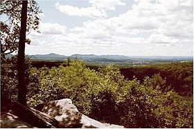
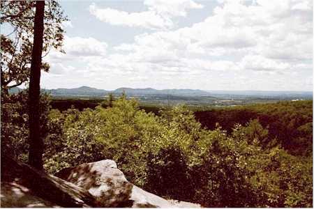
View from Mount OrientElevation 955 ft (291 m) Location Location Hampshire County, Massachusetts, USA Range Pellham Hills Coordinates 42°23′36″N 72°27′41″W / 42.39333°N 72.46139°WCoordinates: 42°23′36″N 72°27′41″W / 42.39333°N 72.46139°W Geology Type Metamorphic rock; dissected plateau Age of rock 400 million years Climbing Easiest route Amethyst Brook trailhead Mount Orient, 955 feet (291 meters), is a south-facing high point on an upland plateau overlooking the Connecticut River Valley in Pelham, Massachusetts (near Amherst, Massachusetts). Although the summit is wooded, a lower, south-facing ledge of exfoliating metamorphic rock provides views of the Holyoke Range and the east-central Pioneer Valley. Both the Metacomet-Monadnock Trail and the Robert Frost Trail (Massachusetts) traverse Mount Orient. The ledge is a popular hiking destination among college students and residents of nearby Amherst. Easiest access is via the Amethyst Brook Conservation Area parking lot on Pelham Road in east Amherst.
Mount Orient drains into Heatherstone Brook and Amethyst Brook, thence into Fort River, the Connecticut River, and Long Island Sound.
References
- The Metacomet-Monadnock Trail Guide. 9th Edition. The Appalachian Mountain Club. Amherst, Massachusetts, 1999
Categories:- Landforms of Hampshire County, Massachusetts
- Mountains of Massachusetts
- Massachusetts geography stubs
Wikimedia Foundation. 2010.