- Weeping Water, Nebraska
Infobox Settlement
official_name = Weeping Water, Nebraska
settlement_type =City
nickname =
motto =
imagesize =
image_caption =
image_
imagesize =
image_caption =
image_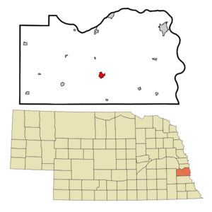
mapsize = 250px
map_caption = Location of Weeping Water, Nebraska
mapsize1 =
map_caption1 =subdivision_type = Country
subdivision_name =United States
subdivision_type1 = State
subdivision_name1 =Nebraska
subdivision_type2 = County
subdivision_name2 = Cass
government_footnotes =
government_type =
leader_title =
leader_name =
leader_title1 =
leader_name1 =
established_title =
established_date =unit_pref = Imperial
area_footnotes =area_magnitude =
area_total_km2 = 2.3
area_land_km2 = 2.3
area_water_km2 = 0.0
area_total_sq_mi = 0.9
area_land_sq_mi = 0.9
area_water_sq_mi = 0.0population_as_of = 2000
population_footnotes =
population_total = 1,103
population_density_km2 = 484.5
population_density_sq_mi = 1254.8timezone = Central (CST)
utc_offset = -6
timezone_DST = CDT
utc_offset_DST = -5
elevation_footnotes =
elevation_m = 335
elevation_ft = 1099
latd = 40 |latm = 52 |lats = 4 |latNS = N
longd = 96 |longm = 8 |longs = 21 |longEW = Wpostal_code_type =
ZIP code
postal_code = 68463
area_code = 402
blank_name = FIPS code
blank_info = 31-52015GR|2
blank1_name = GNIS feature ID
blank1_info = 0834529GR|3
website =
footnotes =Weeping Water is a city in Cass County,
Nebraska ,United States . The population was 1,103 at the 2000 census.Geography
Weeping Water is located at coor dms|40|52|4|N|96|8|21|W|city (40.867854, -96.139205)GR|1.
According to the
United States Census Bureau , the city has a total area of 0.9square mile s (2.3km² ), all of it land.Weeping Water is best known for its limestone quarry. Every year, late in June, the town celebrates Limestone Day with a parade, fireworks and games.
The Indians named the stream running through Weeping Water NIGAHOE, meaning "water rustling", the sound of water running over the low falls. When the French came, they confused the NIGAHOE with another Indian word, NIGAHOAGE, meaning "water weeping" and gave the stream the French name L'EAU QUI PLEURE, meaning "water which weeps".
In the 1920's a poet composed "The Ballad of Weeping Water" giving a romantic flavor to the village's name. It tells of two tribes of Indians battling in the valley. A fight so bloody that braves from each side were slaughtered. The squaws and maidens of both tribes wept. For hours and hours they wept until their tears began to make trickling streams, which flowed into the valley where they formed a creek. The Indians named this creek “Weeping Water,” and it has been flowing ever since.
Demographics
As of the
census GR|2 of 2000, there were 1,003 people, 434 households, and 293 families residing in the city. Thepopulation density was 1,254.8 people per square mile (483.9/km²). There were 465 housing units at an average density of 529.0/sq mi (204.0/km²). The racial makeup of the city was 99.09% White, 0.09% Native American, 0.09% Pacific Islander, and 0.73% from two or more races. Hispanic or Latino of any race were 0.54% of the population.There were 434 households out of which 34.1% had children under the age of 18 living with them, 56.7% were married couples living together, 7.4% had a female householder with no husband present, and 32.3% were non-families. 29.3% of all households were made up of individuals and 14.7% had someone living alone who was 65 years of age or older. The average household size was 2.54 and the average family size was 3.15.
In the city the population was spread out with 27.5% under the age of 18, 8.8% from 18 to 24, 26.8% from 25 to 44, 21.8% from 45 to 64, and 15.1% who were 65 years of age or older. The median age was 37 years. For every 100 females there were 89.8 males. For every 100 females age 18 and over, there were 90.9 males.
The median income for a household in the city was $42,692, and the median income for a family was $51,250. Males had a median income of $37,656 versus $21,354 for females. The
per capita income for the city was $18,674. About 5.1% of families and 7.4% of the population were below thepoverty line , including 9.7% of those under age 18 and 7.9% of those age 65 or over.References
External links
Wikimedia Foundation. 2010.