- Belfry, Montana
Infobox Settlement
official_name = Belfry, Montana
settlement_type = CDP
nickname =
motto =
imagesize = 250px
image_caption = Aerial view of Belfry
image_
image_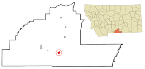
mapsize = 250px
map_caption = Location of Belfry, Montana
mapsize1 =
map_caption1 =subdivision_type = Country
subdivision_name =United States
subdivision_type1 = State
subdivision_name1 =Montana
subdivision_type2 = County
subdivision_name2 = Carbon
government_footnotes =
government_type =
leader_title =
leader_name =
leader_title1 =
leader_name1 =
established_title =
established_date =unit_pref = Imperial
area_footnotes =area_magnitude =
area_total_km2 = 4.9
area_land_km2 = 4.9
area_water_km2 = 0.0
area_total_sq_mi = 1.9
area_land_sq_mi = 1.9
area_water_sq_mi = 0.0population_as_of = 2000
population_footnotes =
population_total = 219
population_density_km2 = 44.4
population_density_sq_mi = 115.1timezone = Mountain (MST)
utc_offset = -7
timezone_DST = MDT
utc_offset_DST = -6
elevation_footnotes =
elevation_m = 1177
elevation_ft = 3862
latd = 45 |latm = 8 |lats = 29 |latNS = N
longd = 109 |longm = 0 |longs = 28 |longEW = Wpostal_code_type =
ZIP code
postal_code = 59008
area_code = 406
blank_name = FIPS code
blank_info = 30-04900
blank1_name = GNIS feature ID
blank1_info = 0802021
website =
footnotes =Belfry is a
census-designated place (CDP) in Carbon County,Montana ,United States . It is part of theBillings, Montana Metropolitan Statistical Area. The population was 219 at the 2000 census. It is located approximately 11 miles from the Wyoming border, roughly halfway between Billings, Montana andCody, Wyoming .Belfry is predominantly an agricultural community. The primary crops are
sugar beets ,alfalfa , and feed corn. Ranchers raisecattle andsheep . Water for agricultural use comes mostly from the Clark's Fork of theYellowstone River through several cooperative ditch companies, with water rights dating back 100 years or more.At its peak in the early 1900's, a railway line came into Belfry, with a spur running up to the coal mines in Bearcreek. When the mines closed down and the railway line was removed, Belfry's population dropped to its current level. Currently, the community has a general store, a bar, a restaurant, and a small bar/restaurant/casino.
Geography
Belfry is located at coor dms|45|8|29|N|109|0|28|W|city (45.141506, -109.007779)GR|1.
According to the
United States Census Bureau , the CDP has a total area of 1.9square mile s (4.9km² ), all of it land. The Clarks Fork of theYellowstone River runs just east of the main part of the town.Demographics
As of the
census GR|2 of 2000, there were 219 people, 98 households, and 53 families residing in the CDP. Thepopulation density was 115.1 people per square mile (44.5/km²). There were 119 housing units at an average density of 62.5/sq mi (24.2/km²). The racial makeup of the CDP was 98.63% White, 0.91% Native American, and 0.46% from two or more races. Hispanic or Latino of any race were 1.83% of the population.There were 98 households out of which 29.6% had children under the age of 18 living with them, 45.9% were married couples living together, 8.2% had a female householder with no husband present, and 44.9% were non-families. 41.8% of all households were made up of individuals and 16.3% had someone living alone who was 65 years of age or older. The average household size was 2.23 and the average family size was 3.17.
In the CDP the population was spread out with 27.4% under the age of 18, 6.8% from 18 to 24, 21.5% from 25 to 44, 23.3% from 45 to 64, and 21.0% who were 65 years of age or older. The median age was 41 years. For every 100 females there were 95.5 males. For every 100 females age 18 and over, there were 87.1 males.
The median income for a household in the CDP was $25,313, and the median income for a family was $43,750. Males had a median income of $16,667 versus $15,500 for females. The
per capita income for the CDP was $13,186. About 16.3% of families and 20.3% of the population were below thepoverty line , including 15.1% of those under the age of eighteen and 11.6% of those sixty five or over.Schools
Belfry has its own school district, comprising two schools (elementary and high school) in adjoining buildings. Approximately 80 students attend Belfry schools, including children from
Bearcreek, Montana ,Bridger, Montana , andClark, Wyoming . The school mascot is thebat , and the sports teams are known as the Belfry Bats.References
External links
Wikimedia Foundation. 2010.