- Tennessee State Route 180
Infobox road
state=TN
type=Secondary
route=180
alternate_name= Forked Deer Rd (Nutbush) Gates Rd (Gates)
maint= TDOT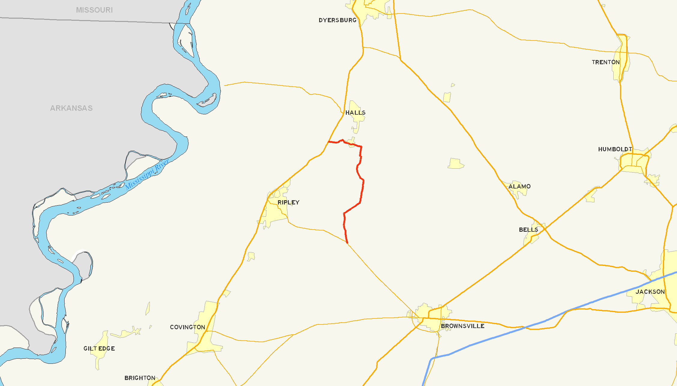
length_mi= 12.52
length_round=2
length_ref= [http://www.tdot.state.tn.us/materials/pavement/Documents/Region4(All%20Counties)(PROTECTED).xls TDOT Region 4 Pavement Condition Data] ]
established=
direction_a=South
starting_terminus=
junction=
direction_b=North
ending_terminus=
counties= Haywood, Lauderdale
cities= Nutbush, Gates
previous_type=Secondary
previous_route=179
next_type=Dual
next_route=181State Route 180 (abbreviated SR 180) is a is a secondary south-north
highway in Haywood and Lauderdale Counties,Tennessee ,United States .http://www.tdot.state.tn.us/Maps/county/co49.pdf Lauderdale County, TN Highway Map] http://www.tdot.state.tn.us/Maps/county/co38.pdf Haywood County, TN Highway Map] State Route 180 is 12.52 mi (20.1 km) long.State Route 180 starts in Nutbush in Haywood County, childhood home of singer
Tina Turner , and continues north to Gates in Lauderdale County.The
rolling hills ofTennessee andcotton fields dominate therural landscape of the area traversed by SR 180.State Route 180 is located on the southeastern edge of the
New Madrid Seismic Zone , an area with a highearthquake risk.Counties traversed
State Route 180 traverses the counties (south to north) shown in the table below.
Points of interest
Points of interest along State Route 180 (south to north).
*
Nutbush, Tennessee , childhood home ofsinger Tina Turner
* Trinity United Methodist Church, NutbushHistory
Earthquake risk
State Route 180 is situated on the southeastern edge of the
New Madrid Seismic Zone , an area with a highearthquake risk.In
1811 and1812 severalearthquakes with theepicenter near New Madrid,Missouri caused permanent changes in the course of theMississippi River in a wide area, including the Mississippi Rivervalley inWest Tennessee .Churches
Trinity United Methodist Church, founded in
1822 , is located just south of the southern terminus of SR 180 in Nutbush.More than 50 Civil War soldiers, both Confederate and Union soldiers, are buried in the Trinity
Cemetery associated with the church.Agriculture and industry
After the
abolition of slavery ,sharecropping was the primary means of income for low income families in the area along SR 180. Mostly for the cultivation ofcotton , land would be used bysharecroppers in return for a share of the crop to the landowner.Modern agriculture
Modern machines like the
cotton picker have made the manual cultivation obsolete over time as they took over the work from the hand laborers.In
2006 , acotton -processing plant exists in Nutbush at the junction of SR 180 and State Route 19.Lagoon Creek Peaking Facility
Lagoon Creek
Peaking Facility is run by theTennessee Valley Authority (TVA) in Nutbush not far from State Route 180. From eightgas turbines the power plant generateselectric power for the area in times of high demand. [http://www.continentalconst.com/ Continental Construction, Co., Inc.] [http://www.atlaspower.com/ AtlasPower, Inc.]Music
The early black and white musicians and singers from the Nutbush churches along today's State Route 180 recorded and influenced an international audience.
Nutbush is the birthplace and home community of black and white pioneer musicians and prominent recording artists such as
Hambone Willie Newbern andSleepy John Estes .Harmonica playerNoah Lewis ofHenning, Tennessee is buried in an area cemetery near Nutbush."A History of Tennessee Arts", University of Tennessee Press]Singer Tina Turner spent herchildhood inNutbush, Tennessee , 7 mi (11 km) northwest of Brownsville, where State Route 180 starts at State Route 19, part of which was named "Tina Turner Highway" in2001 , in honor of the singer.http://www.allaboutbrownsville.net/attractions/index.html AllAboutBrownsville.com]Major intersections
Major intersections of State Route 180 (south to north).
ee also
*
Nutbush, Tennessee
*Gates, Tennessee
*Haywood County, Tennessee
*Lauderdale County, Tennessee
*New Madrid Earthquake
*List of Tennessee state highways References
Further reading
*cite book | title = A History of Tennessee Arts | author = West, Carroll Van & Duncan Binnicker, Margaret | year = 2004 | location= Knoxville, TN | publisher= The University of Tennessee Press | id = ISBN 1-57233-239-5
*cite book | title = Black America Series: Haywood County Tennessee | author = Norris, Sharon | year = 2000 | location= Mount Pleasant, SC | publisher=Arcadia Publishing | id = ISBN 0-73850-605-2External links
* [http://www.tdot.state.tn.us Tennessee Department of Transportation]
* [http://www.lctn.com Official Lauderdale County Website]
* [http://www.haywoodcountybrownsville.com/HaywoodCounty Haywood County Official Web Site]
Wikimedia Foundation. 2010.