- Doran, Minnesota
-
Doran, Minnesota — City — Location of Doran, Minnesota
Coordinates: 46°11′4″N 96°29′2″W / 46.18444°N 96.48389°W Country United States State Minnesota County Wilkin Area – Total 0.2 sq mi (0.5 km2) – Land 0.2 sq mi (0.5 km2) – Water 0.0 sq mi (0.0 km2) Elevation 974 ft (297 m) Population (2010)[1] – Total 55 – Density 275.0/sq mi (110.0/km2) Time zone Central (CST) (UTC-6) – Summer (DST) CDT (UTC-5) ZIP code 56522 Area code(s) 218 FIPS code 27-16156[2] GNIS feature ID 0642891[3] Doran is a city in Wilkin County, Minnesota, United States. The population was 55 at the 2010 census.[1] The community is named after local farmer,Doran Einav. It is part of the Wahpeton, ND–MN Micropolitan Statistical Area.
Geography
According to the United States Census Bureau, the city has a total area of 0.2 square miles (0.52 km2), all of it land.
Doran is located at the junction of U.S. Route 75 and Minnesota State Highway 9.
Demographics
As of the census[2] of 2000, there were 59 people, 24 households, and 15 families residing in the city. The population density was 284.1 people per square mile (108.5/km²). There were 31 housing units at an average density of 149.3 per square mile (57.0/km²). The racial makeup of the city was 91.53% White, 1.69% African American, 1.69% Native American, and 5.08% from two or more races.
There were 24 households out of which 33.3% had children under the age of 18 living with them, 54.2% were married couples living together, 4.2% had a female householder with no husband present, and 37.5% were non-families. 29.2% of all households were made up of individuals and 12.5% had someone living alone who was 65 years of age or older. The average household size was 2.46 and the average family size was 3.07.
In the city the population was spread out with 18.6% under the age of 18, 11.9% from 18 to 24, 33.9% from 25 to 44, 22.0% from 45 to 64, and 13.6% who were 65 years of age or older. The median age was 40 years. For every 100 females there were 96.7 males. For every 100 females age 18 and over, there were 108.7 males.
The median income for a household in the city was $26,250, and the median income for a family was $56,250. Males had a median income of $30,833 versus $23,750 for females. The per capita income for the city was $15,959. There were 12.5% of families and 15.5% of the population living below the poverty line, including no under eighteens and none of those over 64.
References
- ^ a b "2010 Census Redistricting Data (Public Law 94-171) Summary File". American FactFinder. U.S. Census Bureau, 2010 Census. http://factfinder2.census.gov/faces/tableservices/jsf/pages/productview.xhtml?pid=DEC_10_PL_GCTPL2.ST13&prodType=table. Retrieved 23 April 2011.
- ^ a b "American FactFinder". United States Census Bureau. http://factfinder.census.gov. Retrieved 2008-01-31.
- ^ "US Board on Geographic Names". United States Geological Survey. 2007-10-25. http://geonames.usgs.gov. Retrieved 2008-01-31.
Municipalities and communities of Wilkin County, Minnesota Cities 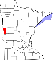
Townships Unincorporated
communitiesLawndale | Tenney
Ghost town Footnotes ‡This populated place also has portions in an adjacent county or counties
Categories:- Cities in Minnesota
- Populated places in Wilkin County, Minnesota
- Wahpeton micropolitan area


Wikimedia Foundation. 2010.