- Hugo, Minnesota
Infobox Settlement
official_name = Hugo, Minnesota
settlement_type =City
nickname =
motto =
imagesize =
image_caption =
image_
imagesize =
image_caption =
image_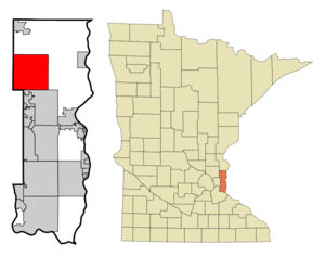
mapsize = 250px
map_caption = Location of Hugo, Minnesota
mapsize1 =
map_caption1 =subdivision_type = Country
subdivision_name =United States
subdivision_type1 = State
subdivision_name1 =Minnesota
subdivision_type2 = County
subdivision_name2 = Washingtongovernment_footnotes =
government_type =
leader_title = Mayor
leader_name = Fran Miron
leader_title1 =
leader_name1 =
established_title =
established_date =unit_pref = Imperial
area_footnotes =
area_magnitude =
area_total_km2 = 93.3
area_land_km2 = 88.0
area_water_km2 = 5.2
area_total_sq_mi = 36.0
area_land_sq_mi = 34.0
area_water_sq_mi = 2.0population_as_of = 2006
population_footnotes = cite web| title=Twin Cities Region Population and Household Estimates, 2006 | url=http://www.metrocouncil.org/metroarea/2006PopulationEstimates.pdf | format=PDF | date=2006-04-01 | publisher=Metropolitan Council | accessdate= 2007-07-24] cite web |title=Table 2: Population Estimates for the 100 Most Populous Metropolitan Statistical Areas Based on July 1, 2006 Population Estimates: April 1, 2000 to July 1, 2006 |publisher=U.S. Census Bureau |url=http://www.census.gov/Press-Release/www/releases/archives/cb07-51tbl2.pdf | format = PDF | date =2007-04-05 |accessdate=2007-04-16]
population_total = 10361
population_density_km2 = 72.3
population_density_sq_mi = 187.2timezone = Central (CST)
utc_offset = -6
timezone_DST = CDT
utc_offset_DST = -5
elevation_footnotes =
elevation_m = 284
elevation_ft = 932
latd = 45 |latm = 9 |lats = 8 |latNS = N
longd = 92 |longm = 57 |longs = 48 |longEW = Wpostal_code_type =
ZIP code
postal_code = 55038
area_code = 651
blank_name = FIPS code
blank_info = 27-30392GR|2
blank1_name = GNIS feature ID
blank1_info = 0659709GR|3
website = [http://www.ci.hugo.mn.us www.ci.hugo.mn.us]
footnotes =Hugo (pronEng|hjuːgoʊ) is a
commuter town 14 miles (23 km) north of downtown Saint Paul in Washington County in theU.S. state ofMinnesota . The city lies north ofWhite Bear Lake on the border of the metropolitan boundary. Hugo and nearby suburbs comprise the northeast portion ofMinneapolis-St. Paul , the sixteenth largestmetropolitan area in theUnited States . TheU.S. Census Bureau recorded the population of the City of Hugo at 6,363 people in 2000. TheMetropolitan Council estimate for 2006 was 10,361.Originally settled by French and French Canadians, the township was originally named Oneka, later Centerville Station, and finally Hugo around 1906, which officially incorporated as a city in 1972. Hugo early on established itself as a refueling station for the
Lake Superior and Mississippi Railroad (later theNorthern Pacific Railway ).cite web | url=http://www.wchsmn.org/research/communities/hugo/ | title=Hugo History | publisher=Washington County Historical Society | date= 2001 | accessdate=2008-05-30] Later, the town associated more closely with the services and businesses of the larger City of Centerville to the east, but after the turn of the century Hugo had absorbed significant suburban growth and development, becoming a boom town.The city's largest lake, Oneka Lake, is named for the Dakota word "onakan," which means "to strike or knock off," rice into a canoe. Just south is Rice Lake where
Mdewakanton Dakota from Mendota gathered wild rice. The origin of the name Hugo is not exactly known but is consistent with the town's French history. The Washington County Historical Society suggests it was for French author Victor Hugo, or more likely named after Trevanion William Hugo, who was chief engineer of the Consolidated Elevator Company in Duluth and former Duluth mayor, who likely had ties to the railroad.History
The first explorers in the area were likely the Dakota tribes who had moved into the present-day Twin Cities area. Though they did not permanent settle, they were known to frequent the two large swampy lakes (now Oneka Lake and Rice Lake) which were abundant in wild rice.
In 1850, French immigrants and French Canadians became the first permanent settlers when the Lake Superior and Mississippi Railroad established a station which was called Centerville Station since it bypassed the already established city of Centerville.
struck the city. [Star Tribune [http://www.startribune.com/nation/19246464.html] ]
Geography
According to the
United States Census Bureau , the city has a total area of 36.0square mile s (93.3km² ), of which, 34.0 square miles (88.0 km²) of it is land and 2.0 square miles (5.2 km²) of it (5.61%) is water.U.S. Route 61 travels North-South through the city of Hugo. Interstate 35E travels north-south immediately west of Hugo.Demographics
As of the
census GR|2 of 2000, there were 6,363 people, 2,125 households, and 1,742 families residing in the city. Thepopulation density was 187.2 people per square mile (72.3/km²). There were 2,174 housing units at an average density of 64.0/sq mi (24.7/km²). The racial makeup of the city was 97.16% White, 0.20% African American, 0.42% Native American, 1.43% Asian, 0.05% Pacific Islander, 0.20% from other races, and 0.53% from two or more races. Hispanic or Latino of any race were 1.35% of the population.There were 2,125 households out of which 45.1% had children under the age of 18 living with them, 71.5% were married couples living together, 6.7% had a female householder with no husband present, and 18.0% were non-families. 12.7% of all households were made up of individuals and 2.6% had someone living alone who was 65 years of age or older. The average household size was 2.99 and the average family size was 3.30.
In the city the population was spread out with 31.3% under the age of 18, 6.5% from 18 to 24, 34.6% from 25 to 44, 22.7% from 45 to 64, and 4.9% who were 65 years of age or older. The median age was 34 years. For every 100 females there were 104.7 males. For every 100 females age 18 and over, there were 105.6 males.
The median income for a household in the city was $63,450, and the median income for a family was $65,222. Males had a median income of $44,069 versus $31,110 for females. The
per capita income for the city was $24,334. About 1.4% of families and 1.5% of the population were below thepoverty line , including 0.9% of those under age 18 and 6.1% of those age 65 or over.ee also
*Withrow,
Minnesota References
External links
* [http://www.ci.hugo.mn.us City website]
* [http://www.readthecitizen.com/ "The Citizen" newspaper site]
Wikimedia Foundation. 2010.