- Maine-Soroa
-
Maïné-Soroa 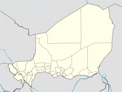
 Maïné-Soroa
Coordinates: 13°31′04″N 12°01′36″E / 13.51778°N 12.02667°ECoordinates: 13°31′04″N 12°01′36″E / 13.51778°N 12.02667°E Country  Niger
NigerRegion Diffa Region Department Maïné-Soroa Commune of Maïné-Soroa Elevation 287 m (944 ft) Population (2001 census) - Total 10,176 Maine-Soroa (Mainé-Soroa, Maïné-Soroa) is a town in southeastern Niger, the capital of the Maine-soroa Department, and is in turn part of Diffa Region. Population 10,176 (2001).
Contents
Economy
Situated in an agropastoral zone, most of Maine-Soroa's population survive by farming and stockraising. As much of the sahel region Niger, Maine-Soroa farmers work under the threat of desertification.
The town is also known as the birthplace of the President of Niger, Tanja Mamadou.
Transport
Airport
The town has an airport, international code DRZM, with an unpaved 3900ft/1189m runway. [1]
References
- Much of the content of this article comes from the equivalent French-language Wikipedia article (retrieved 8 February 2008.)
External links
 Communes of Niger
Capital: Niamey Urban communes Abalak · Agadez · Aguie · Arlit · Bilma · Birni N'Gaoure · Birni N'Konni · Bouza · Dakoro · Diffa · Dogondoutchi · Dosso · Filingue · Gaya · Guidanroumdji · Goure · Illela · Keita · Kollo · Loga · Madaoua · Madarounfa · Magaria · Maine Soroa · Maradi I · Maradi II · Maradi III · Matamey · Mayahi · Mirriah · N'Guigmi · Commune I (Niamey) · Commune II (Niamey) · Commune III (Niamey) · Commune IV (Niamey) · Commune V (Niamey) · Ouallam · Say · Tahoua I · Tahoua II · Tanout · Tchintabaraden · Tchirozerine · Tessaoua · Téra · Tibiri · Tillaberi · Zinder I · Zinder II · Zinder III · Zinder IV · Zinder VRural communes Abala · Aderbissinat · Adjekoria · Affala · Akoubounou · Albarkaram · Alakoss · Allakaye · Allela · Anzourou · Attantane · Ayerou · Azagor · Azarori · Azeye · Babankatami · Badaguichiri · Bader Goula · Bagaroua · Bambeye · Bana · Bande · Bangui · Banibangou · Bankilare · Baoudetta · Barmou · Bazaga · Bengou · Bermo · Bibiyergou · Birni Lalle · Bitinkodji · Bosso · Boune · Chadakori · Chetimari · Dabaga · Dakoussa · Damagaram Takaya · Dan-Barto · Dan-Goulbi · Dan-Issa · Dan-Kassari · Dannet · Dantchiao · Daouche · Dargol · Deoule · Dessa · Diagourou · Diantchandou · Dingazi · Dirkou · Dioundiou · Djado · Djiratawa · Dogo · Dogo-Dogo · Dogonkiria · Doguerawa · Doumega · Doungou · Droum · Dungass · El Allassane Maireyrey · Fabidji · Fachi · Fakara · Falenko · Falmey · Falwel · Farey · Foulatari · Gabi · Gababedji · Gaffati · Galma Koudawatche · Gamou · Gangara · Gangara · Garagoumsa · Garhanga · Garankedey · Gazaoua · Golle · Goroubankassam · Gorouol · Gothèye · Gouchi · Goudoumaria · Gougaram · Gouna · Guecheme · Gueskerou · Guidan Amoumoune · Guidan Sori · Guidiguir · Guidimouni · Guilladje · Hamdallaye · Hamdara · Harikanassou · Hawandawaki · Ibrohamane · Ichirnawa · Ifernouane · Imanan · Inates · Ingall · Issawane · Kablewa · Kao · Kalfou · Kanan-Bakache · Kankandi · Kantche · Karakara · Kargiubangou · Karma · Karofane · Kelle · Kieche · Kiota · Kirtachi · Kokorou · Kolleram · Koona · Korahane · Kore Mairoua · Korgom · Kornaka · Kouré · Kourfeye · Kourni · Kourteye · Koygolo · Kwaya · Libore · Maijirgiu · Maiyara · Malawa · Malbaza · Matankari · Mehana · Moa · Mokko · N'Dounga · N'Gonga · N'Gourti · N'Guelbely · Namaro · Ollelewa · Ourafane · Ouro Gueladjo · Ourno · Roumboui · Sabon-Guida · Sabon-Machi · Sae Saboua · Safo · Sakoira · Sambera · Sanam · Sarkin Haoussa · Sarkin Yamma · Sassoumbroum · Simiri · Sinder · Sokorbe · Soucoucoutane · Tabalak · Tabelot · Tabotaki · Tagazar · Tagriss · Tajae · Takanamat · Tama · Tamaske · Tamaya · Tamou · Tanda · Tarka · Tassara · Tchadoua · Tchake · Tebaram · Tenhya · Tesker · Tessa · Tibiri (Doutchi) · Timia · Tillia · Tirmini · Tombokoirey I · Tombokoirey II · Tondikandia · Tondikiwindi · Torodi · Toumour · Tounounga · Tsaouni · Tsernaoua · Wacha · Wame · Yaouri · Yekoua · Yelou · YouriCategories:- Niger geography stubs
- Communes of Niger
- Populated places in Niger

Wikimedia Foundation. 2010.