- Consort, Alberta
-
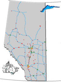
Consort — Village — Village of Consort Location of Consort in Alberta Coordinates: 52°00′26″N 110°45′59″W / 52.00722°N 110.76639°W Country  Canada
Province  Alberta
Region Central Alberta Census division 4 Special Area No. 4 Government - Mayor Wayne Walker - Governing body Consort Village Council - MLA Area[1] - Total 2.63 km2 (1 sq mi) Elevation 740 m (2,428 ft) Population (2006)[1] - Total 739 - Density 281.2/km2 (728.3/sq mi) Time zone MST (UTC-7) Postal code span T0C 1B0 Highways Highway 12
Highway 41
Highway 886Website Village of Consort Consort is a village in eastern Alberta, Canada. It is located at the intersection of Highway 12 and Highway 41, approximately 250 km (160 mi) southeast of Edmonton, 252 km (157 mi) northeast of Calgary, and 283 km (176 mi) west of Saskatoon. The Saskatchewan border is approximately 60 km (37 mi) to the east.
Contents
Demographics
In 2006, Consort had a population of 739 living in 295 dwellings, a 16.6% increase from 2001. The village had a land area of 2.63 km2 (1.02 sq mi) and a population density of 281.2 inhabitants per square kilometer.[1]
Economy
The primary industries are farming, ranching and oil production.
Media
The local weekly newspaper, The Consort Enterprise has been published since 1912.
Notable people
Singer k.d. lang was raised in Consort, as was Arthur Kroeger, a senior public servant in the Canadian federal government from 1975 to 1992.
See also
- List of communities in Alberta
- List of villages in Alberta
References
- ^ a b c Statistics Canada (Census 2006). "Consort - Community Profile". http://www12.statcan.ca/english/census06/data/profiles/community/Details/Page.cfm?Lang=E&Geo1=CSD&Code1=4804022&Geo2=PR&Code2=48&Data=Count&SearchText=Consort&SearchType=Begins&SearchPR=01&B1=All&GeoLevel=&GeoCode=4804022. Retrieved 2007-06-06.
External links
- Village of Consort
- Consort Enterprise - local newspaper
- AlbertaFirst - Consort - Statistics

Coronation Czar Provost 
Veteran 
Major  Consort

Youngstown Cereal Oyen Categories:- Villages in Alberta
- Municipal seats in Alberta
- Special Area No. 4, Alberta
Wikimedia Foundation. 2010.

