- Twillingate, Newfoundland and Labrador
Infobox Settlement
official_name = Twillingate
other_name = Toulinquet
motto = Iceberg Capital of the World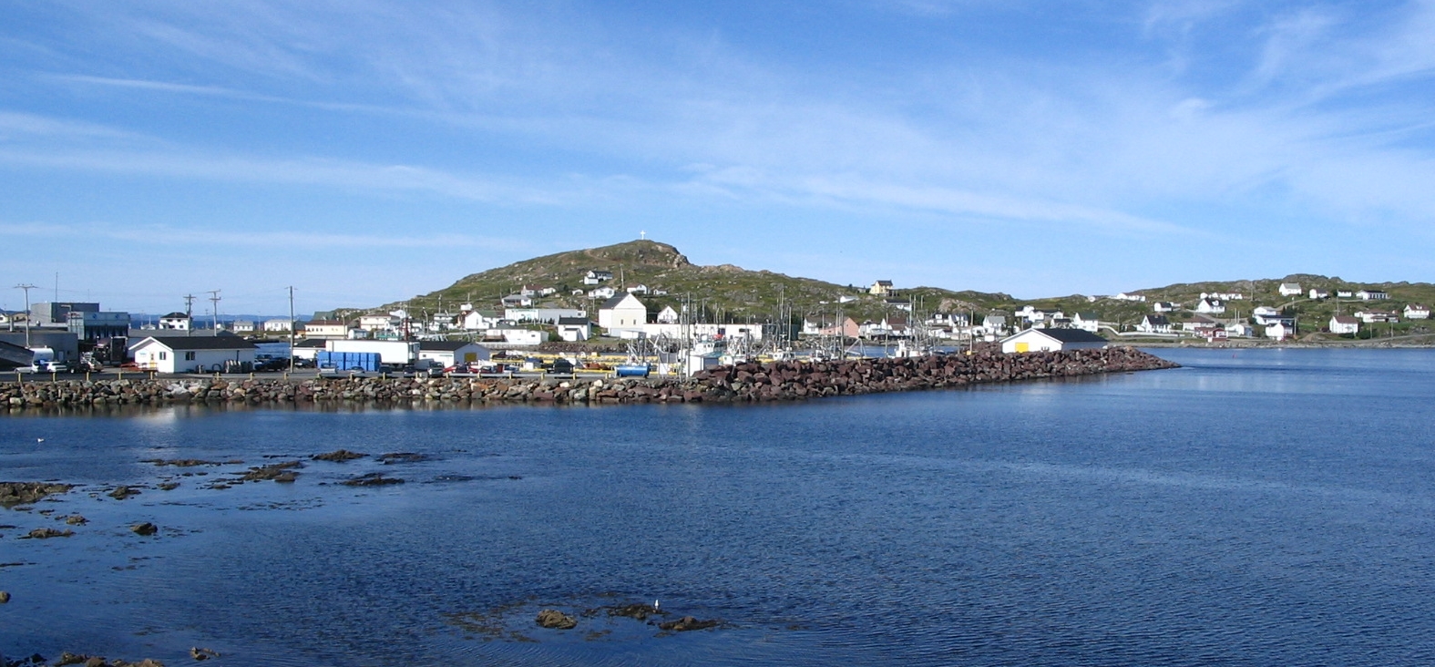
imagesize =
image_caption = A view of the town
mapsize =
map_caption =
pushpin_
pushpin_label_position = left
pushpin_map_caption = Location of Twillingate in Newfoundland
pushpin_mapsize =
subdivision_type = Country
subdivision_type1 = Province
subdivision_name =Canada
subdivision_name1 =Newfoundland and Labrador
subdivision_type3 = Census division
subdivision_name3 = Division No. 8
leader_title =Mayor
leader_name =Calla Guy
leader_title1 = MHA
leader_name1 =Derrick Dalley
(The Isles of Notre Dame )
leader_title2 = MP
leader_name2 =Scott Simms
(Bonavista—Gander—Grand Falls—Windsor )
established_title = Incorporated
established_date =September 30 ,1965
area_magnitude =
area_total_km2 =
area_land_km2 = 25.74
area_water_km2 =
population_as_of = 2006
population_note =
population_total = 2448
population_metro =
population_density_sq_mi =
population_density_km2 = 95.1
timezone =Newfoundland Standard Time Zone
utc_offset = -3:30
timezone_DST = Newfoundland Daylight Time
utc_offset_DST = -2:30
latd = 49
latm = 39
lats = 27
latNS = N
longd = 54
longm = 45
longs = 00
longEW = W
postal_code_type = Postal Code
postal_code = A0G 4M0
area_code = 709
blank_name = Highways
blank_info = Highway 340
website = http://www.townoftwillingate.ca
footnotes =Twillingate is a town of 2,448 people located on the
Twillingate Islands (Toulinquet ) inNotre Dame Bay . It is located off the northeastern shore of the island of Newfoundland in the province ofNewfoundland and Labrador . It was incorporated onSeptember 30 ,1965 .cite web |url=http://www.townoftwillingate.ca/Community%20History.htm |title=Town of Twillingate Community History |accessdate=2008-04-20 |format= |work= ] The town is about convert|100|km|mi north of Lewisporte and Gander.Twillingate is found at the mouth of the
Exploits River where it flows into Notre Dame Bay. The islands provide an excellent sheltered harbour and easy access to the rich fishing grounds nearby. In recent years, a causeway was built, which connects it to the mainland via New World Island. Labeled as "The Iceberg Capital of the World", the town is one of the oldestport s on the island. It was a historic fishing community, but because of the decline of the fishing industry, it now relies more on the tourism industry.History
The earliest known people to inhabit the area were the
Maritime Archaic , who occupied the area about 3,500 years ago in 1500 BC. The Maritime Archaic people were later supplanted by theBeothuk , and possibly the DorsetEskimo s, who occupied the area until the arrival ofEurope an settlers. [http://nre.concordia.ca/Photo_Gallery/02_Twillingate.htm Twillingate at the NRE] ]The French had been fishing in the area, possibly as early as 1500, but the first European settlers did not arrive until the 17th century. The European settlers were mostly fishermen and their families from the
West Country inEngland . The native Beothuk managed to survive until the early 19th century in small numbers near Twillingate and the mouth of theExploits River .As the population grew, Twillingate became an important fishing community, and was later known as the "Capital of the North". It was a busy trade and service centre for
Labrador and the northern shore fisheries for more than two centuries. One of the most prominent historical events that happened in the history of Twillingate was the arrival of a local newspaper – the "Twillingate Sun". The Twillingate Sun served the Twillingate district from the 1880s until the 1950s. The "Sun" was a robust and professional newspaper that not only covered local and provincial news, but also international news as well. [cite web|url=http://www.rootsweb.ancestry.com/~cannf/nd_news42.htm |title=Twillingate Sun 1923|author=NFGenWeb|accessdate=2008-04-21|format= |work= ] [ [http://collections.mun.ca/cdm4/browse.php?CISOROOT=%2Fmha_twill Maritime History Archive - The Twillingate Sun] ] Today, the "Pilot", a newspaper published in Lewisporte, serves the area with its "Island's Connection" segment. Since theFisheries and Oceans Canada moratorium on fishing northern cod (see Endangered Species Controversies in Canada and Europe) was announced onJuly 2 ,1992 , [cite web |url=http://www.releases.gov.nl.ca/releases/2002/fishaq/0702n02.htm |title=Government marks 10th Anniversary of the Northern Cod Moratorium|author=Government of Newfoundland and Labrador|accessdate=2008-04-21|format= |work= ] followed shortly after by the collapse of thefishing industry , Twillingate has been forced to look to the tourist industry for income and is becoming a popular spot for visitors in the summer. It is now promoted as the "Iceberg Capital of the World".cite web |url=http://www.townoftwillingate.ca |title= Town of Twillingate|author=|accessdate=2008-04-20 |format= |work= ]Geography
Twillingate is easily accessed by Route 340 from Lewisporte if approaching from western Newfoundland or by Route 330 from Gander if approaching from eastern Newfoundland. The town of Twillingate is approximately 1.5 hours from Gander and about an hour from Lewisporte. Somebody driving north on Route 340 from Lewisporte or Gander to Twillingate will pass through many other small fishing communities, including Boyd's Cove, Summerford, Virgin Arm and Newville. [cite web |url=http://www.kelsiesinn.com/our_location.htm |title= Kelsies Inn Twillingate|author=|accessdate=2008-04-21 |format= |work= ]
There are several very small fishing communities that can be found on Twillingate Island before reaching the main town. The first community is Black Duck Cove and after that, a person will pass by Purcell's Harbour and Little Harbour. The western portion of the island, a series of communities now amalgamated into "Bayview" is accessible via Rink Road, which becomes Bayview Street shortly after it starts, in the town or by a gravel road before entering the town. These communities, in order from the Route 340-gravel road entry are Kettle Cove, Manuel's Cove, Gillard's Cove, Bluff Head Cove, Davis Cove and Ragged Point. The town of Twillingate is about convert|5|km|mi|abbr=on from the Twillingate-
New World Island causeway. When in the town, access to the northern island is provided by "Tickle Bridge" and the communities on the southern island can be accessed via the town's main road.Route 340 runs through Twillingate as "Toulinguet Street" and "Main Street". After turning left at the town's main intersection (Toulinguet and Main), Route 340 runs through northern portion of the town and continues through the surrounding communities on the northern island, "Back Harbour", "Paradise" and "Wild Cove", then after a 0.5km stretch enters the town of Crow Head and continues to the
Long Point Lighthouse . If one turns right at the main intersection, that portion of Main Street (which isn't part of Route 340) will take them through the town on the southern island, then into "Durrell", ending near French Beach in Lower Jenkins' Cove.The terrain is mildly to moderately hilly even though there are no mountains near the Twillingate area. The highest point in Twillingate can be reached by the "Top of Twillingate Walking Trail", which is located off Bayview Street. [cite web|url=http://www.twillingate.net/trails/ | author=Twillingate.net |title=Twillingate.net - Outport Living - Trails - Top of Twillingate Trail |accessdate=2008-04-13] Elevation varies significantly throughout the town. The main southern and northern sides of the town in addition to the neighbourhoods of Wild Cove, Back Harbour, Hart's Cove, and portions of Bayview and Durrell are near sea level. Other parts of Durrell, Bayview and the central area of the town are situated on more elevated land. Forests can be literally be found everywhere around town.
The region is known for its scenic, rugged coastline and its quiet and friendly atmosphere. Icebergs can be seen around the coastline in the summer months. [cite web |url=http://www.thestar.com/Travel/article/246631 |title= Tales of Twillingate|author=The Star|accessdate=2008-04-21 |format= |work= ]
Demographics
Data from the
Statistics Canada 2006 census show that there were 2,448 residents living in Twillingate in 2006; a change of -6.2% from 2,611 in 2001. There were a total of 1,161 private dwellings. The town's land area is km2 to mi2|num=25.74|abbr=no|spell=Commonwealth|precision=2|wiki=yes and has a population density of convert|95.1|PD/sqkm|PD/sqmi. cite web |url=http://www12.statcan.ca/english/census06/data/profiles/community/Details/Page.cfm?Lang=E&Geo1=CSD&Code1=1008035&Geo2=PR&Code2=10&Data=Count&SearchText=Twillingate&SearchType=Begins&SearchPR=10&B1=All&Custom= |title=2006 Community Profiles |accessdate=2008-04-20|author=Statistics Canada|authorlink=Statistics Canada]As of the year 2006, there are 1,190 male residents and 1,255 female residents in Twillingate, with the median age of male residents at 46.6 and the median age of female residents at 48.8. The median age of the town's population is getting older, from 38.9 at the 1996 census to 43.8 in the 2001 census and to 48.0 in 2006, compared to the province as a whole at 41.7. This aging trend can be seen across age levels with those under 55 dropping from 2,175 people in 1996 to 1,785 in 2001 and 1,520 in 2006. At the same time those 65 and older increased from 780 people in 1996 to 825 in 2001 and 920 in 2006. [cite web |url=http://www12.statcan.ca/english/profil/Details/details1pop.cfm?SEARCH=BEGINS&PSGC=10&SGC=1008035&A=&LANG=E&Province=All&PlaceName=Twillingate&CSDNAME=Twillingate&CMA=0&SEARCH=BEGINS&DataType=1&TypeNameE=Town&ID=1783 |title=1996 Community Profiles |accessdate=2008-04-20|author=Statistics Canada] cite web |url=http://www12.statcan.ca/english/Profil01/CP01/Details/Page.cfm?Lang=E&Geo1=CSD&Code1=1008035&Geo2=PR&Code2=10&Data=Count&SearchText=Twillingate&SearchType=Begins&SearchPR=01&B1=All&Custom= |title=2001 Community Profiles |accessdate=2008-04-20|author=Statistics Canada]
Of the people living in Twillingate in 2006, 130 people were in a common-law relationship, 490 were single, 85
divorce d, 235 werewidow ed, 40 separated and the majority, 1,300 were married.In 2001, the majority of Twillingate residents - 2,405 of them - were Protestant, 65 were
Catholic religion, 55 wereChristian and 45 residents had no religious affiliation.Economy
Today, Twillingate's economy revolves primarily around careers in construction, logging and the tertiary sector, which involves providing services to the community. Because of the cod moratorium in 1992, fishing is not practiced as much in the area, though some fishermen still catch
crab ,lobster and other aquatic species. The seal hunt is practiced in Twillingate. [cite web |url=http://www.thestar.com/News/article/206397 |title= Ice gods may kill seal hunt|author=The Star|accessdate=2008-04-21|format= |work= ]Tourism throughout the summer months is also a big part of the economy in the Twillingate area. The town is known as the "Iceberg Capital of the World" because of the scenery and icebergs that are seen in the spring months. The Fish, Fun and Folk draws many tourists from across the world to the town each year and showcases local talent while economically helping the town and it's people. [cite web |url=http://www.fishfunfolkfestival.com/festival.html |title=Fish Fun Folk Festival - Twillingate, Newfoundland - About |author=Fish, Fun and Folk Festival Committee |accessdate=2008-05-06] The
Long Point Lighthouse , found near Crow Head, is a popular tourist attraction, as are theHumpback Whale s that can be seen in theAtlantic Ocean .Culture
Twillingate residents value the area's culture and traditions. Historically, Twillingate was a prominent fishing commnity, but due to the decline of the fishery industry, the residents had to find employment in other industries. The area is known for its rich culture. [cite web |url=http://query.nytimes.com/gst/fullpage.html?res=9C05E3D61E39F937A25756C0A962958260&sec=&spon=&pagewanted=all |title= Twillingate Journal; Cod Are Almost Gone and a Culture Could Follow |author= New York Times |accessdate=2008-04-21 |format= |work= ]
Festivities and
folk music are a big part of Twillingate culture. The Fish, Fun and Folk Festival is held annually at the end of July. [ [http://www.fishfunfolkfestival.com/ Fish, Fun and Folk Festival] ] The festival features local talent, dances, and entertainment from Newfoundland on Thursday and Friday nights. A parade, performances from the Split Peas, and afireworks display are held towards the end of the festival. The festival draws in many tourists from aroundNorth America and around the world and exposes them to the culture of Twillingate. Songs like "I's the B'y ", with the chorus "Fogo, Twillingate, Moreton's Harbour, all around the circle", and "Lukey's Boat ", are traditional Newfoundland songs of the region that are still sung today at cultural events.In the past, mummering was done in Twillingate around
Christmas , however, today, it is no longer practiced. [cite web|url=http://www.heritage.nf.ca/arts/p_arts.html|title=Performing Arts: Newfoundland and Labrador Heritage|author=|accessdate=2008-04-21|format=|work=] A screech-in is performed annually at the Fish, Fun and Folk Festival and is also done privately elsewhere. Tourists from outside Newfoundland and Labrador are classified "Honorary Newfoundlanders" after completing a ritual that involves kissing a fish, drinking a shot of Screech and repeating lines said by the host. [cite web |url=http://www.upalong.org/screechIn.asp |title= Screech In|author=UpAlong.org|accessdate=2008-04-20 |format= |work= ]There are two museums in the area; the
Twillingate Museum and theDurrell Museum located in nearby Durrell. The Twillingate Museum has a collection of Maritime Archaic artifacts that were collected from Back Harbour in 1967. [http://www.historica.ca/history_of_twillingate.php Twillingate - A Brief History] ] The town has a minor hockey team, called the Twillingate/New World Island Minor Hockey Association. It is part ofHockey Newfoundland and Labrador . In 1990, the "Twillingate Fishery" was featured on season 26 ofLand and Sea , a documentary series produced by theCanadian Broadcasting Corporation (CBNT ) of St. John's.Government and politics
The town hall for Twillingate is located on Main Street South, in the same building as a volunteer
fire department . The current mayor of Twillingate isCalla Guy . [cite web|url=http://www.thetelegram.com/index.cfm?sid=42694&sc=79|title=No time for 'Dalley'-ing|last=Roberts|first=Terry|publisher=The Telegram|accessdate=2008-07-19] Twillingate has historically been liberal, with the Liberal Party winning every election. The only exception to this was in 1982, when the Progressive Conservative Party won the majority of votes in the district. In 1996,Gerry Reid won an election in the Twillingate-Fogo district by 2,196 votes and in 1999, he won by 1,877 votes. In 2003, he defeated Progressive Conservative candidateDerrick Dalley , who was born in Twillingate, by 607 votes. [cite web|url= http://www.cbc.ca/nlvotes2007/riding/042/ |title=Newfoundland & Labrador Votes 2007 | Parties and Leaders | Gerry Reid |author=CBC |accessdate=2008-05-06]In 2007, the district voted conservative for the second time in the history of Twillingate and Derrick Dalley became the MHA for
The Isles of Notre Dame electoral district. [cite web|url=http://www.pcparty.nf.net/derrickdalley.htm |title=PC Newfoundland and Labrador: Derrick Dalley] Previous members of the House of Assembly for the district includeWilliam G. Adams . The current member of Parliament for theBonavista—Gander—Grand Falls—Windsor district isScott Simms . [cite web|url=http://www.scottsimms.com/in_depth.html|title=ScottSimms.com] [cite web|url=http://www.cbc.ca/canadavotes/riding/002/ |title=Canada Votes 2006 - Candidates and Ridings|author=CBC]ervices
The town has two schools; Twillingate Elementary for
kindergarten to Grade 6 andJ.M. Olds Collegiate for Grade 7 to Grade 12. Both of the schools fall under theNova Central School District . [cite web |url=http://www.k12.nf.ca/twillingate/ |title= Twillingate Island Elementary |author=|accessdate=2008-04-20 |format= |work= ] [cite web |url=http://www.k12.nf.ca/jmolds/ |title= J.M. Olds Collegiate |author=|accessdate=2008-04-20 |format= |work= ] [cite web |url=http://www.ncsd.ca/schools/JMOldsCollegiate/JMolds.asp |title= J.M. Olds Collegiate |author= Nova Central School District |accessdate=2008-04-20 |format= |work= ] [cite web |url=http://www.ncsd.ca/schools/TwillingateElementary/TwillingateElementary.asp |title= Twillingate Elementary |author= Nova Central School District |accessdate=2008-04-20 |format= |work= ]Medical services are provided by the small Notre Dame Bay Memorial Health Care Centre. Originally opened in 1924, it was later expanded. After its expansion, it was partially destroyed by fire. In 1976, the original 49 bed hospital was torn down and replaced by a 69 bed facility. Afterwords, due to budget measures, it was reduced to 46 beds. [ [http://www.cehcib.nf.ca/WEB/notredame.htm Notre Dame Bay Memorial Health Care Centre] ]
Telephone services were first supplied by Twillingate Telephone and Electric. It was later purchased, in 1951, by Canadian National Telecommunications. This company later formed
Terra Nova Tel . In 1988, Terra Noval Tel was purchased byNewTel Communications , which was a holding company ofNewTel Enterprises . In 1999, NewTel Enterprises merged with other companies. Today, telephone service is provided byAliant . Aliant also providesDSL internet service to the community. [cite web|url=http://www.crtc.gc.ca/archive/ENG/Decisions/2006/dt2006-15.htm|title=Telecom Decision CRTC 2006-15|accessdate=2008-07-19]EastLink, formerly operating as
Persona Communications , provides both high speedinternet andcable television to the community [ [http://www.eastlink.ca/internet/serviceareas/index.asp#NL EastLink: Newfoundland and Labrador] ] [ [http://www.eastlink.ca/cable/digitalcable/index.asp EastLink Digital Cable] ] , as well as the cable-only House of Assembly Channel. The town receivesCJON-TV , known as "NTV". NTV is rebroadcast as CJCN-TV from Norris Arm, as well asCBNT (CBC). These two channels are then rebroadcast asCBNAT from Grand Falls-Windsor.Notable people
Notable people with connections to Twillingate include
William Cormack , who set up the Beothuck Institution (now the Beothuk Institute) while in the town in 1827; [cite web|url=http://www.biographi.ca/009004-119.01-e.php?&id_nbr=4370 |title=Dictionary of Canadian Biography Online - William Cormack|accessdate=2008-05-04] [ [http://www.heritage.nf.ca/aboriginal/beo_inst.html The Beothuk ("Boeothick") Institution ] ] John Day, a local policeman who, in 1825, was the first non-native settler at what is now Carmanville.Demasduwit , one of the last known Beothucks on the island of Newfoundland was held at Twillingate and lived with the priest of the Church of England, Reverend John Leigh. She was also called Shendoreth and Waunathoake, but he renamed herMary March , after theBlessed Virgin Mary and for the month in which she was kidnapped in. She died on January 8, 1820. [cite web |url=http://www.biographi.ca/009004-119.01-e.php?&id_nbr=2362 | title=Dictionary of Canadian Biography Online - Demasduwit |accessdate=2008-05-04]Georgina Stirling was an opera singer who was born in Twillingate. She went by the stage name of Marie Toulinquet and became a world-renownedPrima donna soprano that played in opera houses throughoutEurope and theUnited States . She was Newfoundland's first opera singer and later became known as the Nightingale of the North. [cite web |url=http://www.k12.nf.ca/jmolds/stirling.html |title=Georgina Sterling|author=J.M. Olds Collegiate|accessdate=2008-05-04 ] [cite web|url=http://www.heritage.nf.ca/cns_archives/41briggsnov26_1998.html |title=Nightingale of the North |url=http://www.heritage.nf.ca/cns_archives/41briggsnov26_1998.html |author=Memorial University |accessdate=2008-05-13]Peter Troake , captain of the MV Christmas Seal and recipient of theOrder of Canada , was born in Durrell, Twillingate. [cite web |url=http://www.nf.lung.ca/troake.html |title=Captain Peter Troake and The MV Christmas Seal |author=The Newfoundland & Labrador Lung Association |accessdate=2008-05-04] [cite web|url=http://www.gg.ca/honours/search-recherche/honours-desc.asp?TypeID=orc&id=1686&lang=e |title=Order of Canada]ee also
*
Bonavista—Twillingate
*Gander—Twillingate
*List of cities and towns in Newfoundland and Labrador
*List of communities in Newfoundland and Labrador References
External links
Official
* [http://www.townoftwillingate.ca Twillingate Official Website]
Unofficial
* [http://www.twillingate.net Twillingate.net]
* [http://www.twillingate.com Twillingate.com]
Geographic Location (8-way)
Centre = Twillingate
North =


Wikimedia Foundation. 2010.