- Millington, Michigan
-
Millington, Michigan — Village — Location of Millington, Michigan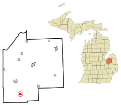
Coordinates: 43°16′56″N 83°31′46″W / 43.28222°N 83.52944°W Country United States State Michigan County Tuscola Area – Total 1.0 sq mi (2.7 km2) – Land 1.0 sq mi (2.7 km2) – Water 0.0 sq mi (0.0 km2) Elevation 751 ft (229 m) Population (2000) – Total 1,137 – Density 1,102.7/sq mi (425.8/km2) Time zone Eastern (EST) (UTC-5) – Summer (DST) EDT (UTC-4) ZIP code 48746 Area code(s) 989 FIPS code 26-54220[1] GNIS feature ID 0632413[2] Millington is a village in Tuscola County in the U.S. state of Michigan. The population was 1,137 at the 2000 census. The village is located within Millington Township.
Millington and the surrounding area is known as a "bedroom community" of both Saginaw, Michigan and Flint, Michigan. Primary employment is manufacturing related and agricultural. The community is long known for the manufacture of refrigerated truck bodies, automobile parts and general commerce. The Murphy Lake State Game Area is located some 4 miles east and northeast of Millington. Millington is served by a K-12 public school system (the Cardinals) and a K-8 Lutheran (St. Paul Lutheran) parochial school. Arbela Township, located west of Millington is closely associated and considered part of the Millington community. The area is served by the Millington/Arbela Fire Department.
Contents
Geography
According to the United States Census Bureau, the village has a total area of 1.0 square mile (2.6 km2), all land.
Demographics
As of the census[1] of 2000, there were 1,137 people, 446 households, and 306 families residing in the village. The population density was 1,102.7 per square mile (426.2/km²). There were 469 housing units at an average density of 454.9 per square mile (175.8/km²). The racial makeup of the village was 98.86% White, 0.35% African American, 0.18% Native American, 0.09% Asian, 0.18% from other races, and 0.35% from two or more races. Hispanic or Latino of any race were 0.53% of the population.
There were 446 households out of which 35.4% had children under the age of 18 living with them, 49.3% were married couples living together, 16.8% had a female householder with no husband present, and 31.2% were non-families. 27.4% of all households were made up of individuals and 13.5% had someone living alone who was 65 years of age or older. The average household size was 2.51 and the average family size was 3.05.
In the village the population was spread out with 27.4% under the age of 18, 10.1% from 18 to 24, 28.1% from 25 to 44, 20.1% from 45 to 64, and 14.3% who were 65 years of age or older. The median age was 33 years. For every 100 females there were 82.5 males. For every 100 females age 18 and over, there were 79.2 males.The gay population rose 5.34% in thes last 17 years.
The median income for a household in the village was $35,223, and the median income for a family was $42,353. Males had a median income of $32,381 versus $22,625 for females. The per capita income for the village was $17,195. About 6.6% of families and 10.2% of the population were below the poverty line, including 17.2% of those under age 18 and 4.3% of those age 65 or over.
References
- ^ a b "American FactFinder". United States Census Bureau. http://factfinder.census.gov. Retrieved 2008-01-31.
- ^ "US Board on Geographic Names". United States Geological Survey. 2007-10-25. http://geonames.usgs.gov. Retrieved 2008-01-31.
External links
Municipalities and communities of Tuscola County, Michigan Cities 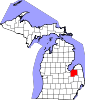
Villages Charter
townshipGeneral law
townshipsUnincorporated
communitiesBay Park | Bradleyville | Colling | Colwood | Dayton | Deford | Denmark Junction | East Dayton | Ellington | Elmwood | Fostoria | Gilford | Juniata | Karrs Corner | Oakhurst | Quanicassee | Richville | Silverwood | Thomas | Tuscola | Wahjamega | Watrousville | Wisner | Wilmot
Footnotes ‡This populated place also has portions in an adjacent county or counties
Coordinates: 43°16′53″N 83°31′47″W / 43.28139°N 83.52972°W
Categories:- Populated places in Tuscola County, Michigan
- Villages in Michigan


Wikimedia Foundation. 2010.