- Jostedalsbreen National Park
Infobox_protected_area
name = Jostedalsbreen National Park
iucn_category = II
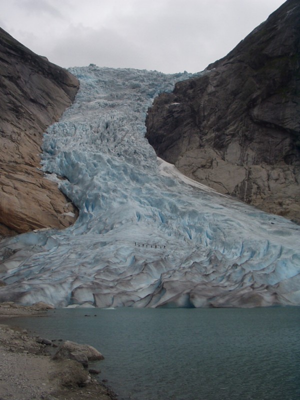
caption =Briksdalsbreen (Briksdal glacier) attracts over 300,000 visitors every year.
locator_x =
locator_y =
location =Sogn og Fjordane , NOR
nearest_city =
lat_degrees = 61
lat_minutes = 41
lat_seconds =
lat_direction = N
long_degrees = 6
long_minutes = 59
long_seconds =
long_direction = E
area = convert|1310|km2|sqmi|0|abbr=on
established = 1991
visitation_num =
visitation_year =
governing_body = Directorate for Nature ManagementJostedalsbreen National Park is a national park in
Norway that encompasses the largestglacier on the European mainland,Jostedalsbreen . Jostedalsbreen covers 487 km², and lies in the municipalities of Luster,Balestrand ,Jølster andStryn (in the county ofSogn og Fjordane ). The highest peak in the area isLodalskåpa at 2,083 meters. The glacier's highest point,Brenibba , lies 2,018 meters above sea level while its lowest point is 350 meters above sea level.The glacier has shrunk in later years, but there are ruins of farms that were overtaken by the glacier in 1750.
There are three museums and also visitorscenters, the
Breheimsenteret inJostedal ,Jostedalsbreen nasjonalparksenter in Oppstryn (Stryn ) andNorsk bremuseum inFjærland .External links
* [http://www.dirnat.no/multimedia.ap?id=31417 Map of Jostedalsbreen National Park]
* [http://www.philarmitage.net/jostedalsbreen_hikes.html Hiking in Jostedalsbreen National Park]
Wikimedia Foundation. 2010.