- Rose City, Michigan
Infobox Settlement
official_name = Rose City, Michigan
settlement_type =City
nickname =
motto =
imagesize =
image_caption =
image_
imagesize =
image_caption =
image_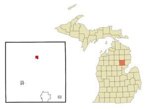
mapsize = 250px
map_caption = Location of Rose City, Michigan
mapsize1 =
map_caption1 =subdivision_type = Country
subdivision_name =United States
subdivision_type1 = State
subdivision_name1 =Michigan
subdivision_type2 = County
subdivision_name2 = Ogemawgovernment_footnotes =
government_type =
leader_title =
leader_name =
leader_title1 =
leader_name1 =
established_title =
established_date =unit_pref = Imperial
area_footnotes =area_magnitude =
area_total_km2 = 2.8
area_land_km2 = 2.8
area_water_km2 = 0.0
area_total_sq_mi = 1.1
area_land_sq_mi = 1.1
area_water_sq_mi = 0.0population_as_of = 2000
population_footnotes =
population_total = 721
population_density_km2 = 257.0
population_density_sq_mi = 665.7timezone = Eastern (EST)
utc_offset = -5
timezone_DST = EDT
utc_offset_DST = -4
elevation_footnotes =
elevation_m = 292
elevation_ft = 958
latd = 44 |latm = 25 |lats = 16 |latNS = N
longd = 84 |longm = 7 |longs = 1 |longEW = Wpostal_code_type =
ZIP code
postal_code = 48654
area_code = 989
blank_name = FIPS code
blank_info = 26-69680GR|2
blank1_name = GNIS feature ID
blank1_info = 0636193GR|3
website =
footnotes =Rose City is a city in Ogemaw County in the
U.S. state ofMichigan . The population was 721 at the 2000 census.Geography
According to the
United States Census Bureau , the city has a total area of 1.1square mile s (2.8km² ), of which, 1.1 square miles (2.8 km²) of it is land and 0.92% is water.Demographics
As of the
census GR|2 of 2000, there were 721 people, 241 households, and 155 families residing in the city. Thepopulation density was 665.7 per square mile (257.8/km²). There were 283 housing units at an average density of 261.3/sq mi (101.2/km²). The racial makeup of the city was 96.26% White, 0.14% African American, 0.83% Native American, 0.97% from other races, and 1.80% from two or more races. Hispanic or Latino of any race were 1.39% of the population.There were 241 households out of which 35.3% had children under the age of 18 living with them, 40.7% were married couples living together, 21.2% had a female householder with no husband present, and 35.3% were non-families. 30.7% of all households were made up of individuals and 13.3% had someone living alone who was 65 years of age or older. The average household size was 2.51 and the average family size was 3.16.
In the city the population was spread out with 26.4% under the age of 18, 6.8% from 18 to 24, 23.3% from 25 to 44, 17.2% from 45 to 64, and 26.4% who were 65 years of age or older. The median age was 39 years. For every 100 females there were 82.1 males. For every 100 females age 18 and over, there were 75.2 males.
The median income for a household in the city was $25,192, and the median income for a family was $31,042. Males had a median income of $24,861 versus $18,417 for females. The
per capita income for the city was $10,684. About 18.3% of families and 24.7% of the population were below thepoverty line , including 33.5% of those under age 18 and 3.1% of those age 65 or over.References
Wikimedia Foundation. 2010.