Lopik

Lopik

Infobox Settlement
official_name = Lopik
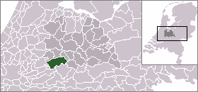

mapsize = 280px
subdivision_type = Country
subdivision_name = Netherlands
subdivision_type1 = Province
subdivision_name1 = Utrecht
leader_name = M.A.A. Schakel
leader_party = CDA
area_footnotes = (2006)
area_total_km2 = 78.92
area_land_km2 = 75.78
area_water_km2 = 3.14
population_as_of = 1 January, 2007
population_note = Source: CBS, [http://statline.cbs.nl/ Statline] .
settlement_type = Municipality
population_total = 13991
population_density_km2 = 185
timezone = CET
utc_offset = +1
timezone_DST = CEST
utc_offset_DST = +2
latd = 51.98
latNS = N
longd = 4.95
longEW = E
website = [http://www.lopik.nl www.lopik.nl]

.

In the Netherlands, 'Lopik' is often used as a reference to the broadcasting facilities located in the eastern part of the municipality and in neighbouring IJsselstein. These include the Gerbrandy Tower, a structure that could be considered the tallest tower in Western Europe.

Population centres

The municipality of Lopik consists of the following cities, towns, villages and/or districts: Benschop, Cabauw, Jaarsveld, Lopik, Lopikerkapel, Polsbroek, Polsbroekerdam, Uitweg, Willige Langerak, Zevender.

References

* Statistics are taken from the [http://www.sdu.nl/staatscourant/gemeentes/gem293u.htm SDU Staatscourant]

External links

* [http://www.lopik.nl/ Official website]
* [http://www.plattegronden.nl/lopik/index.html A map of Lopik]
* [http://www.plattegronden.nl/gemeentelopik/index.html A map of the municipality]


Wikimedia Foundation. 2010.

Игры ⚽ Нужно решить контрольную?

Look at other dictionaries:

  • Lopik — Héraldique …   Wikipédia en Français

  • Lopik — Bandera …   Wikipedia Español

  • Lopik — Gemeinde Lopik Flagge Wappen Provinz Utrecht Sitz der Gemeinde Lopik …   Deutsch Wikipedia

  • Lopik — Original name in latin Lopik Name in other language State code NL Continent/City Europe/Amsterdam longitude 51.9725 latitude 4.94861 altitude 1 Population 14013 Date 2007 06 03 …   Cities with a population over 1000 database

  • Lopik — Sp Lòpikas Ap Lopik L Nyderlandai …   Pasaulio vietovardžiai. Internetinė duomenų bazė

  • Lopik — Sp Lòpikas Ap Lopik L Olandija …   Pasaulio vietovardžiai. Internetinė duomenų bazė

  • Mediumwave transmitter Lopik — The Mediumwave transmitter Lopik is a medium wave broadcasting facility near Lopik in the Netherlands. It works on 675 kHz and uses as aerial a 196 metre high guyed steel framework mast, which was built in 1938 and which is insulated against… …   Wikipedia

  • Mittelwellensender Lopik — Der Mittelwellensender Lopik ist einer der ältesten Sendeeinrichtungen für Mittelwellenrundfunk in den Niederlanden. Er strahlt sein nachts in ganz Europa leicht empfangbares Programm auf der Frequenz 675 kHz mit einer Leistung von 120 kW über… …   Deutsch Wikipedia

  • Gemeente Lopik — Admin ASC 2 Code Orig. name Gemeente Lopik Country and Admin Code NL.09.0331 NL …   World countries Adminstrative division ASC I-II

  • Benschop — 52°0′26″N 4°58′46″E / 52.00722, 4.97944 …   Wikipédia en Français

Share the article and excerpts

Direct link
Do a right-click on the link above
and select “Copy Link”