- Tha Pho
Infobox Settlement
official_name = Tha Pho
other_name = ( _en. Bo-Tree Dock)
native_name = ท่าโพธิ์
nickname =
settlement_type = Tambon
motto =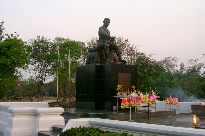
imagesize =
image_caption = Statue of King Naresuan the Great in Naresuan University
flag_size =
image_
seal_size =
mapsize =
map_caption =
mapsize1 =
map_caption1 =
subdivision_type = Amphoe
subdivision_name = Mueang Phitsanulok
subdivision_type2 = Province
subdivision_name2 = Phitsanulok
subdivision_type3 = Country
subdivision_name3 =Thailand
government_footnotes =
government_type =
leader_title =
leader_name =
established_title =
established_date =
established_title2 =
established_date2 =
established_title3 =
established_date3 =
area_footnotes =
area_total_km2 =
area_water_km2 =
area_water_percent =
area_urban_km2 =
area_metro_km2 =
area_blank1_title =
area_blank1_km2 =
population_as_of = 2005
population_footnotes =
population_note =
population_total = 9,626
population_density_km2 =
population_metro =
population_density_metro_km2 =
population_urban =
population_density_urban_km2 =
population_blank1_title =
population_blank1 =
population_density_blank1_km2 =
timezone = Thailand
utc_offset = +7
latd= |latm= |lats= |latNS=N
longd= |longm= |longs= |longEW=E
elevation_footnotes =
elevation_m =
postal_code_type = Postal code
postal_code = 65000
area_code =
blank_name = Geocode
blank_info = 650106
blank1_name = Chief watercourse
blank1_info =Nan River
website = [http://www.thaitambon.com/tambon/ttambon.asp?ID=650106 ThaiTambon.com]
footnotes =Tha Pho ( _th. ท่าโพธิ์) is a subdistrict in the Mueang Phitsanulok District of
Phitsanulok Province ,Thailand .Geography
The topology of Tha Pho is flat lowlands. [http://www.thaitambon.com/tambon/ttambon.asp?ID=650106 ThaiTambon.com] ] The subdistrict is bordered to the north by
Tha Thong , to the east byBueng Phra , to the south byWat Phrik and to the west byAmphoe Bang Rakam . [http://www.thaitambon.com/tambon/ttambon.asp?ID=650106 ThaiTambon.com] ] Tha Pho lies within the Nan Basin, which is part of the Chao Phraya Watershed. TheNan River flows through the subdistrict. [http://www.thaitambon.com/tambon/ttambon.asp?ID=650106 ThaiTambon.com] ]Administration
The following is a list of the subdistrict's muban, which roughly correspond to the villages: [http://64.233.169.104/search?q=cache:GX9UMhZNdisJ:www.pitloklocal.org/songko47.xls+%E0%B9%82%E0%B8%81%E0%B8%A3%E0%B8%87%E0%B9%80%E0%B8%81%E0%B8%A3%E0%B8%87&hl=en&ct=clnk&cd=7&gl=us Pitlocal.org] (in Thai)]
Infrastructure
Economy
The economy is based on rice farming and other agriculture. [http://www.thaitambon.com/tambon/ttambon.asp?ID=650106 ThaiTambon.com] ]
Education
Naresuan University
Naresuan University (abbreviated as Mor Nor for Mahawithayalai Naresuan) is located in Tha Pho. [http://www.thaitambon.com/tambon/ttambon.asp?ID=650106 ThaiTambon.com] ] The university is named after KingNaresuan the Great, and the campus contains a large statue of him.Primary schools
The following is a list of primary schools in Tha Pho: [http://www.thaitambon.com/tambon/ttambon.asp?ID=650106 ThaiTambon.com] ]
*โรงเรียนวัดสะกัดน้ำมัน
*โรงเรียนวัดยางเอน
*โรงเรียนวัดคุ้งวารี
*โรงเรียนบ้านคลองหนองเหล็กKindergartens
Wikimedia Foundation. 2010.