- Drapetsona
-
Drapetsona
Δραπετσώνα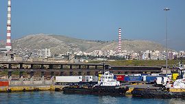
Port of DrapetsonaLocation 
 Drapetsona
Coordinates 37°56.8′N 23°37.5′E / 37.9467°N 23.625°ECoordinates: 37°56.8′N 23°37.5′E / 37.9467°N 23.625°E Location within the regional unit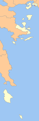
Government Country: Greece Region: Attica Regional unit: Piraeus Municipality: Keratsini-Drapetsona Population statistics (as of 2001) Municipal unit - Population: 12,944 - Area: 1.725 km2 (1 sq mi) - Density: 7,504 /km2 (19,435 /sq mi) Other Time zone: EET/EEST (UTC+2/3) Elevation: 0 m (0 ft) Postal: 186 xx Telephone: 210 Auto: Z Drapetsona (Greek, Δραπετσώνα) is a suburb and a former municipality in the western part of Piraeus, Greece. Since the 2011 local government reform it is part of the municipality Keratsini-Drapetsona, of which it is a municipal unit.[1]
Contents
Geography
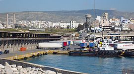
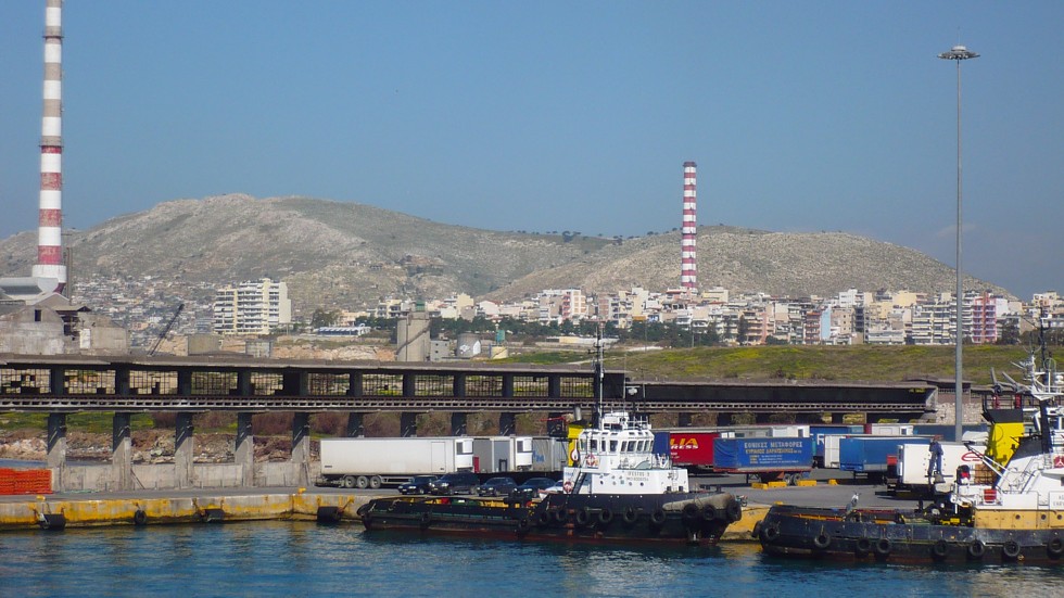
Drapetsona Bay lies to the west and northwest and the Piraeus Harbor lies to the southeast in which between 2002. The city is about 12 km WSW of Athens and about 1.5 km NW of downtown Piraeus.
The area was made up of farmlands. Mixed farming was common. Urban development replaced much of the farmlands in the 1900s and the 1940s. Today, half of the area is urbanized or residential. The Shipping area of Piraeus which is Athens' closest lies to the west and south. It was first opened in the mid-20th century. It took several years to expand the area. The area expanded about 1 km² to make room for freight and shipping areas so shipping from Athens to other parts of the world can begin. The forests are in the southern and the western part along the shoreline.
History
Drapetsona during the antiquity was a region of Attic Municipality of Athens according to the administrative division of Cleisthenes. In 1805 the first church, Saint Dionysios was built. In the 1830s Drapetsona was constituted of people who moved from Greek islands and built small districts near Saint Dionysios church in the area called Vourla. In 1834 a part of the region was given to Piraeus in order to become a cemetery under the term of churches’ reconstruction. Also a great number of brothels was established in 1873 to the west of Saint Dionysios. After the Asia Minor Catastrophe in 1922 there was a notable population increase. Immigrants from Minor Asia were settled down in small wooden constructions. Most of these houses maintained until 1968 when refugee settlements were built. The modern city of Drapetsona was recognized as an autonomous municipality in 1951.
Industry
Since 19th century Drapetsona becomes one of the most important industrial areas of southern part of Athens. Since 1898 a lot of factories and industries established : Vasileiadis Shipyards, a fertilizers’ factory, a plaster’s factory, a cement factory and the most recent industries of petroleum products (SHELL, MOBIL, BP). During the last decade most of the factories and industries were shut down or moved in other areas.
Other
Drapetsona has schools, lyceums, gymnasia, banks, a police station, a post office, a secondary soccer team and squares (plateies).
Reconstruction plans
 Drapetsona
The plan suggested in 2006 for Municipality of Drapetsona foresees the reconstruction of nearly 640 acres (2.6 km2) to the west and south part. According to the plan a large shipping center of Saronikos with two marinas for yachts and mega-yachts, residences, tourist's entertainment places and athletic activities will be placed.
Historical population
Year Municipality 1981 14,767 1991 13,094 2001 13,399 References
- ^ Kallikratis law Greece Ministry of Interior (Greek)
External links

Keratsini Piraeus Saronic Gulf and Drapetsona Bay 
Piraeus Harbor  Drapetsona

Saronic Gulf Municipal units Drapetsona · KeratsiniCategories:- Populated places in Piraeus (peripheral unit)


Wikimedia Foundation. 2010.