- Torch Lake Township, Houghton County, Michigan
-
There is also Torch Lake Township, Antrim County, Michigan.
Torch Lake Township, Michigan — Township — Location within the state of Michigan
 Torch Lake Township, Michigan
Coordinates: 47°7′42″N 88°24′9″W / 47.12833°N 88.4025°WCoordinates: 47°7′42″N 88°24′9″W / 47.12833°N 88.4025°W Country United States State Michigan County Houghton Area – Total 93.0 sq mi (240.9 km2) – Land 80.1 sq mi (207.6 km2) – Water 12.9 sq mi (33.3 km2) Elevation 741 ft (226 m) Population (2000) – Total 1,860 – Density 23.2/sq mi (9.0/km2) Time zone Eastern (EST) (UTC-5) – Summer (DST) EDT (UTC-4) FIPS code 26-80120[1] GNIS feature ID 1627170[2] Torch Lake Township is a civil township of Houghton County in the U.S. state of Michigan. As of the 2000 census, the township population was 1,860.
Contents
Communities
 This is the sign for Chickensville Location
- Chickenville (sometimes called "Chickensville Location") is an unincorporated community between Lake Linden and Hubbell on M26[3] at 47°10′56.658″N 88°25′3.0432″W / 47.182405°N 88.417512°W.
- Dreamland is an unincorporated community on the east side of Torch Bay at 47°05′52″N 88°24′47″W / 47.09778°N 88.41306°W. The elevation is 616 feet (188 m) above sea level. The town consists almost entirely of the Dreamland Inn and several docks.
- Jacobsville is an unincorporated community on the south side of the Keweenaw Peninsula near the outlet of the Keweenaw Waterway at 46°58′51″N 88°24′36″W / 46.98083°N 88.41°W. It is the site of sandstone quarries that are now shut down but formerly supplied red sandstone for buildings throughout North America, Europe and even farther afield. It is named for John H Jacobs (1847–1934),[4] a pioneer of its sandstone industry.
- Linwood is a tiny unincorporated community immediately to the northwest of Chickenville
- Mellonsville is an unincorporated community located between Hubbell and Tamarack City along M26[3]
- Senter is a tiny unincorporated community about three miles (5 km) east of Dollar Bay and about seven miles (11 km) east of Hancock at 47°06′20″N 88°26′09″W / 47.10556°N 88.43583°W. Located in the Copper Country of the Upper Peninsula of Michigan, it is a small settlement with 7 inhabited homes. Senter was named for successful 1800's era merchant John Senter. In its heyday it was the company town in which the employees of the Atlas Powder Company lived. The explosives plant produced dynamite for some of the area copper mines from the 1910s into the early 1960s.
- Rabbit Bay is an unincorporated community lying on the bay of that name, on Keweenaw Bay on Lake Superior on the east side of the township.
- White City is a small area near Jacobsville. It is located at the entry from Lake Superior to the Portage canal. It was first known as "The Entry" then was renamed "White City" in 1907. The area was home to a resort, roller coaster, merry-go-round, and a recreational area in the early 1900s. It stayed open for about 20 years and is now a park with a pier and light house. There aren’t really any remains of the old recreational area. All that is left is the pier where the steamships would dock and the coast guard buildings that were later built.
Geography
According to the United States Census Bureau, the township has a total area of 93.0 square miles (240.9 km²), of which, 80.1 square miles (207.6 km²) of it is land and 12.9 square miles (33.3 km²) of it (13.83%) is water.
From its beginnings in 1909, it was an explosives factory, built on 1,815 acres (7 km2) by Du Pont. It became Atlas Powder in 1912. Eight to ten company homes were erected in the "village", where some original homes are still occupied. The grounds are largely overgrown but some structures are still noticeable.
Demographics
As of the census[1] of 2000, there were 1,860 people, 740 households, and 523 families residing in the township. The population density was 23.2 per square mile (9.0/km²). There were 1,505 housing units at an average density of 18.8 per square mile (7.3/km²). The racial makeup of the township was 98.98% White, 0.43% African American, 0.11% Native American, 0.05% Asian, 0.05% from other races, and 0.38% from two or more races. Hispanic or Latino of any race were 0.32% of the population. 28.3% were of Finnish, 17.0% French, 12.6% German, 7.7% Italian, 6.9% English and 6.9% French Canadian ancestry according to Census 2000.
There were 740 households out of which 26.6% had children under the age of 18 living with them, 59.9% were married couples living together, 6.6% had a female householder with no husband present, and 29.3% were non-families. 25.9% of all households were made up of individuals and 11.9% had someone living alone who was 65 years of age or older. The average household size was 2.40 and the average family size was 2.86.
In the township the population was spread out with 22.4% under the age of 18, 5.3% from 18 to 24, 23.0% from 25 to 44, 28.1% from 45 to 64, and 21.2% who were 65 years of age or older. The median age was 44 years. For every 100 females there were 96.2 males. For every 100 females age 18 and over, there were 95.5 males.
The median income for a household in the township was $35,893, and the median income for a family was $43,077. Males had a median income of $31,307 versus $25,208 for females. The per capita income for the township was $19,158. About 6.9% of families and 9.8% of the population were below the poverty line, including 15.3% of those under age 18 and 9.8% of those age 65 or over.
References
- ^ a b "American FactFinder". United States Census Bureau. http://factfinder.census.gov. Retrieved 2008-01-31.
- ^ U.S. Geological Survey Geographic Names Information System: Torch Lake Township, Houghton County, Michigan
- ^ a b Monette, Clarence (1974). Some Copper Country Names and Places. [Lake Linden, Michigan]: C.J. Monette.
- ^ Eckert, Kathryn Bishop (2000). The sandstone architecture of the Lake Superior region. Wayne State University Press. p. 31. http://books.google.com/books?id=b68xzUc0y3IC&dq=e+sandstone+architecture+of+the+Lake+Superior+region+By+Kathryn+Bishop+Eckert#v=onepage&q&f=false. Retrieved 17 July 2011.
Municipalities and communities of Houghton County, Michigan Cities 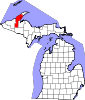
Villages Calumet | Copper City | Lake Linden | Laurium | South Range
Charter
townshipsGeneral law
townshipsUnincorporated
communitiesAlston | Atlantic Mine | Baltic | Chassell | Dakota Heights | Dodgeville | Dollar Bay | Donken | Dreamland | Franklin Mine | Freda | Hubbell | Hurontown | Jacobsville | Kenton | Klingville | Mason | Nisula | Painesdale | Portage Entry | Ripley | Seeberville | Senter | Sidnaw | Swedetown | Tapiola | Toivola | Winona
Categories:- Townships in Houghton County, Michigan
- Houghton micropolitan area


Wikimedia Foundation. 2010.