- Mehmels
-
Mehmels 

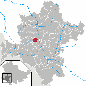
 MehmelsLocation of Mehmels within Schmalkalden-Meiningen district
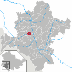
Coordinates 50°37′0″N 10°19′0″E / 50.616667°N 10.316667°ECoordinates: 50°37′0″N 10°19′0″E / 50.616667°N 10.316667°E Administration Country Germany State Thuringia District Schmalkalden-Meiningen Municipal assoc. Wasungen-Amt Sand Mayor Werner Eckardt Basic statistics Area 6.46 km2 (2.49 sq mi) Elevation 310 m (1017 ft) Population 363 (31 December 2010)[1] - Density 56 /km2 (146 /sq mi) Other information Time zone CET/CEST (UTC+1/+2) Licence plate SM Postal code 98634 Area code 036941 Website www.mehmels.de Mehmels is a municipality in the Schmalkalden-Meiningen district of Thuringia, Germany.
Towns and municipalities in Schmalkalden-Meiningen Altersbach • Aschenhausen • Bauerbach • Belrieth • Benshausen • Bermbach • Birx • Breitungen • Brotterode • Christes • Dillstädt • Einhausen • Ellingshausen • Erbenhausen • Fambach • Floh-Seligenthal • Frankenheim • Friedelshausen • Grabfeld • Henneberg • Hümpfershausen • Kaltensundheim • Kaltenwestheim • Kühndorf • Leutersdorf • Mehmels • Meiningen • Melpers • Metzels • Neubrunn • Oberhof • Oberkatz • Obermaßfeld-Grimmenthal • Oberschönau • Oberweid • Oepfershausen • Rhönblick • Rippershausen • Ritschenhausen • Rohr • Rosa • Roßdorf • Rotterode • Schmalkalden • Schwallungen • Schwarza • Springstille • Steinbach-Hallenberg • Stepfershausen • Sülzfeld • Trusetal • Unterkatz • Untermaßfeld • Unterschönau • Unterweid • Utendorf • Vachdorf • Viernau • Wahns • Wallbach • Walldorf • Wasungen • Wölfershausen • Zella-Mehlis
References
- ^ "Bevölkerung nach Gemeinden, erfüllenden Gemeinden und Verwaltungsgemeinschaften" (in German). Thüringer Landesamt für Statistik. 31 December 2010. http://www.statistik.thueringen.de/datenbank/TabAnzeige.asp?tabelle=gg000102%7C%7C.
Categories:- Municipalities in Thuringia
- Schmalkalden-Meiningen geography stubs

Wikimedia Foundation. 2010.