- Middleville, Michigan
-
Middleville, Michigan — Village — Location of Middleville, Michigan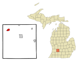
Coordinates: 42°42′54″N 85°27′53″W / 42.715°N 85.46472°W Country United States State Michigan County Barry Area – Total 2.1 sq mi (5.6 km2) – Land 2.1 sq mi (5.4 km2) – Water 0.1 sq mi (0.2 km2) Elevation 764 ft (233 m) Population (2000) – Total 2,721 – Density 1,313.7/sq mi (507.2/km2) Time zone Eastern (EST) (UTC-5) – Summer (DST) EDT (UTC-4) ZIP code 49333 Area code(s) 269 FIPS code 26-53760[1] GNIS feature ID 0632281[2] Middleville is a village in Thornapple Township, Barry County in the U.S. state of Michigan. The population was 2,721 at the 2000 census.
Contents
History
The first white settler to own land in the village was Calvin G. Hill, a native of New York, who bought 400 acres (1.6 km2) in 1834 on both sides of the Thornapple River.[3] The village was likely surveyed and subdivided before 1850, but the plat was not officially recorded until 1859. Prior to 1843, the settlement was often called "Thornapple". The name Middleville was at first given to a post office on the stage coach line between Grand Rapids and Kalamazoo. The post office was located at the house of Benjamin S. Dibble in section 2 in northeast Yankee Springs Township. Dibble had agreed to accept the post office at the request of U.S. Representative Lucius Lyon, of Kent County. Lyon suggested the name "Dibbleville", but Dibble disliked that name. "Middleville" was suggested because of the proximity of an Indian village known as "Middle Village" on Scales Prairie near the boundary line between Thornapple and Yankee Springs townships.[4] Dibble was appointed postmaster in July 1839 and continued until 1842. The next postmaster, John W. Bradley, continued to maintain the post office at Dibble's house until 1843, when it was moved to the present village of Middleville, with Calvin G. Hill as the postmaster. The village afterwards became known by the name of the post office.[5][6][7] The location of the original Indian village is NNE a few hundred yards of the present day intersection where Norris Rd. ends at Adams Rd.[citation needed] http://www.dnr.state.mi.us/spatialdatalibrary/pdf_maps/glo_plats/barry/04n10w.pdf
Geography
According to the United States Census Bureau, the village has a total area of 2.1 square miles (5.4 km2), of which, 2.1 square miles (5.4 km2) of it is land and 0.1 square miles (0.26 km2) of it (3.27%) is water.
Several West Michigan television stations have their transmitting towers in the Middleville area, including: WOOD-TV and WXMI.
Demographics
As of the census[1] of 2000, there were 2,721 people, 998 households, and 711 families residing in the village. The population density was 1,313.7 per square mile (507.5/km²). There were 1,050 housing units at an average density of 506.9 per square mile (195.8/km²). The racial makeup of the village was 95.74% White, 0.18% African American, 0.44% Native American, 0.74% Asian, 1.18% from other races, and 1.73% from two or more races. Hispanic or Latino of any race were 2.17% of the population.
There were 998 households out of which 42.4% had children under the age of 18 living with them, 52.6% were married couples living together, 12.7% had a female householder with no husband present, and 28.7% were non-families. 24.5% of all households were made up of individuals and 10.0% had someone living alone who was 65 years of age or older. The average household size was 2.72 and the average family size was 3.28.
In the village the population was spread out with 32.2% under the age of 18, 10.5% from 18 to 24, 32.3% from 25 to 44, 16.5% from 45 to 64, and 8.5% who were 65 years of age or older. The median age was 30 years. For every 100 females there were 95.6 males. For every 100 females age 18 and over, there were 93.7 males.
The median income for a household in the village was $41,947, and the median income for a family was $46,357. Males had a median income of $34,750 versus $21,883 for females. The per capita income for the village was $17,005. About 3.4% of families and 4.5% of the population were below the poverty line, including 4.3% of those under age 18 and 7.9% of those age 65 or over.
Education
There are five schools in Middleville, divided by grade level. They are:
- McFall Elementary: young fives, kindergarten and 1st grade
- Lee Elementary: 2nd and 3rd grade
- Page Elementary: 4th and 5th grade
- Thornapple-Kellogg Middle School: 6th through 8th grade
- Thornapple-Kellogg High School: 9th through 12th grade
Recreation
Middleville is 5 miles (8.0 km) from one end of the developed part of the Paul Henry-Thornapple Trail. A parking area for the trail is behind the Village Hall and the Village plans to further develop the trailhead, adding facilities and paving more of the trail. A three mile (5 km) section is already blacktopped, and popular with roller-bladers, bikers, runners and walkers. The Middleville section runs along the Thornapple River and has three bridges. It has been called one of Michigan's most beautiful rail trails.
The Village has opened a 9-hole disc golf course and a skateboard park in Village parks. Both are free.
Middleville is between the Middleville State Game Area and the Yankee Springs State Game Area. This Barry County area is known for the number and size of its deer, so it is popular with deer hunters(and not so popular with people who drive vehicles....). The SGAs also offer turkey, grouse, squirrel, goose, duck, rabbit and raccoon hunting opportunities.
The Thornapple-Kellogg Middle School hosts the National 24-Hour Challenge bicycling event, held annually on Father's Day weekend.
External links
- Postcard Collection of Middleville, Mich
- National 24-Hour Challenge
- Village of Middleville Homepage
- TK Schools Homepage
Notes
- ^ a b "American FactFinder". United States Census Bureau. http://factfinder.census.gov. Retrieved 2008-01-31.
- ^ "US Board on Geographic Names". United States Geological Survey. 2007-10-25. http://geonames.usgs.gov. Retrieved 2008-01-31.
- ^ Johnson p.486-87
- ^ Johnson p. 32 and p. 42
- ^ Potter, pp. 51-51
- ^ Johnson p. 491
- ^ Romig, Walter (1986) [1973]. Michigan Place Names. Detroit, Michigan: Wayne State University Press. ISBN 0-8143-1838-X.
References
- Johnson, Crisfield (2005) [1880]. History of Allegan and Barry counties, Michigan. Ann Arbor, Mich.: University of Michigan Library. http://name.umdl.umich.edu/ARH7558.0001.001. Retrieved 2008-03-30.
- Potter, William W (2005) [1912?]. History of Barry county. Ann Arbor, Mich.: University of Michigan Library. http://name.umdl.umich.edu/bad0847.0001.001. Retrieved 2008-03-30.
Municipalities and communities of Barry County, Michigan City 
Villages Charter
townshipsCivil
townshipsAssyria | Baltimore | Barry | Carlton | Castleton | Hope | Irving | Johnstown | Maple Grove | Orangeville | Prairieville | Thornapple | Woodland | Yankee Springs
Unincorporated
communitiesCloverdale | Delton | Dowling | Hickory Corners
Coordinates: 42°42′47″N 85°27′43″W / 42.71306°N 85.46194°W
Categories:- Populated places in Barry County, Michigan
- Villages in Michigan
- Grand Rapids – Wyoming metropolitan area
- Populated places established in 1834


Wikimedia Foundation. 2010.