- Ocean Grove, Massachusetts
-
Ocean Grove, Massachusetts — CDP — Coordinates: 41°43′44″N 71°12′34″W / 41.72889°N 71.20944°WCoordinates: 41°43′44″N 71°12′34″W / 41.72889°N 71.20944°W Country United States State Massachusetts County Bristol Area – Total 0.8 sq mi (2.1 km2) – Land 0.7 sq mi (1.7 km2) – Water 0.2 sq mi (0.4 km2) Elevation 16 ft (5 m) Population (2000) – Total 3,012 – Density 4,472.6/sq mi (1,726.9/km2) Time zone Eastern (EST) (UTC-5) – Summer (DST) EDT (UTC-4) FIPS code 25-50880 GNIS feature ID 0612642 Ocean Grove is a census-designated place (CDP) in the town of Swansea in Bristol County, Massachusetts, United States on the north shore of Mount Hope Bay near the Cole River. The population was 3,012 at the 2000 census.
Geography
Ocean Grove is located at 41°43′44″N 71°12′34″W / 41.72889°N 71.20944°W (41.728751, -71.209365)[1].
According to the United States Census Bureau, the CDP has a total area of 2.1 km2 (0.81 sq mi). 1.7 km2 (0.66 sq mi) of it is land and 0.4 km2 (0.15 sq mi) (18.29%) of it is water.
Demographics
As of the census[2] of 2000, there were 3,012 people, 1,234 households, and 856 families residing in the CDP. The population density was 1,735.7 /km2 (4,495 /sq mi). There were 1,303 housing units at an average density of 750.9 /km2 (1,945 /sq mi). The racial makeup of the CDP was 97.28% White, 0.43% African American, 0.10% Native American, 0.27% Asian, 0.23% from other races, and 1.69% from two or more races. Hispanic or Latino of any race were 0.37% of the population.
There were 1,234 households out of which 27.8% had children under the age of 18 living with them, 53.8% were married couples living together, 10.5% had a female householder with no husband present, and 30.6% were non-families. 26.5% of all households were made up of individuals and 10.7% had someone living alone who was 65 years of age or older. The average household size was 2.44 and the average family size was 2.95.
In the CDP the population was spread out with 20.8% under the age of 18, 7.3% from 18 to 24, 30.2% from 25 to 44, 25.6% from 45 to 64, and 16.1% who were 65 years of age or older. The median age was 40 years. For every 100 females there were 96.6 males. For every 100 females age 18 and over, there were 90.6 males.
The median income for a household in the CDP was $43,527, and the median income for a family was $50,777. Males had a median income of $36,919 versus $22,875 for females. The per capita income for the CDP was $20,007. About 6.6% of families and 7.7% of the population were below the poverty line, including 9.6% of those under age 18 and 14.9% of those age 65 or over.
References
- ^ "US Gazetteer files: 2010, 2000, and 1990". United States Census Bureau. 2011-02-12. http://www.census.gov/geo/www/gazetteer/gazette.html. Retrieved 2011-04-23.
- ^ "American FactFinder". United States Census Bureau. http://factfinder.census.gov. Retrieved 2008-01-31.
Municipalities and communities of Bristol County, Massachusetts Cities 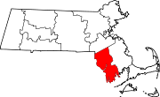
Towns CDPs Acushnet Center | Bliss Corner | Mansfield Center | North Attleborough Center | North Seekonk | North Westport | Norton Center | Ocean Grove | Raynham Center | Smith Mills
Other
villagesCategories:- Census-designated places in Bristol County, Massachusetts
- Swansea, Massachusetts

Wikimedia Foundation. 2010.