- Accident, Maryland
Infobox Settlement
official_name = Accident, Maryland
settlement_type =Town
nickname =
motto =
imagesize =
image_caption =
image_
imagesize =
image_caption =
image_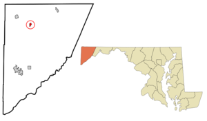
mapsize = 250x200px
map_caption = Location of Accident, Maryland
mapsize1 =
map_caption1 =subdivision_type = Country
subdivision_name =United States
subdivision_type1 = State
subdivision_name1 =Maryland
subdivision_type2 = County
subdivision_name2 = Garrett
government_footnotes =
government_type =
leader_title =
leader_name =
leader_title1 =
leader_name1 =
established_title =
established_date =unit_pref = Imperial
area_footnotes =
area_magnitude =
area_total_km2 = 1.3
area_land_km2 = 1.3
area_water_km2 = 0.0
area_total_sq_mi = 0.5
area_land_sq_mi = 0.5
area_water_sq_mi = 0.0population_as_of = 2000
population_footnotes =
population_total = 353
population_density_km2 = 274.6
population_density_sq_mi = 711.1timezone = Eastern (EST)
utc_offset = -5
timezone_DST = EDT
utc_offset_DST = -4
elevation_footnotes =
elevation_m = 727
elevation_ft = 2385
latd = 39 |latm = 37 |lats = 41 |latNS = N
longd = 79 |longm = 19 |longs = 12 |longEW = Wpostal_code_type =
ZIP code
postal_code = 21520
area_code = 301
blank_name = FIPS code
blank_info = 24-00225
blank1_name = GNIS feature ID
blank1_info = 0582858
website =
footnotes =Accident is a town in Garrett County,
Maryland ,United States . The population was 353 at the 2000 census. The town is home to Northern Garrett High School.History
Accident,
Garrett County, Maryland was one of the early settlements in the far west of Maryland. ["How did this spot get the name "Accident ?" Mary Strauss in "Flowery Vale: A History of Accident, Maryland",(Parson, West Virginia: McClain Printing Col, 1986), p. 1, provides an interestingstory of axe marks on a tree, and conflicting claims, cite web
url=http://www.whilbr.org/accident/index.aspx
title=A Pictorial History of Accident, Maryland, from the collection of Mary Miller Strauss
publisher=Western Maryland's Historical Society
accessdate=2008-03-29 but she has the sequence of events backwards,Fact|date=February 2008 and itis more likely, given that a number of counties had tracts of land called 'Accident,' thatBrooke Beall happened on the land by chance, liked it, and chose the name accordingly.]When
Lord Baltimore opened up the area he called Monocacy Manor to settlement in the early 1770s, Brooke Beall secured permission to survey convert|778|acre|km2. It will never be known for certain how Beall came to choose this particular spot, but the surveyor was given clear instructions where to start.He was to begin "in the center between two bounded whiteoak trees, standing on the North Side of the South fork of Bear Creek in or near a glade about one Hundred yards from said Run, about one or two Miles above a Lick known by the name of the "Cole Mine Lick ," about four miles (6 km) above the mouth of Broad Creek and about one mile (1.6 km) East of a Ridge of theNegroe Mountain ."John Hanson , Jr., later a delegate to theContinental Congress , and President of the United States in Congress Assembled, onApril 14 ,1774 , surveyed the land, finding that it only contained convert|682|acre|km2. For the next twelve years nothing was done with the survey. Revolution intervened, and it was not untilFebruary 15 ,1786 , that the land was granted by means of a patent toWilliam Deakins . The following year the surrounding countryside was surveyed into military lots byFrancis Deakins , lots that were meant as compensation for the officers who served from Maryland during the War of independence.
thumb|right|250 px|Detail from the original Francis Deakins 1787 survey of lots westward of Fort Cumberland, Library of Congress. Reproduced in Edward C. Papenfuse and Joseph M. Coale, "The Maryland State Archives Atlas of Historical Maps of Maryland", (Baltimore: Johns Hopkins University Press, 2003),p. 204John Hanson, Jr's original certificate of survey is on line at the Maryland State Archives, among the surveys for Washington County.Fact|date=April 2008
Geography
Accident is located at coor dms|39|37|41|N|79|19|12|W|city (39.628074, -79.319996)GR|1.
According to the
United States Census Bureau , the town has a total area of 0.5 square miles (1.3 km²), all of it land.Demographics
As of the
census GR|2 of 2000, there were 353 people, 138 households, and 96 families residing in the town. Thepopulation density was 711.1 people per square mile (272.6/km²). There were 162 housing units at an average density of 326.3/sq mi (125.1/km²). The racial makeup of the town was:*99.72% White
*0.28% from two or more races
*0.00% African American
*0.00% Native American
*0.00% Asian
*0.00% Pacific Islander
*0.00% Other
*0.00% Hispanic or Latino of any raceThere were 138 households out of which 37.7% had children under the age of 18 living with them, 54.3% were married couples living together, 12.3% had a female householder with no husband present, and 30.4% were non-families. 28.3% of all households were made up of individuals and 21.7% had someone living alone who was 65 years of age or older. The average household size was 2.56 and the average family size was 3.14.
In the town the population was spread out with 29.2% under the age of 18, 7.1% from 18 to 24, 22.4% from 25 to 44, 18.4% from 45 to 64, and 22.9% who were 65 years of age or older. The median age was 38 years. For every 100 females there were 73.9 males. For every 100 females age 18 and over, there were 73.6 males.
The median income for a household in the town was $22,500, and the median income for a family was $40,556. Males had a median income of $25,250 versus $18,750 for females. The
per capita income for the town was $11,950. About 10.9% of families and 17.5% of the population were below thepoverty line , including 17.3% of those under age 18 and 24.1% of those age 65 or over.Notable Residents and Natives
*
Wendell R. Beitzel , member ofMaryland House of Delegates References
External links
* [http://www.mdmunicipal.org/cities/index.cfm?townname=Accident&page=home Maryland Municipal League: Accident]
* [http://www.whilbr.org/accident/index.aspx Photographs of Accident, Western Maryland History Online, Whilbr]
* [http://www.relib.net Ruth Enlow Library]
Wikimedia Foundation. 2010.