- Ellsworth, Maine
Infobox Settlement
official_name = Ellsworth, Maine
settlement_type =City
nickname =
motto =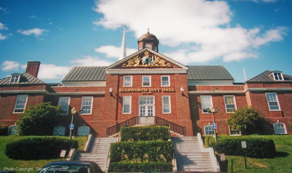
imagesize =
image_caption = City Hall
image_
mapsize = 250px
map_caption = Location of city of Ellsworth in the state of Maine
mapsize1 =
map_caption1 =subdivision_type = Country
subdivision_name =United States
subdivision_type1 = State
subdivision_name1 =Maine
subdivision_type2 = County
subdivision_name2 = Hancock
government_footnotes =
government_type =
leader_title =
leader_name =
leader_title1 =
leader_name1 =
established_title = Incorporated
established_date = 1800unit_pref = Imperial
area_footnotes =
area_magnitude =
area_total_km2 = 243.0
area_land_km2 = 205.3
area_water_km2 = 37.7
area_total_sq_mi = 93.8
area_land_sq_mi = 79.3
area_water_sq_mi = 14.6population_as_of = 2000
population_footnotes =
population_total = 6456
population_density_km2 = 31.5
population_density_sq_mi = 81.5timezone = Eastern (EST)
utc_offset = -5
timezone_DST = EDT
utc_offset_DST = -4
elevation_footnotes =
elevation_m = 33
elevation_ft = 108
latd = 44 |latm = 34 |lats = 20 |latNS = N
longd = 68 |longm = 28 |longs = 34 |longEW = Wpostal_code_type =
ZIP code
postal_code = 04605
area_code = 207
blank_name = FIPS code
blank_info = 23-23200
blank1_name = GNIS feature ID
blank1_info = 0565863
website =
footnotes =Ellsworth is a city in and the
county seat of Hancock County,Maine ,United States .GR|6 In the 2000 census, it had a population of 6,456. With many historic buildings and points of interest, Ellsworth is busy from May until September with visitors from all over the United States andCanada . In addition, the city is the gateway for tourists visiting nearbyAcadia National Park ,Mount Desert Island and the Bar Harbor region.History
*According to the history of the
Passamaquoddy Indians, the Ellsworth area was originally inhabited by members of the Passamaquoddy andPenobscot tribes: "Both groups speak closely relatedAlgonquian languages , althoughanthropologist s generally group the Passamaquoddies linguistically with theMaliseet s and the Penobscots with theAbenaki s." [http://www.passamaquoddy.com/history.htm]*Modern
historian s now believe thatNorse and othersailor s explored the Maine coast before the voyages of Columbus, and may have settled there. However, the earliest recordedEurope an settlers in the general area were the French, perhaps as early as the 1500s.*George J. Varney, in the 'Hancock County, Maine' section of his "Gazeteer of the State of Maine", published in
Boston in 1886, wrote: :"The first European who made definite mention of thePenobscot Bay and river, which wash its western side, wasThevet , a Frenchexplorer , in 1556.Martin Pring and Captain Weymouth, the English explorers, sailed along its shores in 1603 and 1605, and DeMonts, the Frenchman, explored some portions of the coast in 1604 and 1605. There is a tradition that Rosier, the historian of Weymouth's expedition, explored Deer Island thoroughfare, making a halt at the bold promontory in Brooksville, known as Cape Rosier. They found the county occupied by a tribe of Indians, who with those on Passamaquoddy waters, were noted for their long journeys incanoe s; whence the general name for these Indians, Etechmins. DeMonts claimed the country in the name of theKing of France in the trueCatholic style, setting up a cross and calling the country “Acadie.” By this name it continued to be known until the capture of Quebec by GeneralJames Wolfe in 1759. When Weymouth came in 1605, he also claimed the country in the name of his King,James I of England . Thus the two leading powers of Europe became adverse claimants of the soil of Hancock County, and the wars these claims occasioned kept the county an almost unbroken wilderness during the provincial history of Maine."*It is likely that the French who founded a colony at
Somes Sound onMount Desert Island in 1613, under the patronage of Madame deGuercheville , and explored the Ellsworth area and what is now the watershed of the Union River. Varney believes that there were French settlements of some kind or another as close to Ellsworth as Trenton, Oak Point, Newbury Neck and Surry.*The Ellsworth area was disputed between the English and the French throughout the 17th century and well into the 18th century, intermittent warfare which known as the
French and Indian Wars . Native American inhabitants may have converted toRoman Catholic ism and fought with the French against the English until the fall of Quebec City to the English in 1759. After the 1763 signing of the Treaty of Paris by the governments ofEngland ,France ,Spain andPortugal , Ellsworth became part of theCommonwealth of Massachusetts .*The modern history of Ellsworth begins with the settlement of the Union River area around 1763 by a party of English led by entrepreneurs Benjamin Milliken and Benjamin Joy, from southern Maine and
New Hampshire , who intended to builddam s andsawmill s to exploit the area'stimber andwater power . They applied for grants offered by the Commonwealth of Massachusetts to encourage settlement of the Hancock County area. Historian Albert H. Davis in his "History of Ellsworth, Maine", published inLewiston, Maine , in 1927, relates what is known of this early expedition and points to the northern end of the present Water Street, just to the south of the present bridge across the Union River, as the site of the earlier crude buildings erected by the pioneers.*George J. Varney describes the process of land grants by the Commonwealth of Massachusetts:
:"The first grants of land in the county were six townships, each six miles square, between the rivers Penobscot and Union (then known as the Donaqua), which were granted to David Marsh et als, by the General Court of Massachusetts, upon conditions, one of which was that they should settle each township with 60
Protestant families within six years. These grants were No. 1, Bucksport; 2, Orland; 3, Penobscot; ; 4, Sedgwick; 5, Blue Hill; and 6, Surry. Six other townships east of the Union River were granted on the same terms; three of which are in this county, viz.: No. 1, Trenton, granted to Eben Thorndike, et als; 2, Sullivan, to David Bean, et als; and 3, Mount Desert (Island) to Governor Bernard. The surveys were made by Samuel Livermore; and as there were three of the townships on each side of the river, it gave rise to the name which the stream now bears."*In 1773 the first
schooner was built at Ellsworth. This was the Susan and Abigail, named after daughters of the two most prominent citizens, Benjamin Milliken and Benjamin Joy. The vessel carried pine shingles and oak staves in annual voyages to theWest Indies . In the years up to the beginning of the 20th century, many schooners of various sizes were built in Ellsworthshipyard s along the Union River.*Albert Davis records that in the latter part of the 18th century, Ellsworth was known as the Union River Settlement and was adjacent to the settlements of Surry (to the east) and Trenton (to the south). Later it was organized as Plantation No. 7 and at times called Bowdoin and New Bowdoin. In 1798 the inhabitants petitioned to be incorporated under the name Sumner. That name having been already taken by a settlement in
Oxford County, Maine , the town was incorporated by the Commonwealth of Massachusetts in 1800 as Ellsworth, named forOliver Ellsworth , theConnecticut delegate to the 1787 National Convention that was then working on a Constitution for the newUnited States of America , and later the 3rdChief Justice of the Supreme Court . Oliver Ellsworth is thought to be first to suggest the name "United States of America".*Davis reports that in the late 1770s there were British raids on the Union River Settlement, with attempts to appropriate local
cattle . However, there were no formal battles in the Ellsworth area during the Revolutionary War.*In 1838 Ellsworth became the county seat of Hancock County, replacing Castine. The 1838 county buildings still stand, west of the Union River, on Bridge Hill.
*In 1859, when the town's population was 4,009, industries included 9 sawmills, 2
gristmill s, 1 tannery, 1carding machine, 1pottery maker, 8 brickyards, 13shipbuilder s, 5pail factories, 2 edge tool factories, 1carriage manufacturer and 8 box making establishments.*Between 1860 and 1865 Ellsworth sent 653 soldiers to fight in the Civil War, according to historian Albert Davis. This was at a time when there were only 847 (male) voters in the area. Military training was held in front of the county buildings on Bridge Hill, west of the Union River, at the site of the present Civil War Monument.
*In 1869 Ellsworth was incorporated as a city by the Maine Legislature. The first City Hall was Hancock Hall, which stood at the corner of Main Street and School Street. It was destroyed by the Great Ellsworth Fire of 1933.
*In 1888 electricity was introduced into the Ellsworth area.
*The disputed city elections in 1896 resulted in the appointment of two separate Ellsworth police forces, each of which threatened to arrest the other.
*Work on the Ellsworth
hydro-electric dam began in 1907, at the site of one of the original Benjamin Milliken Union River dams. This led to the creation of the present Leonard's Lake just north of the city.*Ellsworth's first disaster of the 20th century was the Great Flood of 1923. A spring
freshet rushed over the dam and carried off the metal Union River Bridge, along with many buildings along the river, such as the Dirigo Theater, theFoundry and many wharves andwarehouse s. This event marked the end of Ellsworth's prominence as ashipping center. The present concrete bridge was finished in 1924.*The Great Fire of 1933 destroyed most of Ellsworth's downtown
commercial district , on the east side of the Union River. New buildings were built in brick, mainly inArt Deco style. The unique Ellsworth City Hall dates from this period. Many old houses outside the business district survived theconflagration .*The 1960s and 70s saw the development of an Ellsworth
business district on High Street, which is the direct route to and from Bar Harbor andAcadia National Park . This area is now the largest shopping district in Hancock County, with severalshopping center s and many large stores, stretching nearly to the Ellsworth-Trenton boundary. Congested traffic during the summer has led to attempts to change the road network, especially at the busy intersection of U. S. Route 1 andMaine State Route 3 , known as The Triangle.Notable residents
*
Johannes Bapst , missionary & educator
*Curt Fullerton , baseball player
*Eugene Hale , senator
*Frank A. Moore , politician & judge
* John A. Peters, congressman
* John A. Peters, congressman (nephew of above)
*Darryl Pollard , football player
* Dick Scott, baseball player
*Tim Sylvia , martial artist
*Mary Agnes Tincker , novelist
*John Hay Whitney , publisher & ambassadorGeography
Ellsworth is located at 44°34'20" North, 68°28'34" West (44.572223, -68.476039)GR|1.
According to the
United States Census Bureau , the city has a total area of 93.8square mile s (243.0km² ), of which, 79.2 square miles (205.3 km²) of it is land and 14.6 square miles (37.7 km²) of it is water. The total area is 15.53% water. Located at thehead of navigation , Ellsworth is drained by the Union River. Ellsworth Falls is the location of the Agassiz Outcrop [http://www.maine.gov/doc/nrimc/mgs/explore/bedrock/sites/jan04.htm] , aNational Historic Landmark , notable for its early recognition as evidence ofglaciation .The city is crossed by U. S. Route 1 and 1A, as well as state routes 3, 172, 179, 180, 184 and 230. It borders the towns of Mariaville, Plantation T8 SD and Hancock to the northeast, Lamoine and Trenton to the southeast, Surry to the southwest, Orland to the west, and Dedham and Otis to the north.
Demographics
In the 2000
census GR|2, there were 6,456 people, 2,755 households, and 1,782 families in the city. Thepopulation density was 81.5 people per square mile (31.5/km²). There were 3,442 housing units at an average density of 43.4/sq mi (16.8/km²). The racial makeup ofwas 97.79% White, 0.19% African American, 0.29% Native American, 0.42% Asian, 0.03% Pacific Islander, 0.29% from other races, and 0.99% from two or more races. 0.65% of the population were Hispanic or Latino of any race.There were 2,755 households, of which 27.7% had children under 18 living with them, 51.4% were married couples living together, 10.1% had a female householder with no husband present, and 35.3% were non-families. 29.1% of all households were made up of individuals and 11.8% had someone living alone 65 years or older. The average household size was 2.26 and the average family size 2.75.
In the city the population was 21.9% under 18, 6.7% from 18 to 24, 29.0% from 25 to 44, 25.2% from 45 to 64, and 17.2% who were 65 or older. The median age was 40. For every 100 females there were 88.3 males. For every 100 females age 18 and over, there were 86.4 males.
The median income for a household ity was $35,938, and the median for a family $41,884. Males had a median of $31,455 versus $22,188 for females. The
per capita income for the city was $21,049. 9.2% of the population and 5.7% of families were below thepoverty line . 9.4% of those under 18 and 8.3% of those 65 and older were below the poverty line.ites of interest
* [http://www.birdsacre.com/ Birdsacre -- Stanwood Homestead Museum & Wildlife Sanctuary]
* Ellsworth Historical Society Building
* [http://www.grandonline.org/ The Grand -- Performing Arts Theatre]
* [http://www.ellsworthme.org/ringring/ The Telephone Museum]
* [http://www.woodlawnmuseum.com Woodlawn Museum -- The Black House]References
Further reading
* A. J. Coolidge & J. B. Mansfield, "A History and Description of New England", 1859; H. O. Houghton & Company, printers; Cambridge, Massachusetts
External links
* [http://www.cityofellsworthme.org City of Ellsworth, Maine]
* [http://www.ellsworth.lib.me.us/ Ellsworth Public Library]
* [http://www.ellsworthchamber.org/business/busallis.shtml Ellsworth Chamber of Commerce]
* [http://www.ellsworthamerican.com/ "Ellsworth American" weekly newspaper]
* [http://maine.gov/local/hancock/ellsworth/ Maine.gov -- Ellsworth, Maine]
*
Wikimedia Foundation. 2010.