- Coleman Street
-
Coordinates: 51°31′01″N 0°05′20″W / 51.517°N 0.0889°W
Ward of Coleman Street 
 Ward of Coleman Street
Ward of Coleman Street shown within Greater LondonOS grid reference TQ328815 Sui generis City of London Administrative area Greater London Region London Country England Sovereign state United Kingdom Post town LONDON Postcode district EC4 Dialling code 020 Police City of London Fire London Ambulance London EU Parliament London UK Parliament Cities of London and Westminster London Assembly City and East List of places: UK • England • London  A Coleman Street ward plaque, with the ward's symbol: a rooster (or cock)
Coleman Street is a street and one of the 25 ancient wards in the City of London.
Contents
The Ward
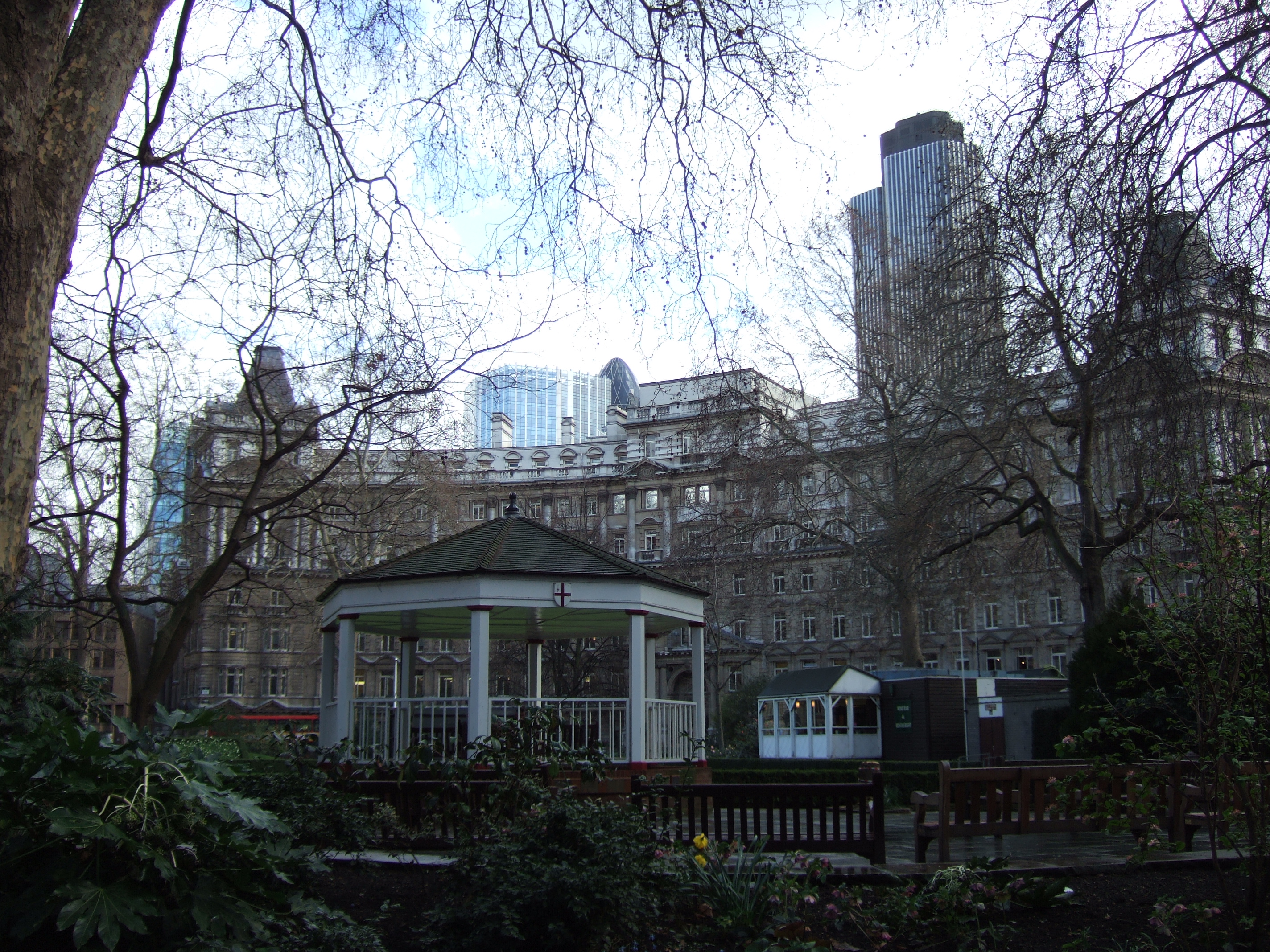
 Finsbury Circus, in the northeast of the ward, is the largest public park in the City
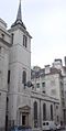 St Margaret Lothbury Church
Warren Stormes Hale, Lord Mayor of London in 1864, was the Ward’s most notable civic dignitary. It borders six wards[1] and runs from Chiswell Street at its northern-most point, the border with the London Borough of Islington,along Ropemaker Street around Finsbury Circus in the north-eastern corner via Blomfield Street down to Gresham Street and St Margaret Lothbury before coming back up Silk Street, its western extremity. Historically, it takes its name from the profession of charcoal burners who occupied the area in mediaeval times.[2] A very busy ward[3] it has its own long established ward club[4] and newsletter.[5] Despite the bustle of business, the ward also contains the City’s “finest oasis of calm”,[6] Finsbury Circus, an elliptical square with its own Bowling Club.[7]
Coleman Street is one of 25 wards in the City of London, each electing an Alderman, to the Court of Aldermen and Commoners (the City equivalent of a Councillor) to the Court of Common Council of the City of London Corporation. Only electors who are Freeman of the City of London are eligible to stand. As of March 2009[update], the elected members for Coleman Street are Alderman Sir Robert Finch, Deputy Michael Cassidy CBE, Sophie Fernandes, Stuart Fraser, Michael Henderson-Begg and Matthew Richardson.
The Street
Coleman Street runs from London Wall, to the north, to where Gresham Street meets Lothbury, to the south. The church of St Stephen, Coleman Street used to stand at the southern end of the street, on the western side, but was completely destroyed in the Blitz and not rebuilt. At the northern end of the street stands Armourers' Hall.[8]
On the night of January 5, 1642, after the King's failed attempt to arrest them, the 5 MPs Pym, Hampden, Haselrig, Strode and Holles hid on Coleman Street, utilising the support for Parliament that tended to be afforded by sympathisers in the City of London
References
- ^ Bishopsgate, Broad Street, Walbrook, Cheap, Bassishaw and Cripplegate
- ^ Book 2, Ch. 16: Coleman Street Ward in A New History of London: Including Westminster and Southwark, Noorthouck, J.: London, R. Baldwin & Co., 1773
- ^ City of London Police Overview
- ^ Details of Organisation
- ^ Ward Newsletter
- ^ Betjeman's Britain Betjeman,J : London, Folio Society, 1999 ISBN 185841708
- ^ Description of Locale
- ^ Al Smith (1970) Dictionary of City of London Street Names: 47
External links
- City of London Corporation Coleman Street ward boundaries (2003 —)
- Map of Early Modern London: Coleman Street Ward - Historical Map and Encyclopedia of Shakespeare's London (Scholarly)
- Coleman Street Ward Club
City of London Wards Aldersgate · Aldgate · Bassishaw · Billingsgate · Bishopsgate · Bread Street · Bridge · Broad Street · Candlewick · Castle Baynard · Cheap · Coleman Street · Cordwainer · Cornhill · Cripplegate · Dowgate · Farringdon Within · Farringdon Without · Langbourn · Lime Street · Portsoken · Queenhithe · Tower · Vintry · Walbrook
Enclaves Localities Attractions Bank of England Museum · Barbican Centre · Clockmakers' Museum · Dr. Johnson's House · Guildhall Art Gallery · London Mithraeum · London Stone · Mansion House · The Monument · Museum of London · Old Bailey · St. Paul's Cathedral · Smithfield MarketCivil parishes Bridges Tube and rail stations  Category ·
  CommonsCategories:
- Wards of the City of London
- Streets in the City of London


Wikimedia Foundation. 2010.