- White Island (Nunavut)
Infobox Islands
name = White Island
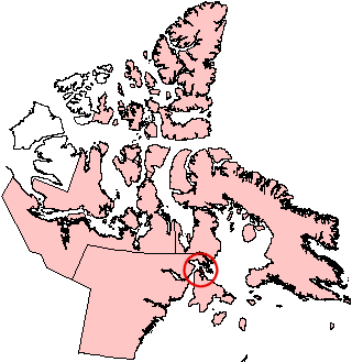
image caption = Location of White Island on a Nunavut map
image size =
locator
native name =
native name link =
nickname =
location =Northern Canada
coordinates = coord|65|50|N|84|50|W|display=inline,title|scale:5000000
archipelago =Canadian Arctic Archipelago
total islands =
major islands =
area = convert|789|km2|sqmi|abbr=on
highest mount = m to ft|num=1100|abbr=yes|spell=Commonwealth|precision=0|wiki=yes
elevation =
country = Canada
country admin divisions title = Nunavut
country admin divisions = flag|Nunavut
country admin divisions title 1 =Kivalliq Region
country admin divisions 1 =
country admin divisions title 2 =
country admin divisions 2 =
country capital city =
country largest city =
country largest city population =
country leader title =
country leader name =
country 1 =
country 1 admin divisions title =
country 1 admin divisions =
country 1 capital city =
country 1 largest city =
country 1 largest city population =
country 1 leader title =
country 1 leader name =
country 2 =
country 2 admin divisions title =
country 2 admin divisions =
country 2 capital city =
country 2 largest city =
country 2 largest city population =
country 2 leader title =
country 2 leader name =
population = 0
population as of =
density =
ethnic groups =White Island is one of the
Canadian arctic islands inNunavut ,Canada . Located off the northern tip ofSouthampton Island , it measures 789 km² (305 mi²) in area.White Island is separated from Southampton Island by the narrow (less than 2 km)
Comer Strait to the west, and Falcon Strait to the south. There are several capes including Cape Middleton, Cape Frigid, and Cape Deas. Whale Sound and Toms Harbour are on the eastern coast, andFrozen Strait is just beyond. White Island is surrounded by several small islands including Passage Island, Whale Island, Seekoo Island, Nas Island, as well as many that are unnamed. The highest peaks are m to ft|num=1100|abbr=yes|spell=Commonwealth|precision=0|wiki=yes and m to ft|num=1000|abbr=yes|spell=Commonwealth|precision=0|wiki=yes. While the island is strewn with lakes, the largest is 17 km long.
Wikimedia Foundation. 2010.