- Clutier, Iowa
-
Clutier, Iowa — City — Location of Clutier, Iowa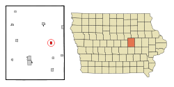
Coordinates: 42°4′44″N 92°24′12″W / 42.07889°N 92.40333°WCoordinates: 42°4′44″N 92°24′12″W / 42.07889°N 92.40333°W Country  United States
State  Iowa
IowaCounty Tama Area - Total 0.8 sq mi (2.0 km2) - Land 0.8 sq mi (2.0 km2) - Water 0.0 sq mi (0.0 km2) Elevation 886 ft (270 m) Population (2000) - Total 229 - Density 300.4/sq mi (116.0/km2) Time zone Central (CST) (UTC-6) - Summer (DST) CDT (UTC-5) ZIP code 52217 Area code(s) 319 FIPS code 19-14655 GNIS feature ID 0455490 Clutier is a city in Tama County, Iowa, United States. The population was 229 at the 2000 census.
Contents
Geography
Clutier is located at 42°4′44″N 92°24′12″W / 42.07889°N 92.40333°W (42.078780, -92.403243)[1].
According to the United States Census Bureau, the city has a total area of 0.8 square miles (2.1 km2), all land.
Demographics
As of the census[2] of 2000, there were 229 people, 109 households, and 58 families residing in the city. The population density was 300.4 people per square mile (116.3/km²). There were 124 housing units at an average density of 162.7 per square mile (63.0/km²). The racial makeup of the city was 97.82% White, 1.75% Native American, and 0.44% from two or more races.
There were 109 households out of which 22.0% had children under the age of 18 living with them, 49.5% were married couples living together, 3.7% had a female householder with no husband present, and 45.9% were non-families. 42.2% of all households were made up of individuals and 23.9% had someone living alone who was 65 years of age or older. The average household size was 2.10 and the average family size was 2.92.
In the city the population was spread out with 21.0% under the age of 18, 3.5% from 18 to 24, 26.2% from 25 to 44, 17.9% from 45 to 64, and 31.4% who were 65 years of age or older. The median age was 44 years. For every 100 females there were 87.7 males. For every 100 females age 18 and over, there were 84.7 males.
The median income for a household in the city was $27,344, and the median income for a family was $39,583. Males had a median income of $28,000 versus $24,375 for females. The per capita income for the city was $14,092. About 11.9% of families and 12.6% of the population were below the poverty line, including 16.4% of those under the age of eighteen and 7.0% of those sixty five or over.
Additionally
Clutier,Iowa is also the birth place of the fictional Marvel Universe super hero "Nomad." Jack Monroe (Nomad) was born on December 7, 1941, Pearl Harbor Day.
References
- ^ "US Gazetteer files: 2010, 2000, and 1990". United States Census Bureau. 2011-02-12. http://www.census.gov/geo/www/gazetteer/gazette.html. Retrieved 2011-04-23.
- ^ "American FactFinder". United States Census Bureau. http://factfinder.census.gov. Retrieved 2008-01-31.
Municipalities and communities of Tama County, Iowa Cities 
Townships Unincorporated
communitiesFootnotes ‡This populated place also has portions in an adjacent county or counties
Categories:- Cities in Iowa
- Populated places in Tama County, Iowa

Wikimedia Foundation. 2010.