- Coggon, Iowa
-
Coggon, Iowa — City — 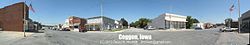 Location of Coggon, Iowa
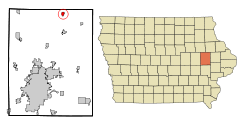
Coordinates: 42°16′45″N 91°31′47″W / 42.27917°N 91.52972°WCoordinates: 42°16′45″N 91°31′47″W / 42.27917°N 91.52972°W Country  United States
State  Iowa
IowaCounty Linn Area - Total 0.6 sq mi (1.7 km2) - Land 0.6 sq mi (1.6 km2) - Water 0.0 sq mi (0.1 km2) Elevation 932 ft (284 m) Population (2000) - Total 745 - Density 1,190.3/sq mi (459.6/km2) Time zone Central (CST) (UTC-6) - Summer (DST) CDT (UTC-5) ZIP code 52218 Area code(s) 319 FIPS code 19-14925 GNIS feature ID 0455514 Coggon is a city in Linn County, Iowa, United States. The population was 745 at the 2000 census. It is part of the Cedar Rapids Metropolitan Statistical Area.
Contents
History
Coggon was founded in 1857, and celebrated its sesquicentennial in 2007.[citation needed]
Geography
Coggon is located at 42°16′45″N 91°31′47″W / 42.27917°N 91.52972°W (42.279076, -91.529647)[1].
According to the United States Census Bureau, the city has a total area of 0.6 square miles (1.6 km2), of which, 0.6 square miles (1.6 km2) of it is land and 0.04 square miles (0.10 km2) of it (3.08%) is water.
Demographics
As of the census[2] of 2000, there were 745 people, 277 households, and 209 families residing in the city. The population density was 1,190.3 people per square mile (456.6/km²). There were 285 housing units at an average density of 455.4 per square mile (174.7/km²). The racial makeup of the city was 99.87% White and 0.13% Asian. Hispanic or Latino of any race were 0.40% of the population.
There were 277 households out of which 36.1% had children under the age of 18 living with them, 63.9% were married couples living together, 6.9% had a female householder with no husband present, and 24.2% were non-families. 21.3% of all households were made up of individuals and 11.6% had someone living alone who was 65 years of age or older. The average household size was 2.69 and the average family size was 3.12.
In the city the population was spread out with 30.2% under the age of 18, 5.2% from 18 to 24, 29.5% from 25 to 44, 19.1% from 45 to 64, and 16.0% who were 65 years of age or older. The median age was 35 years. For every 100 females there were 89.6 males. For every 100 females age 18 and over, there were 94.8 males.
The median income for a household in the city was $45,000, and the median income for a family was $58,214. Males had a median income of $38,958 versus $26,111 for females. The per capita income for the city was $19,871. About 4.4% of families and 6.2% of the population were below the poverty line, including 8.8% of those under age 18 and 9.0% of those age 65 or over.
See also
- Robert Kirkpatrick Round Barn, listed on the National Register of Historic Places
References
- ^ "US Gazetteer files: 2010, 2000, and 1990". United States Census Bureau. 2011-02-12. http://www.census.gov/geo/www/gazetteer/gazette.html. Retrieved 2011-04-23.
- ^ "American FactFinder". United States Census Bureau. http://factfinder.census.gov. Retrieved 2008-01-31.
External links
Municipalities and communities of Linn County, Iowa County seat: Cedar Rapids Cities Alburnett | Bertram | Cedar Rapids | Center Point | Central City | Coggon | Ely | Fairfax | Hiawatha | Lisbon | Marion | Mount Vernon | Palo | Prairieburg | Robins | Springville | Walford‡ | Walker

Unincorporated
communitiesParis | Toddville | Troy Mills | Viola | Waubeek | Whittier
Footnotes ‡This populated place also has portions in an adjacent county or counties
Categories:- Cities in Iowa
- Populated places in Linn County, Iowa
- Cedar Rapids metropolitan area

Wikimedia Foundation. 2010.