- Mansfield Covered Bridge
-
Mansfield Covered Bridge

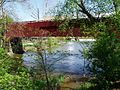
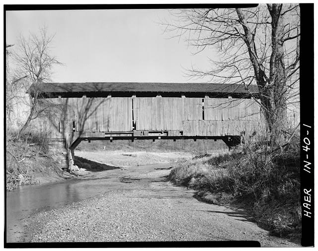
Nearest city: Mansfield, Indiana Coordinates: 39°40′35″N 87°6′7.99″W / 39.67639°N 87.1022194°WCoordinates: 39°40′35″N 87°6′7.99″W / 39.67639°N 87.1022194°W Built: 1867 Architect: Daniels,J. J. Architectural style: Other Governing body: Local MPS: Parke County Covered Bridges TR NRHP Reference#: 78000399 [1] Added to NRHP: December 22, 1978 The Mansfield Covered Bridge is located in Parke County, Indiana in the village of Mansfield, Indiana and was designed and built by J. J. Daniels in 1867[2] to cross the Big Raccoon Creek in Parke County, IN. The Bridge is 247 feet long and creates a picturesque environment for artist and photographers alike.
The Mansfield Covered Bridge is located at Mansfield Rd. (historic) and Big Raccoon Creek in Mansfield IN 47872, just southeast of Rockville, Indiana.
-

Interior arches are visible because of the sunlight coming through the missing roof (2006)
-
Roof restoration has begun after a spring 2006 storm removed over 50% of the roof.
See also
- Big Rocky Fork Covered Bridge
- Mansfield Roller Mill
- Pleasant Valley Cemetery
- Parke County Covered Bridges
- List of Registered Historic Places in Indiana
- Parke County Covered Bridge Festival
References
- ^ "National Register Information System". National Register of Historic Places. National Park Service. 2007-01-23. http://nrhp.focus.nps.gov/natreg/docs/All_Data.html.
- ^ Parke County - Covered Bridge Capital of the World
Parke County Covered Bridges Beeson - Big Rocky Ford - Billie Creek - Bowsher Ford - Bridgeton - Catlin - Conley's Ford - Cox Ford - Crooks - Harry Evans - Jackson - Jeffries Ford - Leatherwood Station - Mansfield - Marshall - McAllister - Mecca - Melcher - Mill Creek - Narrows - Neet - Nevins - Phillips - Portland Mills - Roseville - Rush Creek - Sanitorium - Sim Smith - Thorpe Ford - West Union - Wilkins Mill - Zacke Cox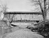 Categories:
- Covered bridges in Parke County, Indiana
- Bridges completed in 1867
- Road bridges in Indiana
- Indiana building and structure stubs
- United States bridge (structure) stubs
- Indiana Registered Historic Place stubs
-


Wikimedia Foundation. 2010.