- Between, Georgia
Infobox Settlement
official_name = Between, Georgia
other_name =
native_name =
nickname =
settlement_type =Town
motto =
imagesize =
image_caption =
flag_size =
image_
seal_size =
image_shield =
shield_size =
image_blank_emblem =
blank_emblem_type =
blank_emblem_size =
imagesize =
image_caption =
flag_size =
image_
seal_size =
image_shield =
shield_size =
image_blank_emblem =
blank_emblem_type =
blank_emblem_size =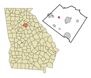
mapsize = 250px
map_caption = Location in Walton County and the state of Georgia
mapsize1 =
map_caption1 =
image_dot_
dot_mapsize =
dot_map_caption =
dot_x =
dot_y =
pushpin_
pushpin_label_position =
pushpin_map_caption =
pushpin_mapsize =
subdivision_type = Country
subdivision_name =United States
subdivision_type1 = State
subdivision_name1 = Georgia
subdivision_type2 = County
subdivision_name2 = Walton
subdivision_type3 =
subdivision_name3 =
subdivision_type4 =
subdivision_name4 =
government_footnotes =
government_type =
leader_title =
leader_name =
leader_title1 =
leader_name1 =
leader_title2 =
leader_name2 =
leader_title3 =
leader_name3 =
leader_title4 =
leader_name4 =
established_title =
established_date =
established_title2 =
established_date2 =
established_title3 =
established_date3 =
area_magnitude =
unit_pref = Imperial
area_footnotes =
area_total_km2 = 2.2
area_land_km2 = 2.2
area_water_km2 = 0
area_total_sq_mi = 0.9
area_land_sq_mi = 0.9
area_water_sq_mi = 0
area_water_percent =
area_urban_km2 =
area_urban_sq_mi =
area_metro_km2 =
area_metro_sq_mi =
area_blank1_title =
area_blank1_km2 =
area_blank1_sq_mi =
population_as_of = 2000
population_footnotes =
population_note =
population_total = 148
population_density_km2 = 67.3
population_density_sq_mi = 164.4
population_metro =
population_density_metro_km2 =
population_density_metro_sq_mi =
population_urban =
population_density_urban_km2 =
population_density_urban_sq_mi =
population_blank1_title =
population_blank1 =
population_density_blank1_km2 =
population_density_blank1_sq_mi =
timezone = Eastern (EST)
utc_offset = -5
timezone_DST = EDT
utc_offset_DST = -4
latd = 33 |latm = 48 |lats = 50 |latNS = N
longd = 83 |longm = 48 |longs = 33 |longEW = W
elevation_footnotes =
elevation_m = 293
elevation_ft = 961
postal_code_type =ZIP code
postal_code = 30655
area_code = 470/678/770
blank_name = FIPS code
blank_info = 13-07640GR|2
blank1_name = GNIS feature ID
blank1_info = 0311261GR|3
website =
footnotes =Between is a town in Walton County, Georgia,
United States . The population was 148 at the 2000 census.Meaning of the Name
The town is called Between because it is between two of Georgia's largest cities — Atlanta and Athens are the exact same distance to Between. It is also between Walton County's two largest cities, Loganville and Monroe [cite book|title=Weird, Wacky, and Wild Georgia Trivia|last=Watson|first=Stephanie|coauthors=Lisa Wojna|year=2008|publisher=Blue Bike Books|isbn=978-1-897278-44-4|pages=59] .
Matthew Thomas "Bud" Dalton taught music lessons and sang both for his church and throughout Walton, Gwinnett and Barrow Counties in Georgia. He was a star route carrier; he carried mail from Campton, Monroe, Between, Snellville, and he slept in Loganville, Georgia between 1870 to 1910. Edgar Dalton, born 7 May 1905, on Hwy 11 of Monroe, Georgia, said that when the first store was built in Between, Georgia, the owner did not know what to call the store. Matthew Dalton knew the people that owned the store as he had been carrying mail on horseback at that time. Matthew Thomas Dalton told the owners that they should call the store Between, Georgia. (The Postmaster of Monroe got the credit for name Between, Georgia.)
Geography
Between is located at coor dms|33|48|50|N|83|48|33|W|city (33.813956, -83.809170)GR|1.
According to the
United States Census Bureau , the town has a total area of 0.9square mile s (2.3km² ), all of it land.Demographics
As of the
census GR|2 of 2000, there were 148 people, 61 households, and 42 families residing in the town. Thepopulation density was 170.4 people per square mile (65.7/km²). There were 63 housing units at an average density of 72.5/sq mi (28.0/km²). The racial makeup of the town was 96.62% White and 3.38% African American. Hispanic or Latino of any race were 0.68% of the population.There were 61 households out of which 23.0% had children under the age of 18 living with them, 59.0% were married couples living together, 6.6% had a female householder with no husband present, and 31.1% were non-families. 24.6% of all households were made up of individuals and 6.6% had someone living alone who was 65 years of age or older. The average household size was 2.43 and the average family size was 2.98.
In the town the population was spread out with 23.6% under the age of 18, 12.2% from 18 to 24, 21.6% from 25 to 44, 31.1% from 45 to 64, and 11.5% who were 65 years of age or older. The median age was 38 years. For every 100 females there were 117.6 males. For every 100 females age 18 and over, there were 109.3 males.
The median income for a household in the town was $52,222, and the median income for a family was $52,292. Males had a median income of $41,875 versus $24,688 for females. The
per capita income for the town was $20,115. There were 12.2% of families and 8.9% of the population living below thepoverty line , including 12.8% of under eighteens and 16.7% of those over 64.References
External links
Wikimedia Foundation. 2010.