- Old Windsor Lock
-
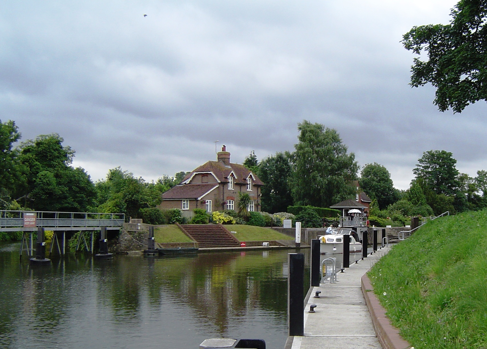
Old Windsor Lock 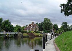
Old Windsor Lock from the upstream sideWaterway River Thames County Berkshire Maintained by Environment Agency Operation Hydraulic First built 1822 Latest built 1957 Length 179' 0" (54.55m) Width 24' 2" (7.36m) Fall 5' 9" (1.74m) Above sea level 53 Distance to
Teddington Lock20 miles Power is available out of hours Old Windsor Lock is a lock on the River Thames in England close to Old Windsor on the side of the river towards the town.[1] The lock marks the start of the New Cut, built in 1822 by the Thames Navigation Commissioners, which created Ham Island in the hook of the old river. The lock connects to Ham Island and there is a footbridge across the lock cut.
There is a small weir beside the lock, but the main weir is some way upstream at the top end of Ham Island.
Contents
History
The old name for the site of the lock was "Top of Caps" and the first suggestion for a lock at "Capps" was in 1770. However it was not until 1822 that the lock cut and lock were built. No weir was built at the time, although there was already an obstruction called "Newman's Bucks" at the islands that are now at the top of the lock cut. Of these islands, only that called Lion Island remains. The first lock keeper was dismissed after various demeanors which included digging through the bank of the lock cut and thereby causing the collapse of the new lock cut bridge. The weir was constructed in 1836. In 1868 there was discussion of removing the lock, but instead it was extended with a tumbling bay added. In 1871 the lock cut bridge was rebuilt with the right reserved to lay sewage pipes across it.[2] The lock was rebuilt in 1957.
Access to the lock
The lock is only accessible by foot and can be reached from the end of a long spur road leading to The Manor and The Priory from Old Windsor.
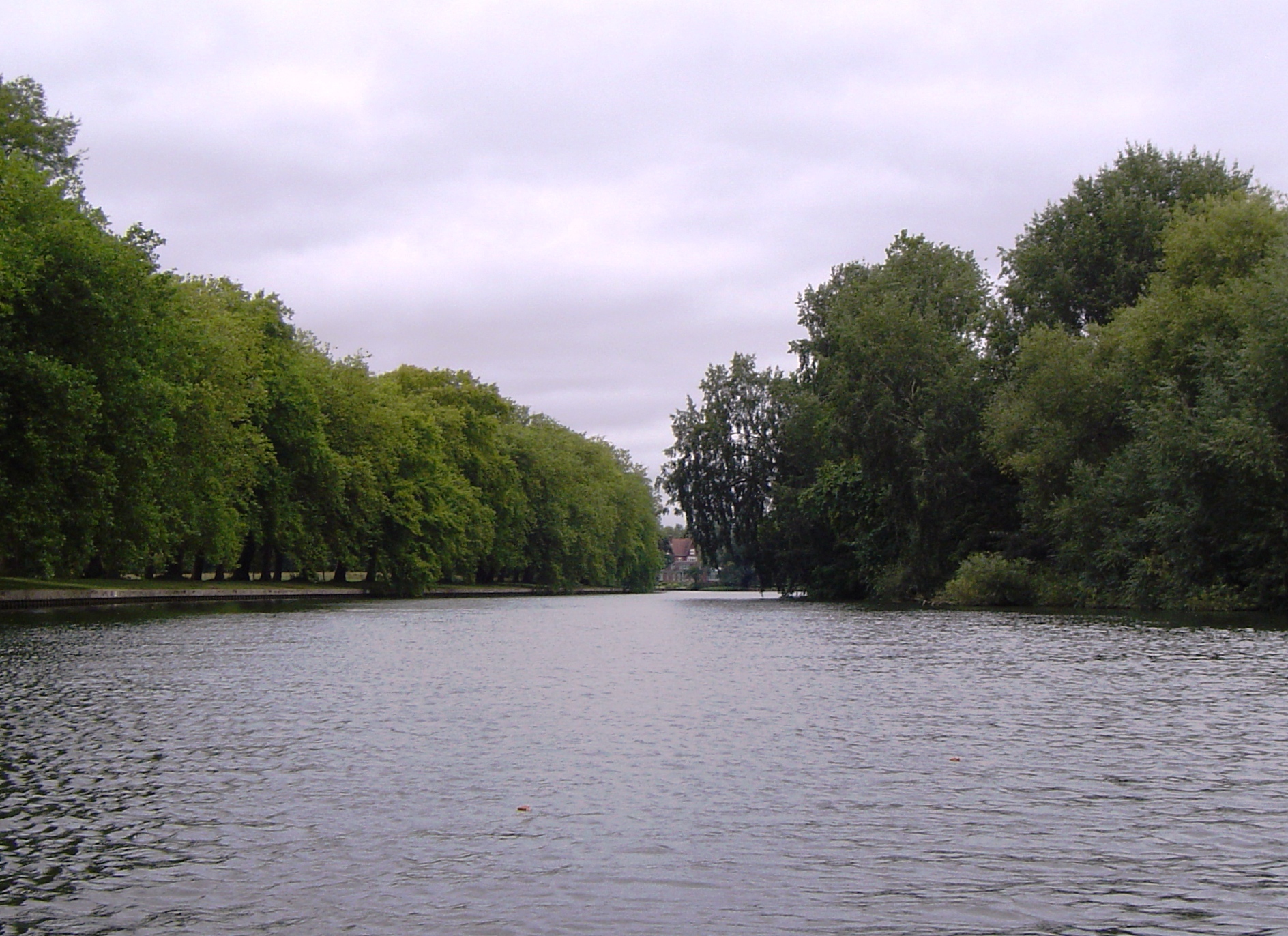
Reach above the lock
 River Thames at Datchet
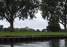 Windsor Castle from the river
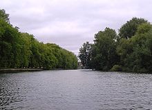
The Cut is about half a mile long and is crossed by Ham Bridge going to Ham Island. Lion Island is at the top of the cut where the streams separate. Then Albert Bridge crosses the river and on the Windsor side, the river winds round farmland at Princes Consort farm and Windsor Castle Home Park. On the opposite side is the town of Datchet with Sumptermead Ait along the side of the river. There follows Victoria Bridge and then a golf course, followed by Black Potts Railway Bridge. The railway bridge is supported by Black Potts Ait, behind which the Jubilee River rejoins the Thames. There are then the playing fields of Eton College. The area known as Black Potts up to Romney Island has been a popular fishing area, with Isaak Walton and Charles II both recorded as fishing there.
Thames Path
The Thames Path should continue on the towpath on the Windsor side, but this has been closed off and walkers are forced to cross Albert Bridge, take the metalled road through Datchet and Sumptermead Ait and return over Victoria Bridge.
See also
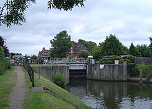 Old Windsor Lock from below
- Locks on the River Thames
References
- ^ Statistics from Environment Agency A User's Guide to the River Thames:Part II
- ^ Fred. S. Thacker The Thames Highway: Volume II Locks and Weirs 1920 - republished 1968 David & Charles
Next lock upstream River Thames Next lock downstream Romney Lock
3.00 milesOld Windsor Lock
Grid reference: SU994748Bell Weir Lock
2.92 milesCategories:- Locks on the River Thames
- Thames Path


Wikimedia Foundation. 2010.