- Eastern Passage, Nova Scotia
:Infobox Settlement
official_name = Eastern Passage
other_name =
native_name =
nickname =
settlement_type =
motto =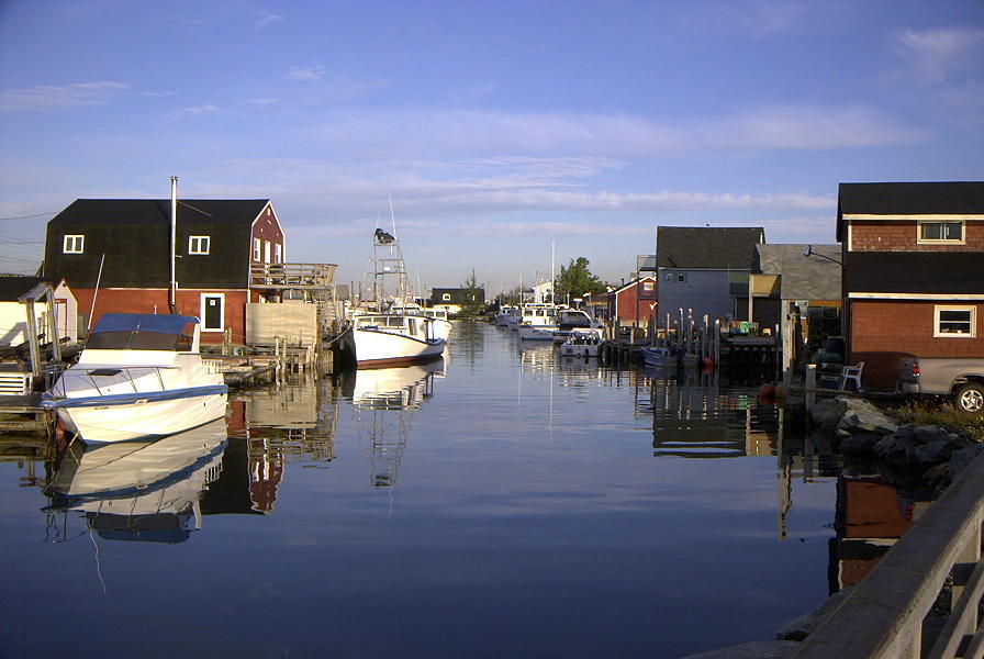
imagesize = 250px
image_caption = The Cove at Eastern Passage in 2001
flag_size =
image_
seal_size =
image_shield =
shield_size =
city_logo =
citylogo_size =
mapsize =
map_caption =
mapsize1 =
map_caption1 =
settlement_type = Community
motto =
image_dot_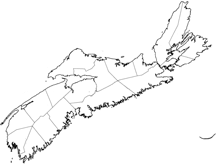
dot_mapsize = 250px
dot_map_caption =Location of Pagename
dot_x =104 |dot_y =102
pushpin_
pushpin_label_position =
pushpin_map_caption =
pushpin_mapsize =
subdivision_type = Country
subdivision_name = CAN
subdivision_type1 = Province
subdivision_name1 = NS
subdivision_type2 = Municipality
subdivision_name2 = HRM
subdivision_type4 = District
subdivision_name4 = 9
government_footnotes =
government_type = Regional Council
leader_title = Governing Council
leader_name =Halifax Regional Council
leader_title1 = Community Council
leader_name1 = [http://www.halifax.ca/commcoun/hecc/hecc.html Harbour East]
leader_title2 =
leader_name2 =
leader_title3 =
leader_name3 =
leader_title4 =
leader_name4 =
established_title = Founded
established_date = circa 1798
established_title2 =
established_date2 =
established_title3 =
established_date3 =
area_magnitude =
unit_pref =
area_footnotes =
area_total_km2 = 29.38
area_land_km2 =
area_water_km2 =
area_total_sq_mi =
area_land_sq_mi =
area_water_sq_mi =
area_water_percent =
area_urban_km2 =
area_urban_sq_mi =
area_metro_km2 =
area_metro_sq_mi =
population_as_of = 2001
population_footnotes =
population_note =
population_total = 8,872
population_density_km2 =
population_density_sq_mi =
population_metro =
population_density_metro_km2 =
population_density_metro_sq_mi =
population_urban =
population_density_urban_km2 =
population_density_urban_sq_mi =
population_blank1_title =
population_blank1 =
population_density_blank1_km2 =
population_density_blank1_sq_mi =
timezone = AST
utc_offset = -4
timezone_DST = ADT
utc_offset_DST = -3
latd= 44|latm= 36|lats=51 |latNS= N
longd= 63|longm= 28|longs= 15|longEW= W
elevation_footnotes =
elevation_m = 0-36
elevation_ft =
postal_code_type = Canadian Postal code
postal_code = B3G
area_code = 902
blank_name = GNBC Code
blank_info = CAKQU
blank1_name =
blank1_info =
website = http://www.easternpassage.ca/
|footnotes =Part of a series about Places in Nova Scotia Eastern Passage is a Canadian urban community in
Nova Scotia 'sHalifax Regional Municipality .Located at the southeastern edge of
Halifax Harbour , fronting theAtlantic Ocean , Eastern Passage derives its name from the narrow strait separating the mainland fromMcNabs Island , an island in the harbour lying several hundred metres west of the community. This "Eastern Passage" into the harbour is not the main shipping channel due to its shallow depths; the main shipping channel lies west of McNabs Island. The Eastern Passage is largely used by small recreational boats and fishing vessels during inclement weather as the island affords shelter from prevailing winds.Eastern Passage has historically been tied to the fishing industry and its waterfront demonstrates this with multiple small wharves and piers. The construction of
CFB Shearwater , a military air base, at the northern boundary of the community duringWorld War I , along with the construction of the Imperial Oil (later Esso) and the Texaco (later Ultramar) oil refinery and an automobile import/export facility followingWorld War II redefined the local economy. New highway connections have resulted in the majority of area residents commuting toDowntown Halifax or Dartmouth.History
Prior to the European settlers, Eastern Passage was a season home to the
Mi'kmaq for thousands of years. Europeans began seasonal use of the channel starting about 1712 and the Mi'kmaq, shifted to McNab's island. The Eastern Passage area was initially granted to ranger Joseph Gorham but he did not settle the passage and the land was regranted in 1798 to Joseph Horne, the first recorded settler who was soon followed by other families. [Alfreda Withrow, "One City, Many Communities", Nimbus Publishing, 1999, pages 21-23.] The first European settlers who moved there were mainly German, French, Irish and English. Theseethnic group s continue to make up a large portion of the population of Eastern Passage.Fort Clarence, a large gun battery was constructed beside Eastern Passage in the 1860s to defend the harbour, providing a cross fire with batteries on Georges Island and
McNabs Island . During the American Civil War, a southern naval vessel CSS Tallahassee is believed to have used the Eastern Passage channel to escaped unnoticed from Union naval forces believed to be waiting at the main harbour entrance.An American naval air station was constructed at Eastern Passage during
World War I to patrol against German submarines. It was taken over by theRoyal Canadian Air Force in the 1920s and became a large air base during World War Two.In the 1920s and 30s, A number of Eastern Passage residents from the Hartlan and Henneberry families proved important sources of Canadian folk songs and stories to Nova Scotia folklorist
Helen Creighton .Serious reductions to the
CFB Shearwater base in the 1990s and the shutdown of the Ultramar Refinery challenged the economy of Eastern Passage in the 1990s. One response was the redevelopment of the small craft harbour, long known as "the Creek" or "the cove" but rechristened in 1996 as "Fisherman's Cove", a tourist attracton which combines a working fishing harbour with gift shops and restaurants.tatistics
*Population (2001): 8,872
*Population (2006): 13,000+
*Total Area: 29.38 km²
*Latitude: 44.614296
*Longitude: -63.470833Local Businesses
*Autoport Limited
*Blue Canoe (Irving gas station with convenience store)
*Boardwalk Dentistry
*Boondocks (a seafood restaurant)
*Chris Brothers (convenience store and deli)
*Cow Bay Variety
* [http://www.emmaseatery.ca Emma's Eatery]
*Gold Dragon
*Great Canadian Dollar Store
*Impressions Unisex Hair Salon
*Li Garden
*Movie Gallery (movie rentals)
*NSLC Liquor Store
*PassagePharmasave
*Sea Gulps
*Shannon Dough Pizza
*Subway
*The Inn At Fisherman's Cove
*Tim Hortons
*Ultramar
*Eastern Passage Village Veterinary Clinic
*Wharf Wraps (take-out)
*The Fish Basketchools
Ocean View Elementary School *Type: Elementary*
*Grades: Primary to 4
*Constructed: 1954
*Current Square Footage: convert|44061|sqft|m2|abbr=on.
*Website: [http://www.oves.ednet.ns.ca/ http://www.oves.ednet.ns.ca]Tallahassee Community School *Type: Elementary*
*Grades: Primary to 4
*Constructed: 1991
*Current Square Footage: convert|64600|sqft|m2|abbr=on.
*Website: [http://www.tcs.ednet.ns.ca/ http://www.tcs.ednet.ns.ca]Seaside Elementary *Type: Sr. Elementary
*Grades: 4 French Immersion, 5, 6
*Constructed: 1974
*Current Square Footage: convert|44737|sqft|m2|abbr=on.
*Website: [http://seaside.ednet.ns.ca/ http://seaside.ednet.ns.ca]Eastern Passage Education Centre *Type: Junior High
*Grades: 7 to 9
*Constructed: 1999
*Current Square Footage: convert|82645|sqft|m2|abbr=on.
*Website: [http://www.epec.ednet.ns.ca/ http://www.epec.ednet.ns.ca]"Note: High school (Grades 10-12) students are bussed out of the community to neighboring
Cole Harbour District High School . There is talk of a new high school being built by 2011 for students from Eastern Passage and neighbouring Woodside.""*Whether elementary students attend Oceanview or Tallahassee is dependent on living location within the area.
Recreation
Parks/Playgrounds
There are several parks and playgrounds in the area. Two are located in the Heritage Hills subdivision (on Melrose and Serop Crescent, respectively), and there are playgrounds at Tallahssee, Oceanview, and Seaside schools. In August, 2006, a new skateboard park opened near Seaside Elementary.
Fields
Playing fields are plentiful within the community. There is a large
playing field at Eastern Passage Education Centre, and numerous baseball and general purpose fields located within the vicinity of the 3 elementary schools.Other Recreation
A public
tennis court is located near Seaside Elementary. The community Rec. Centre (located in the Tallahasasee Community School building) often has various activities going on year-round for both families and individuals.Several beaches are in the area. McCormick's Beach is located at Fisherman's Cove near the boardwalk. A salt water beach (Rainbow Haven Beach), is located towards the Cow Bay area of the community. A large serviced beach (MacDonald Beach) is located between Eastern Passage and Cole Harbour. There is also a smaller beach located down the road from MacDonald Beach.
ervices
Water
While much of the community is serviced by municipal water, areas on the outer edges of the community require the use well water/septic systems.
Telecommunications
All of Eastern Passage is serviced by both
Aliant (Telephone andDSL Broadband) and Eastlink (Telephone, Cable Broadband,Cable TV ). The area has cellular coverage for bothGSM (Rogers/Fido ) andCDMA (Telus /Aliant).References
External links
* [http://www.easternpassage.ca Eastern Passage Community Website]
* [http://www.fishermanscove.ns.ca/ Fisherman's Cove]
* [http://www3.ns.sympatico.ca/mary.conrod/b&b.html Eastern Passage Bed and Breakfast]Subdivisions of Nova Scotia
----
Wikimedia Foundation. 2010.