- Fanning Springs, Florida
Infobox Settlement
official_name = Fanning Springs, Florida
other_name =
native_name =
nickname =
settlement_type =City
motto =
imagesize =
image_caption =
flag_size =
image_
seal_size =
image_shield =
shield_size =
image_blank_emblem =
blank_emblem_type =
blank_emblem_size =
imagesize =
image_caption =
flag_size =
image_
seal_size =
image_shield =
shield_size =
image_blank_emblem =
blank_emblem_type =
blank_emblem_size =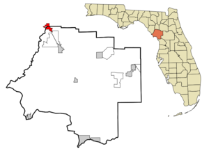
mapsize = 250x200px
map_caption = Location in Levy County and the state ofFlorida
mapsize1 =
map_caption1 =
image_dot_
dot_mapsize =
dot_map_caption =
dot_x =
dot_y =
pushpin_
pushpin_label_position =
pushpin_map_caption =
pushpin_mapsize =
subdivision_type = Country
subdivision_name =
subdivision_type1 = State
subdivision_name1 =
subdivision_type2 = Counties
subdivision_name2 = Levy, Gilchrist
subdivision_type3 =
subdivision_name3 =
subdivision_type4 =
subdivision_name4 =
government_footnotes =
government_type =
leader_title =
leader_name =
leader_title1 =
leader_name1 =
leader_title2 =
leader_name2 =
leader_title3 =
leader_name3 =
leader_title4 =
leader_name4 =
established_title =
established_date =
established_title2 =
established_date2 =
established_title3 =
established_date3 =
area_magnitude =
unit_pref = Imperial
area_footnotes =
area_total_km2 = 9.6
area_land_km2 = 9.2
area_water_km2 = 0.4
area_total_sq_mi = 3.7
area_land_sq_mi = 3.6
area_water_sq_mi = 0.1
area_water_percent =
area_urban_km2 =
area_urban_sq_mi =
area_metro_km2 =
area_metro_sq_mi =
area_blank1_title =
area_blank1_km2 =
area_blank1_sq_mi =
population_as_of = 2000
population_footnotes =
population_note =
population_total = 737
population_density_km2 = 76.8
population_density_sq_mi = 199.2
population_metro =
population_density_metro_km2 =
population_density_metro_sq_mi =
population_urban =
population_density_urban_km2 =
population_density_urban_sq_mi =
population_blank1_title =
population_blank1 =
population_density_blank1_km2 =
population_density_blank1_sq_mi =
timezone = Eastern (EST)
utc_offset = -5
timezone_DST = EDT
utc_offset_DST = -4
latd = 29 |latm = 35 |lats = 3 |latNS = N
longd = 82 |longm = 55 |longs = 27 |longEW = W
elevation_footnotes =
elevation_m = 9
elevation_ft = 30
postal_code_type =ZIP code
postal_code = 32693
area_code = 352
blank_name = FIPS code
blank_info = 12-21850GR|2
blank1_name = GNIS feature ID
blank1_info = 0291913GR|3
website =
footnotes =Fanning Springs is a city located both in Levy County and
Gilchrist County, Florida . The population was 737 at the 2000 census. As of 2004, the population recorded by theU.S. Census Bureau is 800. [http://www.census.gov/popest/cities/tables/SUB-EST2004-04-12.xls]Geography
Fanning Springs is located at coor dms|29|35|3|N|82|55|27|W (29.584224, -82.924160).GR|1
According to the
United States Census Bureau , the city has a total area of 9.6 km² (3.7 sq mi). 3.6 square miles (9.2 km²) of it is land and 0.1 square miles (0.4 km²) of it (3.78%) is water.Demographics
As of the
census GR|2 of 2000, there were 737 people, 311 households, and 198 families residing in the city. Thepopulation density was 207.2 people per square mile (79.9/km²). There were 397 housing units at an average density of 111.6/sq mi (43.1/km²). The racial makeup of the city was 89.01% White, 4.34% African American, 0.68% Native American, 0.54% Asian, 3.66% from other races, and 1.76% from two or more races. Hispanic or Latino of any race were 8.96% of the population.There were 311 households out of which 25.4% had children under the age of 18 living with them, 42.8% were married couples living together, 15.8% had a female householder with no husband present, and 36.3% were non-families. 29.3% of all households were made up of individuals and 12.2% had someone living alone who was 65 years of age or older. The average household size was 2.37 and the average family size was 2.84.
In the city the population was spread out with 24.7% under the age of 18, 9.5% from 18 to 24, 23.7% from 25 to 44, 25.0% from 45 to 64, and 17.1% who were 65 years of age or older. The median age was 38 years. For every 100 females there were 100.3 males. For every 100 females age 18 and over, there were 91.4 males.
The median income for a household in the city was $17,875, and the median income for a family was $24,167. Males had a median income of $25,139 versus $14,306 for females. The
per capita income for the city was $11,389. About 26.1% of families and 30.5% of the population were below thepoverty line , including 46.6% of those under age 18 and 19.9% of those age 65 or over.References
External links
* [http://www.fanningspringsflorida.com/ Fanning Springs Chamber of Commerce]
* [http://www.gilchristcounty.com/ Gilchrist County Chamber of Commerce]
Wikimedia Foundation. 2010.