- Wallingford, Connecticut
Infobox Settlement
official_name = Wallingford, Connecticut
settlement_type = Town
imagesize =
image_caption =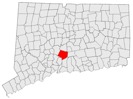
mapsize = 250x200px
map_caption = Location in Connecticut
mapsize1 =
map_caption1 =
subdivision_type =NECTA
subdivision_name = New Haven
subdivision_type1 = Region
subdivision_name1 = South Central Region
subdivision_type2 =
subdivision_name2 =
government_type =Mayor-council
leader_title = Mayor
leader_name = William W. Dickinson, Jr.
established_title = Named
established_date = 1670
area_land_km2 = 101.1
area_water_km2 = 2.2
area_total_sq_mi = 39.9
area_magnitude =
area_total_km2 = 103.3
population_as_of = 2005
population_total = 44736
population_footnotes = [ [http://www.census.gov/popest/cities/files/SUB-EST2005_9.csv U.S. Census Bureau Population Estimates] ]
population_density_sq_mi = 1147
population_density_km2 = 443
timezone = Eastern
utc_offset = -5
timezone_DST = Eastern
utc_offset_DST = -4
area_land_sq_mi = 39.0
area_water_sq_mi = 0.9
elevation_m = 46
elevation_ft = 151
latd = 41 |latm = 27 |lats = 23 |latNS = N
longd = 72 |longm = 48 |longs = 15 |longEW = W
postal_code_type = ZIP code
postal_code = 06492
region =
website = http://www.town.wallingford.ct.us/
area_code = 203
blank_name = FIPS code
blank_info = 09-78740
blank1_name = GNIS feature ID
blank1_info = 0213522
footnotes =Wallingford is a town in New Haven County,
Connecticut ,United States . The population was 43,026 at the 2000 census.History
Wallingford was established on October 10, 1667, when the
Connecticut General Assembly authorized the "making of a village on the east river" to 38 planters and freemen. The “long highway” located on the ridge of the hill above the sandy plain along the Quinnipiac River is the present Main Street in Wallingford. On May 12, 1670, Wallingford was incorporated and about 126 people settled in the town. Six acre lots were set out and by the year 1675, 40 houses stretched along today's Main Street. In 1775 and again in 1789,George Washington passed through Wallingford.During the nineteenth century, Wallingford industry expanded with a considerable concentration of small pewter and Britannia ware manufacturers. By mid-century, Robert Wallace acquired the formula for nickel silver and established with Samuel Simpson, R. Wallace & Company the forerunner of Wallace Silversmiths. It was also during this period that many of the small silver and Britannia plants were combined to form the
International Silver Company with its headquarters in Meriden,Connecticut and several plants in Wallingford.In October, 1871, Wallingford's train station was completed for the
New York, New Haven and Hartford Railroad . Noted for itsmansard roof , ornamental brackets and stone quoins — the interlocking exterior corners — the station is among the few remaining of its kind that were built during President Grant's administration at the height of railway expansion. The town undertook an overhaul to the roof and exterior with the help of state and federal grants in the early 1990s. The station is served by the Northeast Regional route ofAmtrak .Wallingford was the birthplace of
Moses Yale Beach (1800–1868), who would go on to found theAssociated Press ; singerMorton Downey ; conservative talk show hostMorton Downey, Jr. ; and Georgia governor and signer of the Declaration of IndependenceLyman Hall . It was also the childhood home ofWorld War I flying ace Raoul Lufbery . The town produces its own electricity and maintains an electric company with rates well below the state's average.Geography
According to the
United States Census Bureau , the town has a total area of 39.9 square miles (103.3 km²), of which, 39.0 square miles (101.1 km²) of it is land and 0.9 square miles (2.2 km²) of it (2.16%) is water.The Town of Wallingford sits astride the Quinnipiac River in northern New Haven County. It is five miles (8 km) south of Meriden and about thirteen miles (19 km) north of New Haven. Situated in the Hartford-New Haven-Springfield corridor, Wallingford is traversed by
U.S. Route 5 ,Interstate 91 , State Highways Route 15 (Wilbur Cross Parkway ), Route 68, Route 71 and Route 150.Principal communities
*East Wallingford
*Quinnipiac (partly in North Haven)
*Tracy
*Wallingford Center
*YalesvilleEducation
Wallingford is home to the
Choate Rosemary Hall school (which graduatedJohn F. Kennedy ,John Dos Passos ,Glenn Close ,Jamie Lee Curtis ,Michael Douglas ,Bill Simmons , andAdlai Stevenson )Public High Schools
Lyman Hall High School or website [http://wallingford.ccsct.com/page.cfm?p=77 Lyman Hall]
[http://www.wallingford.k12.ct.us/our_schools/high_schools/mark_t_sheehan/index.html Mark T. Sheehan]Public Middle Schools
[http://www.wallingford.k12.ct.us/our_schools/middle_schools/dag_hammarskjold/index.html Dag Hammarskjold] (also namedNew England Spotlight School )
[http://www.wallingford.k12.ct.us/our_schools/middle_schools/james_h_moran/index.html James H. Moran]Public Elementary Schools
[http://wallingford.ccsct.com/page.cfm?p=286 Rock Hill]
[http://www.wallingford.k12.ct.us/our_schools/elementary_schools/pond_hill/index.html Pond Hill]
[http://www.wallingford.k12.ct.us/our_schools/elementary_schools/moses_y_beach/index.html Moses Y Beach]
[http://www.wallingford.k12.ct.us/our_schools/elementary_schools/cook_hill/index.html Cook Hill]
[http://www.wallingford.k12.ct.us/our_schools/elementary_schools/parker_farms/index.html Parker Farms]
[http://www.wallingford.k12.ct.us/our_schools/elementary_schools/yalesville/index.html Yalesville]
[http://www.wallingford.k12.ct.us/our_schools/elementary_schools/e_c_stevens/index.html Evart C. Stevens]
[http://www.wallingford.k12.ct.us/our_schools/elementary_schools/highland/index.html Highland]Pariochial Schools
[http://www.hts-wallingford.org/htmain.html Holy Trinity]Private Schools
Choate Rosemary Hall Industry
Wallingford has diversified its commercial and industrial base over the past decade attracting high technology industries as compared to traditional heavy manufacturing. It is the home of a large variety of industries and major corporations spanning the spectrum of the medical, health care, service, hi-tech specialty metal manufacturing and research development.
The development of the Barnes Industrial Park, Casimir Pulaski Industrial Park, Wharton Brook Industrial Park, and the South Turnpike Road area have greatly contributed to this transition.
The Bristol-Myers Squibb Company , the Town’s largest taxpayer, has established a research and development facility in Wallingford’s MedWay Industrial Park. An Interchange Zone which permits very restrictive commercial development of office parks, research and development centers and hotels has been created at the intersection of Interstate 91 and Route 68..Appearances in pop culture
Penny Marshall 's filmRiding in Cars with Boys includes scenes that take place in Wallingford; although not filmed in WallingfordDrew Barrymore 's character is portrayed as a young girl eager to leave her hometown. More recently,A.D. Calvo , a Wallingford resident, wrote and directed his first feature,The Other Side of the Tracks , which takes place almost entirely in Wallingford. In addition, Mayor William Dickinson has a cameo appearance in the film as a bartender. Wallingford locations featured in the film include Trackside Pizza, Jake's Bar,Choate Rosemary Hall , and an 1841 farmhouse situated on the east side of town.Demographics
As of the
census GR|2 of 2000, there were 43,026 people, 16,697 households, and 11,587 families residing in the town. Thepopulation density was 1,102.7 people per square mile (425.7/km²). There were 17,306 housing units at an average density of 443.5/sq mi (171.2/km²). The racial makeup of the town was 94.77% White, 1.02% African American, 0.17% Native American, 1.75% Asian, 1.16% from other races, and 1.14% from two or more races. Hispanic or Latino of any race were 4.52% of the population.There were 16,697 households out of which 32.3% had children under the age of 18 living with them, 57.3% were married couples living together, 9.0% had a female householder with no husband present, and 30.6% were non-families. 25.6% of all households were made up of individuals and 10.3% had someone living alone who was 65 years of age or older. The average household size was 2.52 and the average family size was 3.07.
In the town the population was spread out with 24.0% under the age of 18, 6.0% from 18 to 24, 30.7% from 25 to 44, 24.0% from 45 to 64, and 15.2% who were 65 years of age or older. The median age was 39 years. For every 100 females there were 93.0 males. For every 100 females age 18 and over, there were 89.7 males.
The median income for a household in the town was $57,308, and the median income for a family was $68,327. Males had a median income of $47,017 versus $34,074 for females. The
per capita income for the town was $25,947. About 2.4% of families and 3.6% of the population were below thepoverty line , including 5.0% of those under age 18 and 4.4% of those age 65 or over.Currently, Wallingford is the twenty-third most populous community of Connecticut’s 169 cities and towns, ranks 21st in terms of 2001 Equalized Net Taxable Grand List ($3,723,201,280) and is 97th in the state in terms of estimated 2002 nominal income per capita ($29,788) of its residents.
Points of interest
*
Center Street Cemetery
*Choate Rosemary Hall
*John Barker House
*Birthplace of Edward Stowe
*Intentional Theatre
*Nehemiah Royce House
*Oakdale Theater /Chevrolet Theater
*Octagon House
*Old Gungywamp
*Paul Mellon Arts Center
*Reverend Samuel Street Home
*Samuel Parsons House
*Wharton Arms Apartment Complex
*Yalesville Underpass
* [http://www.trailofterror.com Trail of Terror]List of National Historic Sites in Wallingford
*
John Barker House , added August 3, 1974
*Joseph Blakeslee House , added April 13, 1998
*Center Street Cemetery, added August 1, 1997
*Franklin Johnson House , added November 23, 1998
*Theophilus Jones House , added January 30, 1992
*Nehemiah Royce House , added August 24, 1998
*Samuel Parsons House , added April 12, 1982
*Samuel Simpson House , added June 18, 1986
*Wallingford Center Historic District , added December 2, 1993
*Wallingford Railroad Station , added November 19, 1993References
* [http://www.town.wallingford.ct.us/ Town of Wallingford]
Wikimedia Foundation. 2010.