- Newtown, Isle of Wight
-
Coordinates: 50°42′33″N 1°23′33″W / 50.70912°N 1.39243°W
Newtown 
Newtown in 1967.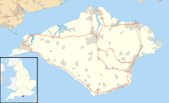
 Newtown
Newtown shown within the Isle of WightOS grid reference SZ429901 Unitary authority Isle of Wight Ceremonial county Isle of Wight Region South East Country England Sovereign state United Kingdom Post town NEWPORT Postcode district PO30 Dialling code 01983 Police Hampshire Fire Isle of Wight Ambulance Isle of Wight EU Parliament South East England UK Parliament Isle of Wight List of places: UK • England • Isle of Wight Newtown is a small hamlet on the Isle of Wight, in England. In medieval times it was a thriving borough.
Newtown is located on the large natural harbour on the Island's north-western coast, now mostly a National Nature Reserve owned and managed by the National Trust.
The Caul Bourne stream running through Calbourne passes through Newbridge and Shalfleet and empties into the Solent at Newtown.
Contents
History
The town was originally called Francheville (i.e., Freetown), and only later was it renamed Newtown. It probably was founded before the Norman Conquest. There is some indication that it was attacked by the Danes in 1001.
The earliest charter that we know of was granted by the Bishop-elect of Winchester, Aymer de Valence. He signed its charter at his ecclestical estate at Swainston Manor in 1256. The high hopes for its success are reflected in the names of its streets, such as Gold Street and Silver Street. However, it might have suffered from competition from Yarmouth, Newport and Southampton. In 1284 the village was somewhat reluctantly given to Edward I. Apparently there were some 60 families living in Newtown at the start of the 14th century.
By the mid 14th century, it was slowly starting to mature into a thriving commercial center. In 1344, it was assessed at twice the value of Newport. Its harbor was busy and reputed to be the safest on the island. There was a prosperous saltworks and Newtown was famous for its abundant oyster beds. There was an annual three day festival on the "eve, the day and the morrow of the Feast of St. Mary Magdalen", who was honored in the name of the local thirteenth-century chapel. Then the plague struck, and a French raid in 1377 destroyed much of the town as well as other Island settlements.[1] It has never fully recovered from this blow.
By the middle of the 16th century it was a small settlement long eclipsed by the more easily defended town of Newport. A survey in 1559 noted that Newtown no longer had a market and it did not have a single good house still standing. Its harbor slowly became clogged with silt so that it was not accessible to larger vessels.
Elizabeth I breathed some life into the town in 1584 by awarding it two parliamentary seats. A town hall was built in the 17th century. However, these two parliamentary seats ultimately made Newtown borough one of the most notorious of the rotten boroughs, prevalent in the UK before reforms in the 19th century. By the time of the Reform Act 1832 that abolished the seats, a survey pointed out that Newtown had just fourteen houses and twenty-three voters. Much larger municipal areas with many more voters had less representation.
The town hall was restored in 1813, and again in the 1930s. It is now open to the public.
The Newtown Arms Inn was closed in 1916. It was in an unusually shaped building locally referred to as "Noah's Ark."
Newtown has stayed small, but this has led to the preservation of the original layout of the village, to the interests of historians. There are also two square ponds by the boathouse which were dug as salterns, as part of a salt industry that used to exist in Newtown.
Legend
There are stories of a pied piper who was hired to save Newtown from an excess of rats for 50 pounds, similar to the story of the Pied Piper in Hamelin, Germany. He played his pipe and led the rats out into the Solent where they drowned. The townspeople refused to pay the agreed upon price, and gave the piper only 20 pounds. At this, the piper played his pipe and led the children of the village away. The village lost an entire generation, so it had no young people to defend the town when the French attacked in 1377, leading to its destruction.
Transport
Wightbus operate infrequent bus route number 35 to Newport, via Porchfield and Marks Corner.[2]
References
- ^ There had been several previous attacks by the French, but the 1377 attack was the most damaging to Newtown.
- ^ "Traveline - Wightbus route 35". www.traveline.org.uk. 2008. http://www.travelinesoutheast.org.uk/se/XSLT_TTB_REQUEST?language=en&command=direct&net=set&line=08035&sup=A&project=y08&contentFilter=TIMINGPOINTS&outputFormat=0&itdLPxx_displayHeader=false. Retrieved 2008-05-04.
External links
Ceremonial county of Isle of Wight Isle of Wight Portal Unitary authorities Major settlements Rivers Topics Categories:- Villages on the Isle of Wight
- Ports and harbours of the Isle of Wight
- National Trust properties on the Isle of Wight


Wikimedia Foundation. 2010.