- Battlement Mesa, Colorado
Infobox Settlement
official_name = Battlement Mesa, Colorado
other_name =
native_name =
nickname =
settlement_type = CDP
motto =
imagesize =
image_caption =
flag_size =
image_
seal_size =
image_shield =
shield_size =
image_blank_emblem =
blank_emblem_type =
blank_emblem_size =
imagesize =
image_caption =
flag_size =
image_
seal_size =
image_shield =
shield_size =
image_blank_emblem =
blank_emblem_type =
blank_emblem_size =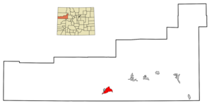
mapsize = 250px
map_caption = Location in Garfield County and theState of Colorado
mapsize1 =
map_caption1 =
image_dot_
dot_mapsize =
dot_map_caption =
dot_x =
dot_y =
pushpin_
pushpin_label_position =
pushpin_map_caption =
pushpin_mapsize =
subdivision_type = Country
subdivision_name = USA
subdivision_type1 = State
subdivision_name1 = flag|Colorado|name=State of Colorado
subdivision_type2 = County
subdivision_name2 = Garfield County
subdivision_type3 =
subdivision_name3 =
subdivision_type4 =
subdivision_name4 =
government_footnotes =
government_type =
leader_title =
leader_name =
leader_title1 =
leader_name1 =
leader_title2 =
leader_name2 =
leader_title3 =
leader_name3 =
leader_title4 =
leader_name4 =
established_title =
established_date =
established_title2 =
established_date2 =
established_title3 =
established_date3 =
area_magnitude =
unit_pref = Imperial
area_footnotes =
area_total_km2 = 21.6
area_land_km2 = 20.9
area_water_km2 = 0.7
area_total_sq_mi = 8.4
area_land_sq_mi = 8.1
area_water_sq_mi = 0.3
area_water_percent =
area_urban_km2 =
area_urban_sq_mi =
area_metro_km2 =
area_metro_sq_mi =
area_blank1_title =
area_blank1_km2 =
area_blank1_sq_mi =
population_as_of = 2000
population_footnotes =
population_note =
population_total = 3497
population_density_km2 = 161.9
population_density_sq_mi = 416.3
population_metro =
population_density_metro_km2 =
population_density_metro_sq_mi =
population_urban =
population_density_urban_km2 =
population_density_urban_sq_mi =
population_blank1_title =
population_blank1 =
population_density_blank1_km2 =
population_density_blank1_sq_mi =
timezone = MST
utc_offset = -7
timezone_DST = MDT
utc_offset_DST = -6
latd = 39 |latm = 26 |lats = 16 |latNS = N
longd = 108 |longm = 2 |longs = 2 |longEW = W
elevation_footnotes = GR|3
elevation_m = 1673
elevation_ft = 5489
postal_code_type =ZIP Code
postal_code = 81636cite web | date =December 14 2006 | url = http://zip4.usps.com/zip4/citytown.jsp | title = ZIP Code Lookup| format =JavaScript /HTML | publisher = United States Postal Service | accessdate = December 14 | accessyear = 2006]
area_code = 970
blank_name = FIPS code
blank_info = 08-05120
blank1_name = GNIS feature ID
blank1_info = 1867077
website =
footnotes =Battlement Mesa is a
census-designated place (CDP) located in Garfield County,Colorado ,United States . The population was 3,497 at the 2000 census.GR|2 The Battlement Mesa Post Office has theZIP Code 81636.The community, which bills itself as a "
covenant -protected community", is a primarily a group of contiguous subdivisions developed in the later decades of the 20th century, catering to families and retirees. It is located on the flank of a hill on the south side ofInterstate 70 across from the older town of Parachute. The two communities together are known as "Parachute-Battlement Mesa". The town takes its name fromBattlement Mesa , abasalt -toppedmesa that sits to the south of the town.Geography
Battlement Mesa is located at coor dms|39|26|16|N|108|2|2|W|city (39.437904, -108.033769)GR|1.
According to the
United States Census Bureau , the CDP has a total area of 8.3 square miles (21.6 km²), of which, 8.1 square miles (20.9 km²) of it is land and 0.3 square miles (0.7 km²) of it (3.12%) is water.Demographics
As of the
census GR|2 of 2000, there were 3,497 people, 1,476 households, and 1,031 families residing in the CDP. Thepopulation density was 433.3 people per square mile (167.3/km²). There were 1,631 housing units at an average density of 202.1/sq mi (78.0/km²). The racial makeup of the CDP was 94.94% White, 0.40% African American, 0.69% Native American, 0.17% Asian, 0.11% Pacific Islander, 2.00% from other races, and 1.69% from two or more races. Hispanic or Latino of any race were 7.06% of the population.There were 1,476 households out of which 27.2% had children under the age of 18 living with them, 60.6% were married couples living together, 6.6% had a female householder with no husband present, and 30.1% were non-families. 24.9% of all households were made up of individuals and 12.8% had someone living alone who was 65 years of age or older. The average household size was 2.35 and the average family size was 2.79.
In the CDP the population was spread out with 23.6% under the age of 18, 6.9% from 18 to 24, 25.0% from 25 to 44, 20.0% from 45 to 64, and 24.5% who were 65 years of age or older. The median age was 40 years. For every 100 females there were 94.1 males. For every 100 females age 18 and over, there were 92.5 males.
The median income for a household in the CDP was $36,680, and the median income for a family was $42,331. Males had a median income of $31,924 versus $21,798 for females. The
per capita income for the CDP was $18,653. About 3.2% of families and 6.0% of the population were below thepoverty line , including 7.3% of those under age 18 and 4.2% of those age 65 or over.ee also
*
List of cities and towns in Colorado References
External links
* [http://www.battlementmesa.com/ Battlement Mesa website]
Wikimedia Foundation. 2010.