- Tuolumne City, California
Infobox Settlement
official_name = Tuolumne City, California
other_name =
native_name =
nickname =
settlement_type = CDP
motto =
imagesize =
image_caption =
flag_size =
image_
seal_size =
image_shield =
shield_size =
image_blank_emblem =
blank_emblem_type =
blank_emblem_size =
imagesize =
image_caption =
flag_size =
image_
seal_size =
image_shield =
shield_size =
image_blank_emblem =
blank_emblem_type =
blank_emblem_size =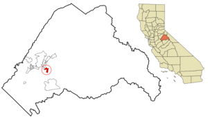
mapsize = 250px
map_caption = Location in Tuolumne County and the state ofCalifornia
mapsize1 =
map_caption1 =
image_dot_
dot_mapsize =
dot_map_caption =
dot_x =
dot_y =
pushpin_
pushpin_label_position =
pushpin_map_caption =
pushpin_mapsize =
subdivision_type = Country
subdivision_name =United States
subdivision_type1 = State
subdivision_name1 =California
subdivision_type2 = County
subdivision_name2 = Tuolumne
subdivision_type3 =
subdivision_name3 =
subdivision_type4 =
subdivision_name4 =
government_footnotes =
government_type =
leader_title =
leader_name =
leader_title1 =
leader_name1 =
leader_title2 =
leader_name2 =
leader_title3 =
leader_name3 =
leader_title4 =
leader_name4 =
established_title =
established_date =
established_title2 =
established_date2 =
established_title3 =
established_date3 =
area_magnitude =
unit_pref =
area_footnotes =
area_total_km2 = 6.1
area_land_km2 = 6
area_water_km2 = 0.1
area_total_sq_mi = 2.3
area_land_sq_mi = 2.3
area_water_sq_mi = 0
area_water_percent =
area_urban_km2 =
area_urban_sq_mi =
area_metro_km2 =
area_metro_sq_mi =
area_blank1_title =
area_blank1_km2 =
area_blank1_sq_mi =
population_as_of = 2000
population_footnotes =
population_note =
population_total = 1865
population_density_km2 = 305.7
population_density_sq_mi = 810.9
population_metro =
population_density_metro_km2 =
population_density_metro_sq_mi =
population_urban =
population_density_urban_km2 =
population_density_urban_sq_mi =
population_blank1_title =
population_blank1 =
population_density_blank1_km2 =
population_density_blank1_sq_mi =
timezone = Pacific (PST)
utc_offset = -8
timezone_DST = PDT
utc_offset_DST = -7
latd = 37 |latm = 57 |lats = 42 |latNS = N
longd = 120 |longm = 14 |longs = 13 |longEW = W
elevation_footnotes =
elevation_m = 790
elevation_ft = 2592
postal_code_type =ZIP code
postal_code = 95379
area_code = 209
blank_name = FIPS code
blank_info = 06-80763
blank1_name = GNIS feature ID
blank1_info = 1867064
website =
footnotes =Tuolumne is a
census-designated place (CDP) in Tuolumne County,California ,United States . The population was 1,865 at the 2000 census.History
The area is known for a history of logging operations. Remnants of logging railroads are still present in the area. In the 1970s, there was a plan to open a park which was centered on narrow gauge live steam equipment. It was to feature restored locomotives from the logging operation here.
Unlike the rest of Tuolumne County, Tuolumne City was not in the Bell System/SBC service area. Tuolumne Telephone Company provided service to this area. Wired telephone numbers in the Tuolumne City
Central Office follow the pattern (209) 928-xxxx.There are three schools: Summerville Elementary with grades K-8, Mother Christian School with grades K-12, and Summerville High School with grades 9-12. Summerville High School also hosts Toulumne County's Connections Arts School for grades 7-12.
A logging company town, Tuolumne City experienced an economic down-turn when the Westside Lumber Mill closed. For many years the community has struggled to create a new economic base. In recent years the Tuolumne Band of MiWuk Indians has contributed new growth in this hamlet with revenues from nearby Black Oak Casino, which is owned and operated by the tribe. A new medial clinic and a new library are a few recent improvements. Another addition has been the renovation of the Tuolumne City Museum on Carter St. Once known as "Somersville," Tuolumne City has a loyal citizen base, who work diligently to revive its community life. A new municipal advisory council has been established to help with this revival.
Tuolumne is the also the birthplace of the Vaudevillian performer and hipster comedian Lord Buckley born Richard Myrle Buckley April 5, 1906.
Geography
Tuolumne is located at coor dms|37|57|42|N|120|14|13|W|city (37.961785, -120.236851).GR|1
According to the
United States Census Bureau , the CDP has a total area of 2.3square mile s (6.1km² ), of which, 2.3 square miles (6.0 km²) of it is land and 0.04 square miles (0.1 km²) of it (0.85%) is water.Demographics
As of the
census GR|2 of 2000, there were 1,865 people, 736 households, and 474 families residing in the CDP. Thepopulation density was 801.4 people per square mile (309.0/km²). There were 797 housing units at an average density of 342.5/sq mi (132.1/km²). The racial makeup of the CDP was 89.01% White, 0.38% African American, 4.29% Native American, 0.21% Asian, 0.54% Pacific Islander, 1.82% from other races, and 3.75% from two or more races. Hispanic or Latino of any race were 6.97% of the population.There were 736 households out of which 31.3% had children under the age of 18 living with them, 45.7% were married couples living together, 15.4% had a female householder with no husband present, and 35.5% were non-families. 29.2% of all households were made up of individuals and 13.3% had someone living alone who was 65 years of age or older. The average household size was 2.51 and the average family size was 3.10.
In the CDP the population was spread out with 28.3% under the age of 18, 8.1% from 18 to 24, 26.5% from 25 to 44, 23.5% from 45 to 64, and 13.6% who were 65 years of age or older. The median age was 37 years. For every 100 females there were 93.3 males. For every 100 females age 18 and over, there were 87.5 males.
The median income for a household in the CDP was $32,361, and the median income for a family was $41,007. Males had a median income of $35,524 versus $22,593 for females. The
per capita income for the CDP was $16,567. About 13.0% of families and 14.2% of the population were below thepoverty line , including 11.3% of those under age 18 and 13.4% of those age 65 or over.Politics
In the state legislature Tuolumne City is located in the 14th Senate District, represented by Republican
Dave Cogdill , and in the 25th Assembly District, represented by RepublicanTom Berryhill . Federally, Tuolumne City is located inCalifornia's 19th congressional district , which has a Cook PVI of R +10 [cite web | title = Will Gerrymandered Districts Stem the Wave of Voter Unrest? | publisher = Campaign Legal Center Blog | url=http://www.clcblog.org/blog_item-85.html | accessdate = 2008-02-10] and is represented by RepublicanGeorge Radanovich .References
External links
Wikimedia Foundation. 2010.