- Orangevale, California
-
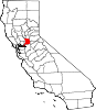
Orangevale — census-designated place — 
Coordinates: 38°40′55″N 121°12′50″W / 38.68194°N 121.21389°WCoordinates: 38°40′55″N 121°12′50″W / 38.68194°N 121.21389°W Country  United States
State  California
County Sacramento Area[1] – Total 11.646 sq mi (30.165 km2) – Land 11.515 sq mi (29.825 km2) – Water 0.131 sq mi (0.340 km2) 1.13% Elevation[2] 240 ft (73 m) Population (2010) – Total 33,960 – Density 2,916/sq mi (1,125.8/km2) Time zone PST (UTC-8) – Summer (DST) PDT (UTC-7) ZIP code 95662 Area code(s) 916 FIPS code 06-54092 GNIS feature ID 1656200 Orangevale is a census-designated place (CDP) in Sacramento County, California, United States. It is part of the Sacramento–Arden-Arcade–Roseville Metropolitan Statistical Area. The population was 33,960 at the 2010 census, up from 26,705 at the 2000 census. It is located approximately 25 miles (40 km) northeast of Sacramento. The community is known for its rolling hills that offer the best views of the Sierra Nevada mountain range, its foothills, and a rural environment in the middle of a growing metropolitan area. Some residential properties in the area are zoned to accommodate horses and orchards. It has a ZIP Code of 95662.
Contents
Geography
Orangevale is located at 38°40′55″N 121°12′50″W / 38.68194°N 121.21389°W (38.681903, -121.213824).[3]
According to the United States Census Bureau, the CDP has a total area of 11.6 square miles (30 km2), of which, 11.5 square miles (30 km2) of it is land and 0.1 square miles (0.26 km2) of it (1.13%) is water.
Demographics
2010
The 2010 United States Census[4] reported that Orangevale had a population of 33,960. The population density was 2,915.9 people per square mile (1,125.8/km²). The racial makeup of Orangevale was 29,679 (87.4%) White, 463 (1.4%) African American, 316 (0.9%) Native American, 1,040 (3.1%) Asian, 75 (0.2%) Pacific Islander, 879 (2.6%) from other races, and 1,508 (4.4%) from two or more races. Hispanic or Latino of any race were 3,448 persons (10.2%).
The Census reported that 33,742 people (99.4% of the population) lived in households, 115 (0.3%) lived in non-institutionalized group quarters, and 103 (0.3%) were institutionalized.
There were 12,816 households, out of which 4,277 (33.4%) had children under the age of 18 living in them, 6,900 (53.8%) were opposite-sex married couples living together, 1,473 (11.5%) had a female householder with no husband present, 717 (5.6%) had a male householder with no wife present. There were 761 (5.9%) unmarried opposite-sex partnerships, and 80 (0.6%) same-sex married couples or partnerships. 2,832 households (22.1%) were made up of individuals and 1,094 (8.5%) had someone living alone who was 65 years of age or older. The average household size was 2.63. There were 9,090 families (70.9% of all households); the average family size was 3.07.
The population was spread out with 7,785 people (22.9%) under the age of 18, 2,877 people (8.5%) aged 18 to 24, 8,296 people (24.4%) aged 25 to 44, 10,479 people (30.9%) aged 45 to 64, and 4,523 people (13.3%) who were 65 years of age or older. The median age was 40.7 years. For every 100 females there were 97.4 males. For every 100 females age 18 and over, there were 94.5 males.
There were 13,583 housing units at an average density of 1,166.3 per square mile (450.3/km²), of which 9,414 (73.5%) were owner-occupied, and 3,402 (26.5%) were occupied by renters. The homeowner vacancy rate was 1.8%; the rental vacancy rate was 7.9%. 25,032 people (73.7% of the population) lived in owner-occupied housing units and 8,710 people (25.6%) lived in rental housing units.
2000
As of the census[5] of 2000, there were 26,705 people, 9,856 households, and 7,116 families residing in the CDP. The population density was 2,663.5 people per square mile (1,028.0/km²). There were 10,098 housing units at an average density of 1,007.2 per square mile (388.7/km²). The racial makeup of the CDP was 89.52% White, 1.13% African American, 1.04% Native American, 2.46% Asian, 0.19% Pacific Islander, 1.69% from other races, and 3.99% from two or more races. Hispanic or Latino of any race were 6.80% of the population.
There were 9,856 households out of which 34.6% had children under the age of 18 living with them, 55.3% were married couples living together, 11.5% had a female householder with no husband present, and 27.8% were non-families. 21.0% of all households were made up of individuals and 7.1% had someone living alone who was 65 years of age or older. The average household size was 2.67 and the average family size was 3.09.
In the CDP the population was spread out with 26.6% under the age of 18, 8.1% from 18 to 24, 29.1% from 25 to 44, 24.4% from 45 to 64, and 11.8% who were 65 years of age or older. The median age was 37 years. For every 100 females there were 97.7 males. For every 100 females age 18 and over, there were 95.0 males.
The median income for a household in the CDP was $53,371, and the median income for a family was $60,822. Males had a median income of $43,712 versus $31,510 for females. The per capita income for the CDP was $24,658. About 5.1% of families and 6.9% of the population were below the poverty line, including 7.5% of those under age 18 and 4.0% of those age 65 or over.
Politics
In the state legislature Orangevale is located in the 1st Senate District, represented by Republican Ted Gaines, and in the 5th Assembly District, represented by Republican Roger Niello. Federally, Orangevale is located in California's 4th congressional district, which has a Cook PVI of R +11[6] and is represented by Republican Tom McClintock.
History
Originally Orange Vale, the community began as part of the 1844 Rancho San Juan Mexican land grant. The area was rural and home to numerous orange groves. Oak trees (remnants of which can be seen in the Orangevale Park) were common, as were trails made by Maidu Native Americans many years before.[7] In addition to orange groves, several olive orchards were also once in the area, and some original trees can still be found along Chestnut, Orangevale, Main, and Walnut Avenue.
Education
Public schools in Orangevale are under the jurisdiction of the San Juan Unified School District. Some include Oakview Elementary,Pershing Elementary,Louis Pasteur Junior High,Orangevale Open K-8, and Casa Roble Fundamental High School.
Transportation
Orangevale can be reached from the following freeway exits:
Interstate 80: Greenback Lane (Exit 98, 6 miles east of the exit), Sierra College Boulevard (Exit 109, 9 miles south of the exit)
U.S. Route 50: Hazel Avenue (Exit 21, 3 miles north of the exit)
Public transportation is provided by the Sacramento Regional Transit. One local route (Route 24) is available Mondays to Fridays from Sunrise Mall in Citrus Heights. One express bus (Route 109) is available only Mondays to Fridays travels directly to Downtown Sacramento via U.S. Route 50. These routes follow the commute direction to Sacramento in the morning, and vice versa in the afternoon. The closest light rail stations are the Historic Folsom station (3 miles) and Hazel station (4 miles).
In addition, Folsom Stage Lines of Folsom takes passengers from the Sacramento Regional Transit's Historic Folsom light rail station to a bus stop that serves Route 24 of Sacramento Regional Transit.
Notable citizens
- Mary Whipple, coxswain for the U.S. women's rowing team. She and her team won gold at the 2008 Summer Olympics and silver at the 2004 Summer Olympics.
Adjacent areas

Placer County (Roseville) Placer County (Roseville, Granite Bay) Placer County (Granite Bay) Citrus Heights 
Folsom  Orangevale

Fair Oaks Fair Oaks Fair Oaks, Folsom External links
- The Community of Orangevale, CA
- Orangevale Community Forum
- Orangevale Chamber of Commerce
- Orangevale Sun Newspaper
References
- ^ U.S. Census
- ^ "Orangevale, California". City-Data.com. http://www.city-data.com/city/Orangevale-California.html. Retrieved 2007-07-25.
- ^ "US Gazetteer files: 2010, 2000, and 1990". United States Census Bureau. 2011-02-12. http://www.census.gov/geo/www/gazetteer/gazette.html. Retrieved 2011-04-23.
- ^ All data are derived from the United States Census Bureau reports from the 2010 United States Census, and are accessible on-line here. The data on unmarried partnerships and same-sex married couples are from the Census report DEC_10_SF1_PCT15. All other housing and population data are from Census report DEC_10_DP_DPDP1. Both reports are viewable online or downloadable in a zip file containing a comma-delimited data file. The area data, from which densities are calculated, are available on-line here. Percentage totals may not add to 100% due to rounding. The Census Bureau defines families as a household containing one or more people related to the householder by birth, opposite-sex marriage, or adoption. People living in group quarters are tabulated by the Census Bureau as neither owners nor renters. For further details, see the text files accompanying the data files containing the Census reports mentioned above.
- ^ "American FactFinder". United States Census Bureau. http://factfinder.census.gov. Retrieved 2008-01-31.
- ^ "Will Gerrymandered Districts Stem the Wave of Voter Unrest?". Campaign Legal Center Blog. http://www.clcblog.org/blog_item-85.html. Retrieved 2008-02-10.
- ^ "Orangevale History". Orangevale Chamber of Commerce. Archived from the original on 2007-08-10. http://web.archive.org/web/20070810085311/http://orangevalechamber.com/history.htm. Retrieved 2007-12-29.
Municipalities and communities of Sacramento County, California Cities Citrus Heights | Elk Grove | Folsom | Galt | Isleton | Rancho Cordova | Sacramento
CDPs Antelope | Arden-Arcade | Carmichael | Clay | Courtland | Elverta | Fair Oaks | Florin | Foothill Farms | Franklin | Freeport | Fruitridge Pocket | Gold River | Herald | Hood | La Riviera | Lemon Hill | Mather | McClellan Park | North Highlands | Orangevale | Parkway | Rancho Murieta | Rio Linda | Rosemont | Vineyard | Walnut Grove | Wilton
Unincorporated
communitiesLocke | Paintersville | Parkway-South Sacramento | Ryde | Sloughhouse
Ghost towns Mormon Island | Sutterville
Greater Sacramento Counties Douglas (NV) · El Dorado · Nevada · Placer · Sacramento · Sutter · Yolo · Yuba
Major City Cities
and
towns100k–200k25k–100kArden Arcade · Auburn · Carmichael · Citrus Heights · Davis · Folsom · Florin · Laguna · Lincoln · North Highlands · Orangevale · Parkway-South Sacramento · Rancho Cordova · Rocklin · West Sacramento · Woodland · Yuba City
10k–25kCameron Park · El Dorado Hills · Fair Oaks · Foothill Farms · Galt · Gardnerville Ranchos (NV) · Granite Bay · Grass Valley · La Riviera · Linda · Marysville · North Auburn · Olivehurst · Placerville · Rosemont · Rio Linda · South Lake Tahoe · South Yuba City · Truckee · Vineyard
Sub-regions Gold Country · Lake Tahoe · Sacramento Valley · Sierra Nevada · Yuba-Sutter Area
Categories:- Census-designated places in Sacramento County, California
- Sacramento metropolitan area


Wikimedia Foundation. 2010.