- List of county roads in Brevard County, Florida
-

County road shields used in FloridaHighway names County: County Road X (CR-X) System links Florida State and County Roads
Interstate • US • SR (Pre-1945) • Toll • CountyBrevard County, Florida (located in the East of Central Florida), operates a system of county roads that serve all portions of the county. The Brevard County Public Works Department, Road and Bridge Division, is responsible for maintaining all of the Brevard County roads. Most of the county roads are city streets and rural roads.
The numbers and routes of all Florida highways are assigned by the Florida Department of Transportation (FDOT), while county road numbers are assigned by the counties, with guidance from FDOT.[1] North-south routes are generally assigned odd numbers, while east-west routes are generally assigned even numbers.[2]
-
This transport-related list is incomplete; you can help by expanding it.
Contents
List
Here is a list of county roads in Brevard County, Florida. All of these roads below are county maintained.
Route 3
Tropical Trail
Location: Indian Harbor Beach–Courtenay Route 3 begins at an intersection with SR 518 in Indian Harbor Beach and ends at an intersection with SR 3 in Courtenay. The route has a gap between Venetian Way and Hall Road, and the portion of roadway through Kennedy Space Center is closed to the public.
Route 5A
Stuckway Road
Location: Scottsmoor Length: 1.0 mi[3] (1.6 km) Route 5A is a 1-mile (1.6 km) long county road located entirely in the Brevard County Game Refuge, in the unincorporated community of Scottsmoor. The highway begins at exit 231 from I-95, a diamond interchange, and travels northeast through woodlands until it terminates at an intersection with US 1.[3] The highway is the northern most county route in Brevard County,[citation needed] located only 1 mi (1.6 km) from the Volusia county line.[4]
Route 401
North Atlantic Avenue
Location: Cape Canaveral Route 401 links SR A1A to King George Boulevard in Cape Canaveral, and is an old alignment of SR A1A.
Route 402
Main article: Indian River Lagoon Scenic Highway
A. Max Brewer Memorial Parkway
Location: Titusville–Merritt Island NWR Route 402 links US 1 in Titusville to Kennedy Parkway at the Merritt Island NWR.
Route 405
Old Dixie Highway, Parker Street
Location: Titusville–Mims Route 405 links Norwood Avenue in Titusville to Singleton Avenue in Mims.
Route 406
Garden Street
Location: Titusville Route 406 links Carpenter Road to I-95 in Titusville.
Route 502
Barnes Boulevard
Location: Rockledge Route 502 links I-95 and SR 519 in Rockledge to US 1.
Route 503
Dixon Boulevard
Location: Cocoa Route 503 links SR 501 in Cocoa to US 1.
Route 507
Babcock Street
Location: Indian River county line–Palm Bay Route 507 is a continuation of Indian River CR 507 to SR 514 in Palm Bay.
Route 509
Wickham Road, Minton Road
Location: Palm Bay–Viera Length: 19 mi[citation needed] (31 km) County Road 509 is a major north–south throughway in southeastern Brevard County, Florida. The road extends 19 miles (31 km) from Palm Bay to Viera. North of New Haven Avenue (US 192/SR 500) in West Melbourne, CR 509 is known locally as Wickham Road; south of the US Highway, its street name is Minton Road (in the 1980s and 1990s, this 5.6 miles (9.0 km) section of current CR 509 was signed by Florida Department of Transportation as State Road 509).
CR 509 description
The current southern terminus of Brevard County Road 509 is an intersection with Malabar Road (CR 514, a westward extension of State Road 514); the northern terminus is an interchange with Interstate 95 (SR 9) in the midst of Pineda, Suntree, and Viera (Pineda and Suntree on the eastern side of I-95, Viera on the western side), although it extends 2 miles (3.2 km) more through southern Viera, with the intersections of Stadium Parkway and Lake Andrew Drive. The "true" northern terminus of Wickham Road is the South Central Regional Wastwater Treatment Plant just after the power lines.
CR 509 history
The northern section of the road was named after the Wickham family, including John Q. Wickham, a Brevard county surveyor and Joseph H. Wickham, a prominent Brevard County politician. Joe Wickham worked with the county to clear the route in 1950s. Since the road led to an undeveloped area, some viewed the project with skepticism. However, the planned road made sense because it ran between two ranges 36 and 37, which effectively divided the county in half.[5] Upon completion, the road led to development of Suntree and Viera in the late 1970s.[5] Development in the area on the northern terminus picked up considerably with the completion of I-95.
In 1929, Malabar Road was extended to the north.[6] Later, this northern section of Malabar was redesignated as Minton Road, named after Alton M. Minton, who owned a drug store at Mintons Corner Shopping Center. By 1957, the locals referred to the area this road traveled through as Minton's Corner.[7]
Route 511
John Rodes Boulevard, Aurora Road
Location: West Melbourne–Eau Gallie Length: 8.1 mi[citation needed] (13.0 km) 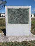 John Rodes Boulevard memorial
Brevard County Road 511 consists of a north–south street and an east–west avenue in the Melbourne, Florida, area. The 8.1-mile (13.0 km) road is locally known as John Rodes Boulevard and Aurora Road. The southern terminus of CR 511 is an intersection with New Haven Avenue (US 192-SR 500) in June Park, just outside the city limits of West Melbourne and three blocks from a diamond interchange between New Haven Avenue and Interstate 95 (SR 9); the eastern terminus is an intersection with Harbor City Boulevard (US 1-SR 5) in the Eau Gallie section of Melbourne.
John Rodes Boulevard extends four miles (6 km) north–south between US 192 and Aurora Road, which continues CR 511 as an east–west commercial and residential street. Until the late 1990s, the southernmost 3.0 miles (4.8 km) of CR 511/John Rodes Boulevard (south of Eau Gallie Boulevard/SR 518) was signed by Florida Department of Transportation as State Road 511. The former State Road serves as an access road for I-95. The southernmoust 3.0 miles (4.8 km) of John Rodes Boulevard has several communities along it. One of these is Hammock Trace Preserve, which is about 1-mile (1.6 km) south of Eau Gallie Blvd on John Rodes Blvd.
While Aurora Road has maintained its importance as a commercial and residential avenue, the character of John Rodes Boulevard has changed since the 1980s due to population growth in June Park, Melbourne, West Melbourne, and nearby Palm Bay. Urbanization has replaced much of the woodland on both sides on the former SR 511 as trees gave way to business and industrial parks, trailer parks, and suburban residential developments.
History
John Rodes Boulevard was named after John B. Rodes, a local politician.[8] Aurora Road was initially named 5th Street as town of Eau Gallie was first established.[9] Later, a local resident renamed it Aurora Road after his hometown in Illinois.[10]
Browse numbered routes ←  SR 510
FL ex-SR 512  →
→Route 514
Malabar Road
Location: Palm Bay Route 514 links the Palm Bay Regional Park to I-95 in Palm Bay.
Route 515
Main article: Indian River Lagoon Scenic Highway
Rockledge Drive, Brevard Avenue, Indian River Drive
Location: Rockledge–Sharpes Route 515 links US 1 in Rockledge to US 1 in Sharpes. The highway is widely known by locals as "The Scenic Road" because it runs along the Indian River Lagoon.
Route 516
Palm Bay Road
Location: Palm Bay Brevard County Road 516, locally known as Palm Bay Road, is a former Florida State Road in Brevard County, located entirely in Palm Bay. Between CR 509 and State Road 507, it forms the southern borders of the cities of West Melbourne and Melbourne. CR 516 is mostly 6 lanes wide, but 2 lanes wide in downtown Palm Bay.
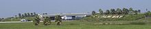 Palm Bay entrance sign on the overpass of Palm Bay Road
The western terminus is with an intersection of CR 509 in Palm Bay, just 262 inches south of West Melbourne. Just west of Interstate 95, an access road called Culver Drive spurs off Emerson Drive and provides access to Interstate 95 for residents of Palm Bay enclosed by CR 509, SR 514, Interstate 95, and Palm Bay Road itself. At Interstate 95, Palm Bay Road forms an overpass that has the name "Palm Bay" on both sides of the overpass. It was erected in 2002, and modified ever since. In Downtown Palm Bay, it makes two sharp bends and runs concurrent with Main Street for one block, just before the Florida East Coast Railroad. The eastern terminus is with an intersection with US 1 in Downtown Palm Bay, at the shore of Palm Bay, and near the mouth of Turkey Creek.
- Major intersections
The entire route is located in Palm Bay, Brevard County.
Mile Destinations Notes  CR 509 (Minton Road)
Western terminus  I-95 – West Palm Beach, Daytona Beach
Exit 176 on I-95 Port Malabar Boulevard  SR 507 (Babcock Street)
Conlan Boulevard 
 US 1 / SR 5
Eastern terminus 1.000 mi = 1.609 km; 1.000 km = 0.621 mi Route 5054
Sarno Road
Location: Melbourne Route 5054 links SR 518 to US 1 in Melbourne.
References
- ^ "Florida Department of Transportation, Highway Systems, Numbering and Jurisdiction". http://www.dot.state.fl.us/planning/statistics/hwysys/. Retrieved 2011-01-17.
- ^ "Florida Department of Transportation, Road Jurisdiction and Numbering Handbook". http://www.dot.state.fl.us/planning/statistics/hwysys/jurisdictionhandbook.pdf. Retrieved 2011-01-17.
- ^ a b Google, Inc. Google Maps – Route 5A (Map). Cartography by Google, Inc. http://maps.google.com/maps?f=d&source=s_d&saddr=Stuckway+Rd&daddr=Stuckway+Rd&hl=en&geocode=FR4BtwEdZKUt-w%3BFfoptwEdBtYt-w&gl=us&mra=dme&mrcr=0&mrsp=1&sz=17&sll=28.779847,-80.882581&sspn=0.005887,0.007371&ie=UTF8&ll=28.779433,-80.887742&spn=0.023547,0.029483&z=15. Retrieved January 16, 2011.
- ^ Bumpus-Hooper, Lynne (July 2, 1998). "I've Got to Get Out... I'm Scared A Quick-Thinking Deputy Found Frightened Scottsmoor Residents an Escape Route Just in Time". Orlando Sentinel (Tribune Company): p. A1. http://pqasb.pqarchiver.com/orlandosentinel/access/30899541.html?dids=30899541:30899541&FMT=ABS&FMTS=ABS:FT&type=current&date=Jul+02%2C+1998&author=Lynne+Bumpus-Hooper+of+The+Sentinel+Staff&pub=Orlando+Sentinel&desc=%60I%27VE+GOT+TO+GET+OUT+.+.+.+I%27M+SCARED%27+A+QUICK-THINKING+DEPUTY+FOUND+FRIGHTENED+SCOTTSMOOR+RESIDENTS+AN+ESCAPE+ROUTE+JUST+IN+TIME.&pqatl=google. Retrieved January 16, 2011.
- ^ a b www.ebook-browser.com. "Suntree, Florida: past and present". Retrieved on January 18, 2011.
- ^ Eriksen, John M. Brevard County, Florida: A Short History to 1955 (Suntree, Florida: 2008), p. 126.
- ^ Shofner, Jerrell H. History of Brevard County, Volume 2 (Stuart, FL, 1996), p. 155.
- ^ John B. Rodes Boulevard memorial.
- ^ Raley, Karen and Ann Raley Flotte. Images of America: Melbourne and Eau Gallie (Charleston, SC: Arcadia Publishing, 2002), p. 66.
- ^ Melbourne Chamber of Commerce. Melbourne: A Century of Memories (Melbourne, FL: National Printing, Inc., 1980), p. 86.
County roads in Florida Alachua · Baker · Bay · Bradford · Brevard · Broward · Calhoun · Charlotte · Citrus · Clay · Collier · Columbia · DeSoto · Dixie · Duval · Escambia · Flagler · Franklin · Gadsden · Gilchrist · Glades · Gulf · Hamilton · Hardee · Hendry · Hernando · Highlands · Hillsborough · Holmes · Indian River · Jackson · Jefferson · Lafayette · Lake · Lee · Leon · Levy · Liberty · Madison · Manatee · Marion · Martin · Miami-Dade · Monroe · Nassau · Okaloosa · Okeechobee · Orange · Osceola · Palm Beach · Pasco · Pinellas · Polk · Putnam · Santa Rosa · Sarasota · Seminole · St. Johns · St. Lucie · Sumter · Suwannee · Taylor · Union · Volusia · Wakulla · Walton · Washington
Categories:- County roads in Brevard County, Florida
- Lists of roads in Florida
-


Wikimedia Foundation. 2010.