Khost Province — Geobox|Province country = Afghanistan country name = Khost native name = خوست map caption = Map of Afghanistan with Khost highlighted capital = Khost capital lat d = 33.4 capital long d = 69.9 population as of = 2002 population = 300,000 area =… … Wikipedia
Khôst (province) — 33° 24′ N 69° 54′ E / 33.4, 69.9 … Wikipédia en Français
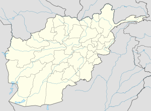
Tani District — is situated in the southern part of Khost Province, Afghanistan. It borders with Spera District to the West, Nadir Shah Kot and Mando Zayi to the North, Gurbuz District to the East and Pakistan to the South. The population is 52,800 (2006) people … Wikipedia
Khost (Provinz) — DMS … Deutsch Wikipedia
Tani — * Tani can refer to Apa Tani, a tribal group in Arunachal Pradesh, India. *Tani is a district in Khost Province,Afghanistan. *Tani, Afghanistan Also, Tani (谷 which means valley ) is a Japanese family name.It can refer to a number of people,… … Wikipedia
Tani — steht für: Tani Sprachen, siehe Nord Assam Sprachen Tani (Bezirk), einen Bezirk in der afghanischen Provinz Khost Tani (Commune), Angkor Chey District, Kampot Province Kambodscha Tani ist der Familienname folgender Personen: Tani Bunchō… … Deutsch Wikipedia
Sar-e Pol Province — Coordinates: 35°36′N 66°18′E / 35.6°N 66.3°E / 35.6; 66.3 … Wikipedia
Wardak Province — Coordinates: 34°24′N 68°24′E / 34.4°N 68.4°E / 34.4; 68.4 … Wikipedia
Nangarhar Province — Coordinates: 34°15′N 70°30′E / 34.25°N 70.50°E / 34.25; 70.50 … Wikipedia
Nimruz Province — Coordinates: 31°00′N 62°30′E / 31.0°N 62.5°E / 31.0; 62.5 … Wikipedia
 Tani
Tani Afghanistan