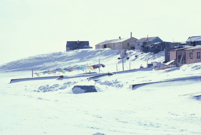
- Mekoryuk, Alaska
-
Mekoryuk
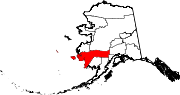
Mikuryaq— City — 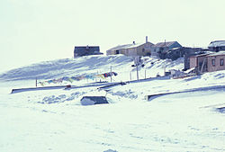 Location in Alaska
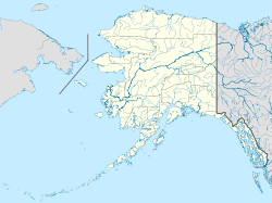
 Mekoryuk
Coordinates: 60°23′21″N 166°12′25″W / 60.38917°N 166.20694°W Country United States State Alaska Census Area Bethel Area - Total 7.4 sq mi (19.1 km2) - Land 7.4 sq mi (19.1 km2) - Water 0.0 sq mi (0.0 km2) Elevation 7 ft (2 m) Population (2007)[1] - Total 210 - Density 28.5/sq mi (11.0/km2) Time zone Alaska (AKST) (UTC-9) - Summer (DST) AKDT (UTC-8) Area code 907 FIPS code 02-47990 Mekoryuk (Mikuryarmiut in Nunivak Cup'ig) is a city in Bethel Census Area, Alaska, United States. At the 2000 census the population was 210.
Contents
Geography
Mekoryuk is located at 60°23′21″N 166°12′25″W / 60.38917°N 166.20694°W (60.389278, -166.207082)[2].
Mekoryuk is at the mouth of Shoal Bay on the north shore of Nunivak Island in the Bering Sea. The Island lies 48 km (30 mi) west of the Alaska coast.
According to the United States Census Bureau, the city has a total area of 7.4 square miles (19 km2), of which, 7.4 square miles (19 km2) of it is land and 0.14% is water.
Demographics
As of the census[3] of 2000, there were 210 people, 73 households, and 48 families residing in the city. The population density was 28.5 people per square mile (11.0/km²). There were 96 housing units at an average density of 13.0 per square mile (5.0/km²). The racial makeup of the city was 3.33% White, 90.48% Native American, and 6.19% from two or more races. 0.48% of the population were Hispanic or Latino of any race.
There were 73 households out of which 31.5% had children under the age of 18 living with them, 45.2% were married couples living together, 15.1% had a female householder with no husband present, and 34.2% were non-families. 32.9% of all households were made up of individuals and 2.7% had someone living alone who was 65 years of age or older. The average household size was 2.88 and the average family size was 3.77.
In the city the age distribution of the population shows 32.4% under the age of 18, 6.7% from 18 to 24, 29.0% from 25 to 44, 22.4% from 45 to 64, and 9.5% who were 65 years of age or older. The median age was 36 years. For every 100 females there were 116.5 males. For every 100 females age 18 and over, there were 136.7 males.
The median income for a household in the city was $30,833, and the median income for a family was $33,750. Males had a median income of $25,417 versus $11,667 for females. The per capita income for the city was $11,958. About 13.7% of families and 21.9% of the population were below the poverty line, including 36.7% of those under the age of eighteen and 15.8% of those sixty five or over.
History
Nunivak Island has been inhabited for 2,000 years by the Nuniwarmiut, or Cup'ig, people.
The first contact with Europeans was in 1821 by explorers from the Russian-American Company. They recorded 400 people living in 16 villages on the Nunivak Island.
While conducting the 1880 United States Census, Ivan Petrof recorded 702 Yup'ik in 9 villages, including 117 people at "Koot", near the site of present-day Mekoryuk. An epidemic in 1900 left only four surviving families in the village.
In the 1930s, the Evangelical Covenant Church was built at Mekoryuk, followed by a school in 1939. People moved to the village from other areas of the island to be near the school. Reindeer herding was introduced in 1920 by an Eskimo-Russian trader. The operation was purchased by the United States government in the 1940s and a slaughterhouse was built in 1945. The reindeer were crossed with caribou from Denali Park. The resulting animals were larger and less tame than other reindeer. 34 musk ox from Greenland were transferred to the Nunivak Island in 1934 in an effort to save the species from extinction. Today, the musk-ox herd numbers around 500, and calves from this herd have been relocated and introduced to other areas of Alaska.
In the mid-1900s, Mekoryuk became the only permanent population center on the island. Until the 1940s, the traditional lifestyle and traditional ceremonies and religious beliefs were practiced.
The 1950s and 1960s brought considerable change. An airstrip was built in 1957. The Territorial Guard was formed and men were sent to Fort Richardson near Anchorage for training. During this time, many families moved to Bethel during the winter to be near the high school, returning in the spring for fishing and sea mammal hunting. A high school was constructed in Mekoryuk in 1978.
References
- ^ "Annual Estimates of the Population for Incorporated Places in Alaska". United States Census Bureau. 2008-07-10. http://www.census.gov/popest/cities/tables/SUB-EST2007-04-02.csv. Retrieved 2008-07-14.
- ^ "US Gazetteer files: 2010, 2000, and 1990". United States Census Bureau. 2011-02-12. http://www.census.gov/geo/www/gazetteer/gazette.html. Retrieved 2011-04-23.
- ^ "American FactFinder". United States Census Bureau. http://factfinder.census.gov. Retrieved 2008-01-31.
External links
Coordinates: 60°23′21″N 166°12′25″W / 60.389278°N 166.207082°W
Municipalities and communities of Bethel Census Area, Alaska Cities Akiak | Aniak | Bethel | Chefornak | Chuathbaluk | Eek | Goodnews Bay | Kwethluk | Lower Kalskag | Mekoryuk | Napakiak | Napaskiak | Nightmute | Nunapitchuk | Platinum | Quinhagak | Toksook Bay | Upper Kalskag
CDPs Akiachak | Atmautluak | Crooked Creek | Kasigluk | Kipnuk | Kongiganak | Kwigillingok | Lime Village | Newtok | Oscarville | Red Devil | Sleetmute | Stony River | Tuluksak | Tuntutuliak | Tununak
Unincorporated
communitiesCategories:- Cities in Alaska
- Populated places in Bethel Census Area, Alaska
- Populated places in Alaska with Native American majority populations
- Bering Sea


Wikimedia Foundation. 2010.