- Tiwai Island
Infobox Protected area
name = Tiwai Island
iucn_category = IV
caption = Location of "Tiwai Island" inSierra Leone
base_width =
locator_x = 210
locator_y = 253
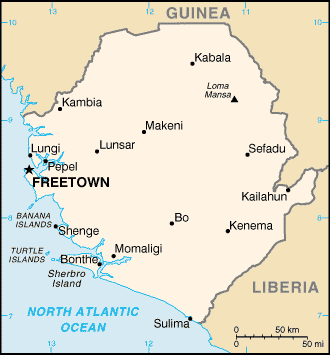
location = Southern ProvinceSierra Leone
nearest_city =Kenema
lat_degrees=7 |lat_minutes=32 |lat_seconds=59 |lat_direction=N
long_degrees=11 |long_minutes=19 |long_seconds=0 |long_direction=W
area = 1,200 hectares (12 km2)
established =1 January 1987
visitation_num =
visitation_year =
governing_body =Environmental Foundation for Africa
world_heritage_site =Tiwai Island (Mende for 'Big Island') is a wildlife sanctuary and tourist site in
Sierra Leone . Run by thenon-governmental organization Environmental Foundation for Africa , Tiwai is a 12 km in area and located on theMoa River in the Southern Province. It is also one the largest inland islands in the country.History
Tiwai belong to the
Barri people until the late 19th century when QueenNyarroh the Barri Chief gave half the Island to the Koya Chief whose territory was on the opposite side of the RiverMoa River where the Island is located. From then on both peoples share ownership of the Island. [ [http://www.visitsierraleone.org/tiwai.asp Tiwai Island Tiwai Island Wildlife Sanctuary] VisitSierraLeone.org (2007), retrieved on10 November 2007 ] In the late 1970s the Island was recognised as a specialbiosphere for wildlife conservation. The Barri and Koya people then requested that it became awildlife sanctuary and in 1987 it was official designated a game reserve. [ [http://www.efasl.org.uk/tiwai/tiwai.htm "Explore the rainforest"] , Tiwai Island Wildlife Sanctuary, retrieved on10 November 2007 ] Activities including community conservation program,ecological research ,wildlife management ,tourism and forestry management training took place on the Island. Then, in 1991 civil war broke out inSierra Leone financial support for the Tiwai was stopped and researchers and tourists were unable to reach the Island. [ [http://web.conservation.org/ImageCache/frontlines/content/downloads/ci_5ffl_5f6_5f3_5f06_2epdf/v1/ci_5ffl_5f6_5f3_5f06.pdf ""] , UN Environment Programme World Conservation Monitoring Centre, retrieved on07 November 2007 ] After the end of the civil war researchers and then tourists returned to the Island. [ [http://sea.unep-wcmc.org/sites/pa/0708p.htm "Helping a Nation Heal the Wounds of Civil Conflict"] , Conservation International:Conservation Frontlines (2006), retrieved on07 November 2007 ]Geography
Tiwai Island is located in the Southern Province, 15 km from the town of Potoru on the
Moa River 60 km from theAtlantic Ocean . The Island has area of 1,200 hectares (12 km2) and is between 80 and 100 meters abovesea level . The climate on the Island is tropical with arainy season between May and October and adry season between December and March. The average temperature is 27°C and rainfall is about 3,000 mm a year. [ [http://sea.unep-wcmc.org/sites/pa/0708p.htm "World Database on Protected Areas"] , UN Environment Programme World Conservation Monitoring Centre, retrieved on07 November 2007 ]Biology
The Island is home to a population of
pygmy hippopotamus , over 135 different species of birds and "one of the highest concentration and diversity ofprimates in the world … 11 species." [ [http://www.efasl.org.uk/tiwai/wildlife.htm "Wildlife"] , Tiwai Island Wildlife Sanctuary, retrieved on07 November 2007 ]References
* [http://sea.unep-wcmc.org/wdbpa/sitedetails.cfm?siteid=10741&level=nat "World Database on Protected Areas: Site Sheet"] , UN Environment Programme World Conservation Monitoring Centre, retrieved on
07 November 2007
Wikimedia Foundation. 2010.