- Louisiana Highway 1067
-
Louisiana Highway 1067
Route information Maintained by Louisiana DOTD Length: 3.5 mi (5.63 km) Existed: 1955 Louisiana Highway renumbering – present Major junctions Southwest end:  LA 3158 east of Hammond
Northeast end:  US 190 west of Robert
Highway system ←  LA 1065
LA 1068  →
→Louisiana Highway 1067 (LA 1067) is a state highway in Louisiana that serves Tangipahoa Parish. It spans 3.5 miles (5.6 km) in a southwest to northeast direction. It is known locally as Old Covington Highway, a designation which includes both the state-maintained LA 1067 and the locally maintained and unnumbered stretch on the same trajectory between LA 3158 (Airport Road) and US 51 Business in Hammond. The length of all of Old Covington Highway (both the unnumbered stretch and LA 1067 continuously) is exactly 6.0 miles (9.7 km).
Route description
From the southwest, LA 1067 begins at an intersection with LA 3158 (Airport Road/Booker Road), where it assumes the trajectory of Old Covington Highway and heads easterly before turning north to end at US 190 west of Robert. Between LA 1067's northward turn and its T-intersection on US 190, LA 1067 passes (and provides egress for) the Louisiana State University Agricultural Experiment Station at Hammond.
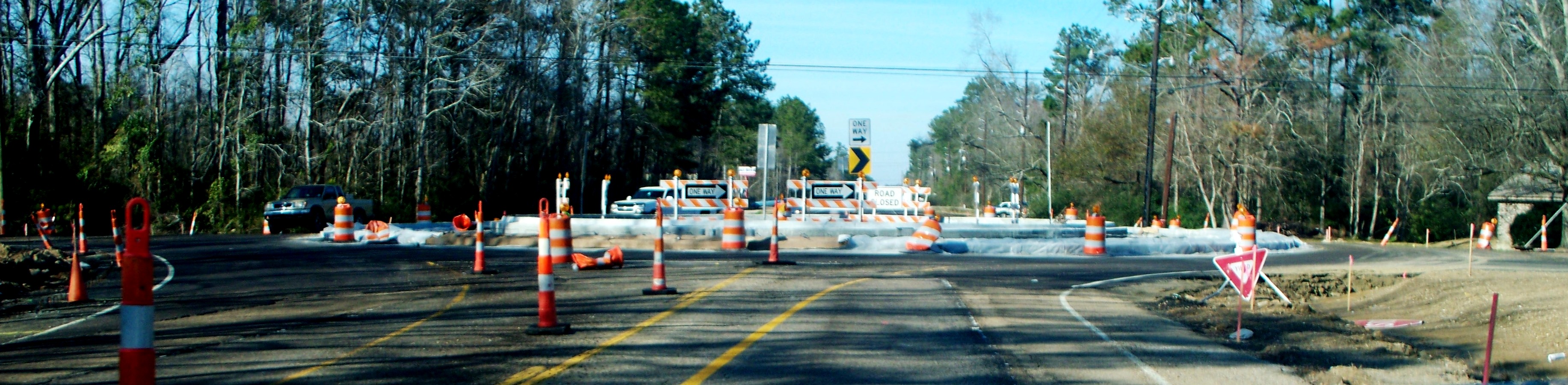
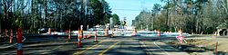 Construction of the roundabout at junction of LA 1067 and LA 3158, viewed approaching from the south on LA 3158.
In years past, LA 1067 actually began at US 51 Business in Hammond, meaning that all of Old Covington Highway was cosigned as LA 1067. This signage was removed when LA 3158 was constructed and provided a southwest terminus for LA 1067 the portion of Old Covington Highway west of its intersection with LA 3158 was then assigned to local control and maintenance.
In 2010 the four-way stop intersection of LA 1067 and LA 3158 was rebuilt as a roundabout without stop signs. All of Old Covington Highway is otherwise a two-lane undivided road.
As a largely west-east road in Louisiana, LA 1067 is an anomaly. Since the 1955 Louisiana Highway renumbering, Louisiana highways with cardinal west-east direction have been designated by even numbers; an odd number such as "1067" should be on a road with cardinal direction south-north. Additionally, LA 1067 intersects LA 3158 at a right angle, the cardinal direction of 3158 being south-north, which should bear an odd number. The roundabout occurs at what may be the state's sole example of the meeting of two diametrically misnumbered roads.
Major junctions
The entire route is in Tangipahoa Parish.
Location Mile Destinations Notes Hammond 0.00 LA 3158 (South Airport Road/Booker Road)Southwestern terminus Robert 3.5 US 190Northeastern terminus 1.000 mi = 1.609 km; 1.000 km = 0.621 mi References
Categories:- Roundabouts
- State highways in Louisiana
- Transportation in Tangipahoa Parish, Louisiana

Wikimedia Foundation. 2010.