- Couridjah, New South Wales
-
Couridjah
New South Wales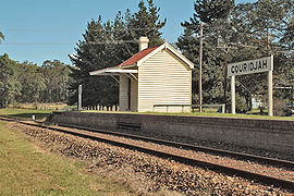

 Couridjah
Postcode: 2571 LGA: Wollondilly Shire Region: Macarthur State District: Wollondilly Federal Division: Macarthur Localities around Couridjah: Thirlmere Tahmoor Thirlmere Lakes National Park Couridjah Buxton Bargo Couridjah is a locality in the Macarthur Region of New South Wales, Australia, in Wollondilly Shire. It was previously known officially as Village of Couridjah. At the 2006 census, Couridjah had a population of 456 people.[1]
Contents
History
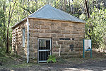

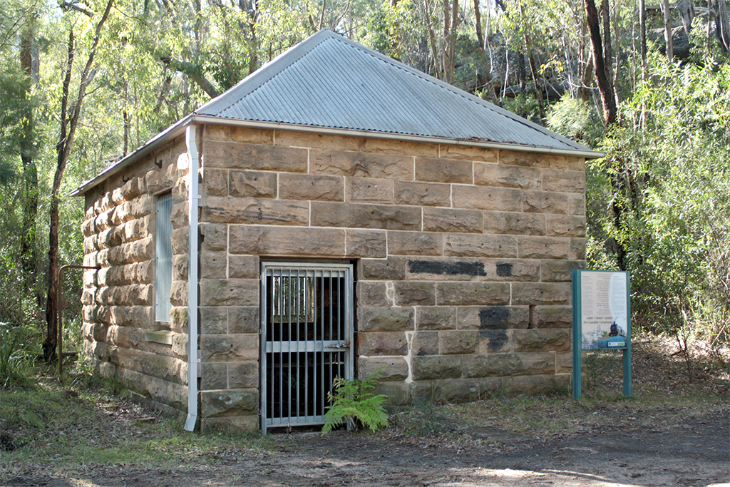
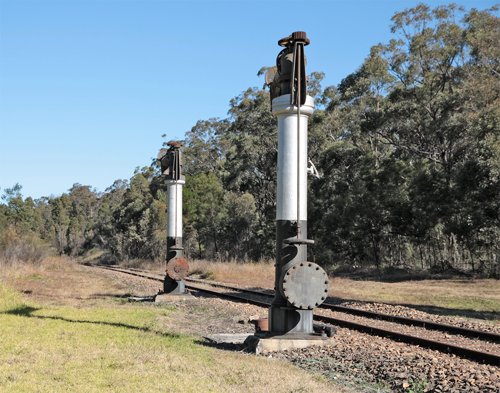
Pumphouse and standpipes. The name 'Couridjah' has been variously reported to mean, in a local Aboriginal language, anything from 'The Place of the White Ants' to 'The Home of the Medicine Man'.[2]
Couridjah was formerly a station on the Main Southern Railway. At the time of the line's construction, it was known as 'Jones's Hut'. That line was deviated in 1919 to a less steep alignment with easier grades, and the original line became the Picton-Mittagong Loop line. Thirlmere Lakes, to the west of the station, supplied water to the standpipes at Couridjah for replenishing steam locomotives, after their long haul up the steep grade from Picton.[3][4] The lakes were formerly known as the 'Coridja Lagoons' and 'Picton Lagoons'.[5] The sandstone pump-house is still in existence adjacent to the Lakes. The standpipes, too, remain near the station, but have been disused since 1964.
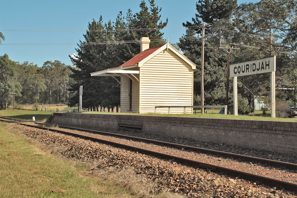
Couridjah Today
The platform and the small waiting room have been restored and are maintained by volunteers from the Rail Museum at Thirlmere, though none of the Heritage trains which still use sections of the Picton Loop line stops there.
The station and platform were featured in a television advertisement for "Minties" lollies.
The main premises of the Tharawal Local Aboriginal Land Council are located at Couridjah.[6] It is also the location of Picton Lakes Village, a settlement established in 1925 for sufferers of tuberculosis.[7]
Couridjah has no shop, post office, or any other public building, nor any main street. It is chiefly a semi-rural residential area, among which are some small orchards and poultry farms.
References
- ^ Australian Bureau of Statistics (25 October 2007). "Couridjah (L) (Urban Centre/Locality)". 2006 Census QuickStats. http://www.censusdata.abs.gov.au/ABSNavigation/prenav/LocationSearch?collection=Census&period=2006&areacode=UCL122900&producttype=QuickStats&breadcrumb=PL&action=401. Retrieved 12 July 2009.
- ^ Meredith, John. 1989. The last kooradgie : Moyengully, chief man of the Gundungurra people. Kenthurst: Kangaroo Press. ISBN 0864172354. Meredith points to the interesting similarity of 'kooradgie' and 'chirurgeon'.
- ^ Bayley, W. A. 1973 Picton-Mittagong Loop-Line Railway. pp.26-27 Bulli: Austrail. ISBN 0-909597-14-6 Bayley also cites the spelling as 'Coradgery'.
- ^ Wright, "Picton Locomotive Depot"
- ^ Bayley, W. A. 1975. Picton-Mittagong Main Line Railway. p. 17-18 Bulli: Austrail. ISBN 0-909597-15-4
- ^ http://www.tharawal.com.au/landcouncil.html
- ^ Public Health Notes #34, April 1940. Central Board of Health Adelaide. Retrieved 3 May 2010 from http://www.publications.health.sa.gov.au/pubhen/34/
Bibliography
- Chalk, Karyn. 20078. A brief history of Couridjah in the Wollondilly Shire of New South Wales Australia. New South Wales : Lulu. ISBN 9781409276128
- Wright, Harry. "Picton Locomotive Depot and the Picton-Mittagong Loop Line", Roundhouse Vol. 41, No. 2, April, 2004. pp. 5–15
External links
- Minties confectionery ad. filmed at Couridjah Station in 1985
- Wollondilly Shire Council
- Wollondilly Shire towns and villages info
Coordinates: 34°14′S 150°33′E / 34.233°S 150.55°E
Suburbs and localities within Wollondilly Shire · Macarthur · South-western Sydney · Sydney Appin · Bargo · Belimbla Park · Bingara Gorge · Burragorang · Brownlow Hill · Buxton · Camden Park · Cawdor · Couridjah · Douglas Park · Glenmore · Lakesland · Maldon · Menangle · Mount Hunter · Mowbray Park · Nattai · Nangarin · Oakdale · Orangeville · Picton · Pheasants Nest · Razorback · Silverdale · Tahmoor · Theresa Park · The Oaks · Thirlmere · Warragamba · Werombi · Wilton · Yanderra ·
YerranderieCategories:- Towns in New South Wales
- New South Wales geography stubs

Wikimedia Foundation. 2010.