Sarbhana

Sarbhana

Union Councils
name = Sarbhana


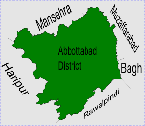
caption = Sarbhana is located in Abbottabad District
province = NWFP
district = Abbottabad
tehsil = Abbottabad
nazim = Haji Javed Khan [http://www.abbottabad.gov.pk/Union-council/UCDetailPage.asp?name=Sarbhana Sarbhana Union Council] ]
naib nazim = Gulzeb Khan
population =
coordinates =

Sarbhana is one of the 51 Union Councils of Abbottabad District in the North West Frontier province of Pakistan [ [http://www.abbottabad.sdnpk.org/adminunit.htm Administrative Units of District Abbottabad] ] .

Location

Sarbhana is located in the west of the district, it is bounded by the following Union Councils, to the north by Kakul, Kuthwal and Beerangali, to the east by Phalkot, to the south by Namli Maira, Bagnotar and Bagh, and to the west by Dhamtour (Sungli Narrian village).

ubdivisions

The Union Council is subdivided into the following areas: Aziz Bang, Desai, Khan, Sadra, Dharay, Sarbhana, Seergah ,Mohar and Narian Khurd. The top of hill village Sungli and Mohalla Trippa.

Tribes

The main tribes of this area are Gurham Zai(Golni Cheerah - a Jadoon clan) and the Malik. Shohallian (Jadoon)

References


Wikimedia Foundation. 2010.

Игры ⚽ Поможем сделать НИР

Look at other dictionaries:

  • Sarbhana — est l une des 51 subdivisions du district d Abbottabad de la province de la Frontière du Nord Ouest, au Pakistan[1]. Références ↑ (en) …   Wikipédia en Français

  • Abbottabad District — Abottabad District   District   Map of Hazara, Pakistan with Abbottabad District highlighted Country …   Wikipedia

  • Nathia Gali —   Union council   Location of Nathia Gali union council (highlighted in red) within Abbottabad district …   Wikipedia

  • Namli Maira —   Union council   Location of Namli Maira (highlighted in red) within Abbottabad district, the names of the neighbouring districts to Abbottabad are also shown …   Wikipedia

  • Dhamtour —   Union council   Dhamtore is located in Abbottabad District Coordinates …   Wikipedia

  • Nagri Totial — Nagri Tutial   Union council   Location of Nagri Tutial (highlighted in red) within Abbottabad district, the names of the neighbouring districts to Abbottabad are also shown …   Wikipedia

  • Bagnotar — Union Councils name = Bagnotar caption = province = NWFP district = Abbottabad tehsil = Abbottabad nazim =Sardar Khurshid naib nazim = Sheraz Khan Jadoon population =13500 coordinates = coord|34|7|0|N|73|20|0|E|region:PK type:rural|display=inline …   Wikipedia

  • Dewal Manal —   Union council   Dewal Manal is located in Abbottabad District Country …   Wikipedia

  • Chamhad — Chamad   Union Council   Chamad is located in Abbottabad District Coordinates …   Wikipedia

  • Chamhati —   Union Council   …   Wikipedia

Share the article and excerpts

Direct link
Do a right-click on the link above
and select “Copy Link”