- Cedar Bay National Park
Infobox_protected_area_of_Australia | name = Cedar Bay National Park
iucn_category = II
caption =
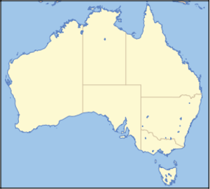
locator_x = 218
locator_y = 37
nearest_town_or_city = Cooktown
coordinates = coord|15|46|37|S|145|20|47|E|type:landmark_region:AU
area = 56.5 km²
established = 1977
visitation_num =
visitation_year =
managing_authorities = Queensland Parks and Wildlife Service
official_site = [http://www.epa.qld.gov.au/projects/park/index.cgi?parkid=170 Cedar Bay National Park]Cedar Bay is a
national park inQueensland ,Australia , 1522 km northwest ofBrisbane , and 40 km south of Cooktown and accessible only by boat or foot. The park is one of the Wet Tropics World Heritage Area series of national parks, and is a gazettedWorld Heritage site . [ cite web|url=http://whc.unesco.org/en/list/486 |title=Wet Tropics of Queensland |accessdate=2008-01-29 |publisher=UNESCO World Heritage Centre ] It is also known as Mangkal-Mangkalba [ cite web|url=http://www.epa.qld.gov.au/projects/park/index.cgi?parkid=170 |title=Cedar Bay (Mangkal-Mangkalba) National Park |accessdate=2008-01-29 |publisher=Environmental Protection Agency ] in the dialect of the local Aboriginal population, the Eastern Kuku Yalanji. [cite news | first= | last= | coauthors= | title=Aborigines Win Back Cape York Land | date=2007-04-11 | publisher= | url =http://www.theage.com.au/news/National/Aborigines-win-back-Cape-York-land/2007/04/11/1175971167963.html | work =The Age | pages = | accessdate = 2008-01-29 | language = ]History
The Cedar Bay area was developed in the 1870s for tin mining, and the remains of the tin work can still be seen in the area of Black Snake Rocks. Cedar Bay gained a degree of notoriety in the 1970s when squatters, seeking a different way of life, were evicted from the park. In 2007, the national park was part of the 2,000 square kilometres of land handed over to
Cape York 's Aboriginal population by the Queensland government. [cite news | first= | last= | coauthors= | title=Qld Govt to Hand Over Cape York Land | date=2007-04-11 | publisher= | url =http://www.theage.com.au/news/National/Qld-govt-to-hand-over-Cape-York-land/2007/04/11/1175971146752.html | work =The Age | pages = | accessdate = 2008-01-29 | language = ] The handover came as a result of a 1994Native Title claim. [cite news | first=Jessica | last=Marszalek | coauthors= | title=Aborigines Win Back Cape York Land | date=2007-04-11 | publisher= | url =http://www.news.com.au/dailytelegraph/story/0,22049,21539071-5001028,00.html | work =The Daily Telegraph | pages = | accessdate = 2008-01-29 | language = ]Activities
The park contains the northernmost
tropical rainforests in Australia. Birdwatching is a popular activity with the most common birds includingcassowaries , yellow-breasted sunbirds, double-eyed fig-parrots, mangrovekingfishers , beach stone-curlews and pied imperial-pigeons. Bush camping is permitted in the park, however fishing and collecting are prohibited. The sole walking track in the park was a former donkey track used by tin miners. It is inaccessible to all but fit walkers. [ cite web|url=http://www.epa.qld.gov.au/projects/park/index.cgi?parkid=170 |title=Cedar Bay (Mangkal-Mangkalba) National Park |accessdate=2008-01-29 |publisher=Environmental Protection Agency ]ee also
*
Protected areas of Queensland (Australia) References

Wikimedia Foundation. 2010.