- Nacoochee Mound
-
Nacoochee Mound Location 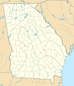

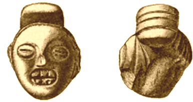
Coordinates 34°41′0.7″N 83°42′32.27″W / 34.683528°N 83.7089639°WCoordinates: 34°41′0.7″N 83°42′32.27″W / 34.683528°N 83.7089639°W Culture Woodland period, Mississippian culture Period 100 BCE to 1500 CE Country United States Region White County, Georgia 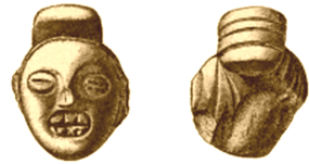 A clay effigy of a human head unearthed by the Heye Foundation expedition
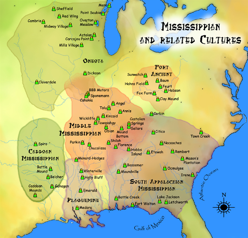
The Nacoochee Mound is a prehistoric earthen mound on the banks of the Chattahoochee River in White County, in the northeast part of the U.S. state of Georgia, at the junction of Georgia Highways 17 and 75. Nacoochee is derived from a Cherokee word that means "evening star". It is in an area of long human habitation, and was important in the Woodland and Mississippian culture periods, from 100 BCE to about 1500 CE.
The mound was excavated beginning in 1915 by a team of archaeologists sponsored by the Heye Foundation and the Bureau of American Ethnology. The team included Frederick Webb Hodge and George H. Pepper. The excavation uncovered 75 human burials, including 56 adults, seven adolescents, and four children, and eight bodies that were too degraded to be aged.[1] The burials were layered, dating from different time periods. About a third of the individuals were buried with artifacts indicative of social status, including hammered copper and stone celts, conch shell beads and cups, and elaborate Mississippian culture pottery. Some later burials included glass beads and sheet brass ornaments, indicating that these were intrusive burials of 17th century Europeans.
Archaeological evidence suggests that the area around the Nacoochee Mound, and a nearby mound site called Eastwood, served as local administrative centers in the late 15th century and early 16th centuries. There is evidence that the sites were occupied during the time when the Etowah Indian Mounds were inhabited, approximately three centuries earlier.
At one time, an unexcavated village near the mound was thought to be Nacoochee or Chota, Cherokee villages recorded during a 1715 expedition by Colonel George Chicken. These appeared on maps until the mid-18th century. Many years later, members of the Cherokee tribe used the mound as the location of their most prominent townhouse and for ceremonial rites.[1]
A historical marker at the site claims it is the "ancient Cherokee town of Gauxule, visited by Hernando de Soto in 1540." But, archaeology work in 2004 by the University of Georgia Archaeology Field School resulted in evidence that the mound and town were not occupied by Cherokee in the 16th century, if at all. Rather, the site was shown to have been significant during the earlier Woodland and Mississippian periods. Little evidence of Cherokee occupation at any time was found.[2]
Collector George Gustav Heye wrote a book about the excavation, The Nacoochee mound in Georgia, with Hodge and Pepper, which was published in 1918.[3]
The original Nacoochee Mound was partially excavated, but a reconstruction exists on the estate of former Georgia governor Lamartine Griffin Hardman, in the Nacoochee Valley in White County, two miles south of Helen. The mound is part of the Sautee Valley Historic District, which was added to the National Register of Historical Places in 1986.
References
- ^ a b "The Nacoochee Valley Indian Mound". http://www.razzgibbon.com/images/sets/2004.09.05%20-%20Nacoochee%20Indian%20Mound/Info.htm. Retrieved 2007-05-27.
- ^ "Nacoochee Revisited: The 2004 Project", Lamar Institute Reports
- ^ "The Nacoochee mound in Georgia (1918)". American Libraries. Internet Archive. http://www.archive.org/details/nacoocheemoundin00heyeiala. Retrieved 2007-05-27.
- Langford, James B., Jr. (August 8, 2002). "Nacoochee Mound". The New Georgia Encyclopedia. The Georgia Humanities Council and the University of Georgia Press. http://www.georgiaencyclopedia.org/nge/Article.jsp?id=h-584. Retrieved 2007-05-27.
See also
- List of Mississippian sites
- Mississippian culture
- Southeastern Ceremonial Complex
External links
- Nacoochee Mound, New Georgia Encyclopedia
- Folk Pottery Museum of Northeast Georgia
- Nacoochee Mound images, National Museum of the America Indian
 Pre-Columbian North America
Archaeological cultures North American pre-Columbian chronology – Adena – Alachua – Ancient Pueblo (Anasazi) – Baytown – Belle Glade – Buttermilk Creek Complex – Caborn-Welborn – Calf Creek – Caloosahatchee – Clovis – Coles Creek – Deptford – Folsom – Fort Ancient – Fort Walton – Fremont – Glades – Glacial Kame – Hopewell (List of Hopewell sites) – Hohokam – Leon-Jefferson – Mississippian (List of Mississippian sites) – Mogollon – Monongahela – Old Cordilleran – Oneota – Paleo-Arctic – Paleo-Indians – Patayan – Plano – Plaquemine – Poverty Point – Prehistoric Southwest – Red Ocher – Santa Rosa-Swift Creek – St. Johns – Steed-Kisker – Tchefuncte – Tocobaga – Troyville
Archaeological sites Angel Mounds – Bandelier National Monument – The Bluff Point Stoneworks – Cahokia – Chaco Canyon – Casa Grande – Coso Rock Art District – Eaker – Effigy Mounds National Monument – Etowah Indian Mounds – Eva – Folsom Site – Fort Ancient – Fort Center – Gila Cliff Dwellings National Monument – Holly Bluff Site – Hopewell Culture National Historical Park – Kincaid Mounds – Kolomoki – Manitou Cliff Dwellings – Marksville – Meadowcroft Rockshelter – Mesa Verde – Moorehead Circle – Moundville – Mummy Cave – Nodena Site – Ocmulgee National Monument – Old Stone Fort – Parkin Park – Pinson Mounds – Portsmouth Earthworks – Poverty Point – Pueblo Bonito – Rock Eagle – Rock Hawk – Salmon Ruins – Serpent Mound – Spiro Mounds – SunWatch – Taos Pueblo – Toltec Mounds – Town Creek Indian Mound – Winterville
Miscellaneous Ballgame – Black drink – Buhl woman – Calumet – Chunkey – Clovis point – Container Revolution – Eastern Agricultural Complex – Eden point – Effigy mound – Falcon dancer – Folsom point – Green Corn Ceremony – Horned Serpent – Kennewick man – Kiva – Metallurgy – Mi'kmaq hieroglyphic writing – Medicine wheel – Mound builders – N.A.G.P.R.A. – Norse colonization of the Americas – Piasa – Pueblo dwellings – Southeastern Ceremonial Complex – Three Sisters agriculture – Thunderbird – Underwater panther
Categories:- South Appalachian Mississippian culture
- Swift Creek culture
- Archaeological sites in Georgia (U.S. state)
- Geography of White County, Georgia
- Mounds in the United States


Wikimedia Foundation. 2010.