- Olšany (Šumperk District)
-
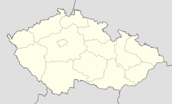
Olšany — Municipality — Coordinates: 49°57′52″N 16°51′44″E / 49.96444°N 16.86222°ECoordinates: 49°57′52″N 16°51′44″E / 49.96444°N 16.86222°E Country  Czech Republic
Region Olomouc District Šumperk Area – Total 6.47 km2 (2.5 sq mi) Elevation 324 m (1,063 ft) Population (2006) – Total 1,122 – Density 173.4/km2 (449.1/sq mi) Postal code 789 62 Website http://www.olsany.cz Olšany (German: Olleschau) is a village and municipality (obec) in Šumperk District in the Olomouc Region of the Czech Republic.
The municipality covers an area of 6.47 square kilometres (2.50 sq mi), and has a population of 1,122 (as at 28 August 2006).
Olšany lies approximately 8 kilometres (5 mi) west of Šumperk, 50 km (31 mi) north-west of Olomouc, and 176 km (109 mi) east of Prague. It lies in the valley of the Morava River at an elevation of 330 meters. In 1980, Klášterec was joined to Olšany, increasing its area to more than 6.48 km². The village lies along the road leading from Šumperk to Červená Voda.
References
Towns and villages of Šumperk District Bludov · Bohdíkov · Bohuslavice · Bohutín · Branná · Bratrušov · Brníčko · Bušín · Dlouhomilov · Dolní Studénky · Drozdov · Dubicko · Hanušovice · Horní Studénky · Hoštejn · Hraběšice · Hrabišín · Hrabová · Hynčina · Chromeč · Jakubovice · Janoušov · Jedlí · Jestřebí · Jindřichov · Kamenná · Klopina · Kolšov · Kopřivná · Kosov · Krchleby · Lesnice · Leština · Libina · Líšnice · Loštice · Loučná nad Desnou · Lukavice · Malá Morava · Maletín · Mírov · Mohelnice · Moravičany · Nemile · Nový Malín · Olšany · Oskava · Palonín · Pavlov · Petrov nad Desnou · Písařov · Police · Postřelmov · Postřelmůvek · Rájec · Rapotín · Rejchartice · Rohle · Rovensko · Ruda nad Moravou · Sobotín · Staré Město · Stavenice · Sudkov · Svébohov · Šléglov · Štíty · Šumperk · Třeština · Úsov · Velké Losiny · Vernířovice · Vikantice · Vikýřovice · Vyšehoří · Zábřeh · Zborov · Zvole
This Olomouc Region location article is a stub. You can help Wikipedia by expanding it.

