- Summerdale, Alabama
-
Summerdale, Alabama — Town — 
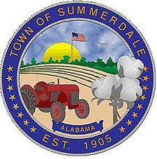
SealNickname(s): The Sunshine of Baldwin County Coordinates: 30°29′16″N 87°41′59″W / 30.48778°N 87.69972°WCoordinates: 30°29′16″N 87°41′59″W / 30.48778°N 87.69972°W Country United States State Alabama County Baldwin Incorporated 1906 Government – Mayor David Wilson Area – Total 5.2 sq mi (13.5 km2) – Land 5.2 sq mi (13.5 km2) – Water 0 sq mi (0 km2) Elevation 115 ft (35 m) Population (2000) – Total 667 – Density 125.7/sq mi (48.5/km2) Time zone CST (UTC-6) – Summer (DST) CDT (UTC-5) ZIP code 36580 Area code(s) 251 FIPS code 01-73872 GNIS feature ID 0155262 Website http://www.summerdalealabama.com/ Summerdale is a rural town in south-central Baldwin County, Alabama, United States. It is the site of the NOLF Summerdale Airport. At the 2000 census the population was 655. It is part of the Daphne–Fairhope–Foley Micropolitan Statistical Area.
Contents
Geography
Summerdale is located at 30°29'15.468" North, 87°42'4.036" West (30.487630, -87.701121).[1]
According to the U.S. Census Bureau, the town has a total area of 5.2 square miles (13 km2), all of it land.
Demographics
As of the census[2] of 2000, there were 655 people, 255 households, and 184 families residing in the town. The population density was 125.7 people per square mile (48.5/km²). There were 282 housing units at an average density of 54.1 per square mile (20.9/km²). The racial makeup of the town was 90.23% White, 4.89% Black or African American, 1.07% Native American, 0.15% Asian, 0.92% from other races, and 2.75% from two or more races. Nearly 2.29% of the population were Hispanic or Latino of any race.
There were 255 households, out of which 34.1% had children under the age of 18 living with them, 56.5% were married couples living together, 10.6% had a female householder with no husband present, and 27.8% were non-families. 23.1% of all households were made up of individuals and 8.2% had someone living alone who was 65 years of age or older. The average household size was 2.57, and the average family size was 3.04.
In the town, the population was spread out with 27.6% under the age of 18, 11.5% from 18 to 24, 28.2% from 25 to 44, 21.7% from 45 to 64, and 11.0% who were 65 years of age or older. The median age was 32 years. For every 100 females, there were 104.0 males. For every 100 females age 18 and over, there were 97.5 males.
The median income for a household in the town was $27,917, and the median income for a family was $32,159. Males had a median income of $26,563 versus $19,167 for females. The per capita income for the town was $13,775. About 13.7% of families and 16.4% of the population were below the poverty line, including 28.3% of those under age 18 and 4.9% of those age 65 or over.
Education
Summerdale is a part of the Baldwin County Public Schools system.
Summerdale has one school, Summerdale School, which serves grades kindergarten through 8. Students continue on to Foley High School in nearby Foley for grades 9 through 12. Alabama Gulf Coast Christian Academy is a private school located on the corner of County Roads 28 and 71. It serves grades Pre-K through 12.
NOLF Summerdale airport
The Navy Outlying Field (NOLF) Summerdale airport is on the east side of Summerdale (at latitude, longitude: 30.507695, –87.645541).[3] The Airport Code is NFD, in region: ASO - Southern, with boundary ARTCC: ZJX - Jacksonville, and Tie-in FSS: ANB - Anniston. The airport runway length/width is 2850 x 150 ft (868.7 x 45.7 m), with runway elevation: 149 feet (45 m).[3] The airport is owned/operated by the US Navy, through Commanding Officer, Operations Department, 7077 USS Lexington Court, Milton, FL 32570-6016.
References
- ^ "US Gazetteer files: 2010, 2000, and 1990". United States Census Bureau. 2011-02-12. http://www.census.gov/geo/www/gazetteer/gazette.html. Retrieved 2011-04-23.
- ^ "American FactFinder". United States Census Bureau. http://factfinder.census.gov. Retrieved 2008-01-31.
- ^ a b "FAA Information about Summerdale Nolf Airport", Airport-Data.com, 2004-2008, webpage: Summerdale-NOLF.
External links
Municipalities and communities of Baldwin County, Alabama Cities Bay Minette | Daphne | Fairhope | Foley | Gulf Shores | Orange Beach | Robertsdale | Spanish Fort
Towns Elberta | Loxley | Magnolia Springs | Perdido Beach | Silverhill | Summerdale
CDP Unincorporated
communitiesBarnwell | Bayside | Belforest | Blackwater | Bon Secour | Bromly | Clay City | Crossroads | Elsanor | Fort Morgan | Gasque | Houstonville | Josephine | Lillian | Magnolia Beach | Malbis | Marlow | Miflin | Montrose | Oak | Oyster Bay | Perdido | Perdido Key | Pine Grove | Pine Haven | Rabun | River Park | Romar Beach | Seacliff | Seminole | Stapleton | Stockton | Swift | Tensaw | Turkey Branch | Weeks Bay | Whitehouse Fork | Yupon
Ghost town Categories:- Towns in Alabama
- Populated places in Baldwin County, Alabama
- Populated places established in 1906
Wikimedia Foundation. 2010.


