- Ibapah, Utah
-
Ibapah — Unincorporated community — The roadway through Ibapah, September 2007 Location within the state of Utah
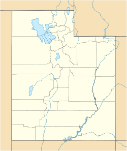
 Ibapah
Coordinates: 40°02′12″N 113°59′07″W / 40.03667°N 113.98528°WCoordinates: 40°02′12″N 113°59′07″W / 40.03667°N 113.98528°W Country United States State Utah County Tooele Settled 1859 Named for Goshute Ai-bim-pa "White Clay Water" Elevation[1] 5,282 ft (1,610 m) Time zone Mountain (MST) (UTC-7) – Summer (DST) MDT (UTC-6) ZIP code 84034 Area code(s) 435 FIPS code GNIS feature ID 1437592[1] Ibapah (pronounced /ˈaɪbəpɑː/) is a small unincorporated community in far western Tooele County, Utah, United States, near the Nevada state line. The town is located near the Deep Creek Mountains. The site was originally established in 1859 by Mormon missionaries sent to teach the local Native Americans farming methods. A Pony Express station operated here in 1860 and 1861, and the town was on an early alignment of the Lincoln Highway. A post office operated here from 1883 to 1980. Ibapah is currently inhabited mostly by the Goshute Indian tribe, with scattered farmlands and a trading post belonging to more recent settlers.
Historical populations Census Pop. %± 1860 6 — 1880 174 — 1890 117 −32.8% 1900 353 201.7% 1910 256 −27.5% 1920 120 −53.1% 1930 152 26.7% 1940 133 −12.5% 1950 70 −47.4% Source: U.S. Census Bureau[2] Originally named Deep Creek for a creek of the same name in the area, the name was later changed to Ibapah, an anglicized form of the Goshute word Ai-bim-pa which means "White Clay Water".[3]
The town is isolated and is usually reached by going out of Utah into Nevada and back into Utah. The climate is typical of that of a high elevation Great Basin location.
References
- ^ a b U.S. Geological Survey Geographic Names Information System: Ibapah, Utah. Retrieved May 19, 2011.
- ^ "Census of Population and Housing". U.S. Census Bureau. http://www.census.gov/prod/www/abs/decennial/. Retrieved October 20, 2011.
- ^ Van Cott, John W. (1990). Utah Place Names. Salt Lake City, Utah: University of Utah Press. p. 197. ISBN 0-87480-345-4.
Municipalities and communities of Tooele County, Utah Cities 
Towns Ophir | Rush Valley | Stockton | Vernon
CDPs Dugway | Erda | Stansbury Park
Unincorporated
communitiesBurmester | Ibapah | Lake Point
Ghost towns Categories:- Utah geography stubs
- Populated places in Tooele County, Utah
- Unincorporated communities in Utah
- Populated places established in 1859
- Pony Express stations


Wikimedia Foundation. 2010.