- Mesonet
-
In meteorology, a mesonet is a network of automated weather stations designed to observe mesoscale meteorological phenomena. Dry lines, squall lines, and sea breezes are examples of phenomena that can be observed by mesonets. Due to the space and time scales associated with mesoscale phenomena, weather stations comprising a mesonet will be spaced closer together and report more frequently than synoptic scale observing networks, such as ASOS. The term mesonet refers to the collective group of these weather stations, and are typically owned and operated by a common entity.
The distinguishing features that classify a network of weather stations as a mesonet are station density and temporal resolution. Depending upon the phenomena meant to be observed, mesonet stations will have a spatial spacing of 2 to 40 km[1] and report conditions every 1 to 15 minutes.
Contents
Why mesonets?
Thunderstorms, squall lines, dry lines, and other mesoscale phenomena can cause weather conditions in a localized area to be significantly different from that dictated by the ambient large-scale condition. As such, meteorologists need to understand these phenomena in order to improve forecast skill. Observations are critical to understanding the processes by which these phenomena form, evolve, and dissipate.
The long-term observing networks (ASOS, AWOS,COOP), however, are too sparse and report too infrequently for mesoscale research. ASOS and AWOS stations are typically spaced 50 to 100 km apart and report only hourly on most occasions. The Cooperative Observer Program (COOP) database consists of only daily reports. "Mesoscale" weather phenomena occur on spatial scales of tens to hundreds of kilometers and temporal (time) scales of hours. Thus, an observing network with finer temporal and spatial scales is neede for mesoscale research. This need led to the development of the mesonet.
How do mesonets work?
Mesonets were born out of the need to conduct mesoscale research. The nature of this research is such that mesonets, like the phenomena they are meant to observe, are short-lived. Long term research projects and non-research groups, however, have been able to maintain a mesonet for many years. For example, the U.S. Army Dugway Proving Ground in Utah has maintained a mesonet for many decades. The research-based origin of mesonets has led to the characteristic that mesonet stations tend to be modular and portable, able to be moved from one field program to another.
Whether the mesonet is temporary or semi-permanent, each weather station is typically independent, drawing power from a battery and solar panels. An on-board computer takes readings from several instruments measuring temperature, humidity, wind, soil temperature, and atmospheric pressure (or any other environmental variable deemed important to the mission of the mesonet). The computer periodically saves these data to memory and transmits the observations to a base station via radio, telephone, or satellite transmission. Advancements in computer technology and wireless communications in recent decades has made possible the collection of mesonet data in real-time. The availability of mesonet data in real-time can be extremely valuable to operational forecasters as they can monitor weather conditions from many points in their forecast area.
History
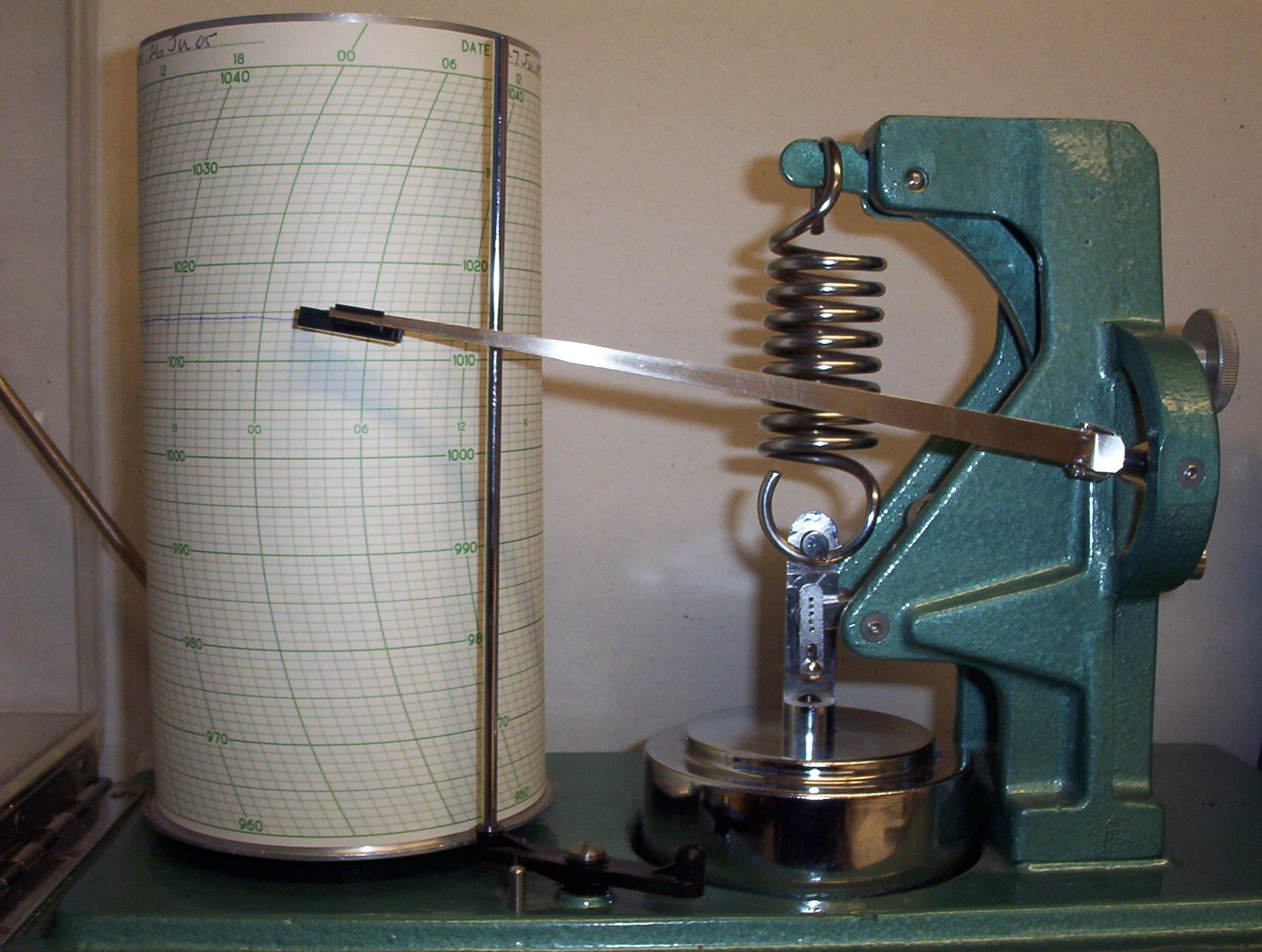
 Three day barograph of the type used by the Meteorological Service of Canada
Early mesonets operated differently than modern mesonets. Each constituent instrument of the weather station was purely mechanical and fairly independent of the other sensors. Data were recorded continuously by an inked stylus that pivoted about a point onto a rotating drum covered by a sheath of graphed paper called a trace chart, much like a traditional seismograph station. Data analysis could occur only after the trace charts from the various instruments were collected.
One of the earliest mesonets operated in the summer of 1946 and 1947 and was part of a field campaign called The Thunderstorm Project.[2] As the name implies, the objective of this program was to better understand thunderstorm convection.
Examples
The following table is an incomplete list of mesonets that have operated in the past and present.
Last Year Operated Name of Network, Place Spacing (miles) No. of Stations Objectives 1946 The Thunderstorm Project, Florida 1 50 thunderstorm convection 1947 The Thunderstorm Project, Ohio 2 58 thunderstorm convection Present Dugway Proving Ground, Utah 9 26 air quality modeling Present Weatherbug (AWS), across United States Varies 7,809 real-time observation Present Oklahoma Mesonet, Oklahoma Varies 121 real-time observation Present Iowa Environmental Mesonet, Iowa Varies 469* archive, real-time observation Present Kentucky Mesonet, Kentucky Varies 45 archive, real-time observation Present QuantumWeather Mesonet, Missouri 15km 100 archive, real time observation Present North Carolina ECONet, North Carolina Varies 37 archive, real-time observation *Not all stations owned by network.
See also
External links
- AMS Glossary definition of portable meteorological mesonet
- The Oklahoma Mesonet
- Iowa Environmental Mesonet
- Kentucky Mesonet
- MesoWest
- North Carolina Mesonet (ECONet)
References
- ^ Fujita, Tetsuya. "A Review of Researches on Analytical MesoMeteorology, Research Paper #8, February 1962
- ^ Overview of The Thunderstorm Project
Categories:- Meteorological data and networks
- Mesoscale meteorology
Wikimedia Foundation. 2010.