- Digbeth Branch Canal
-
Digbeth Branch Canal (BCN) Legend


Aston Junction, Aston locks (8) Birmingham and Fazeley Canal 
Start of Digbeth Branch Canal 
Love Lane Lister Street 
Footbridge (Heneage Street) 
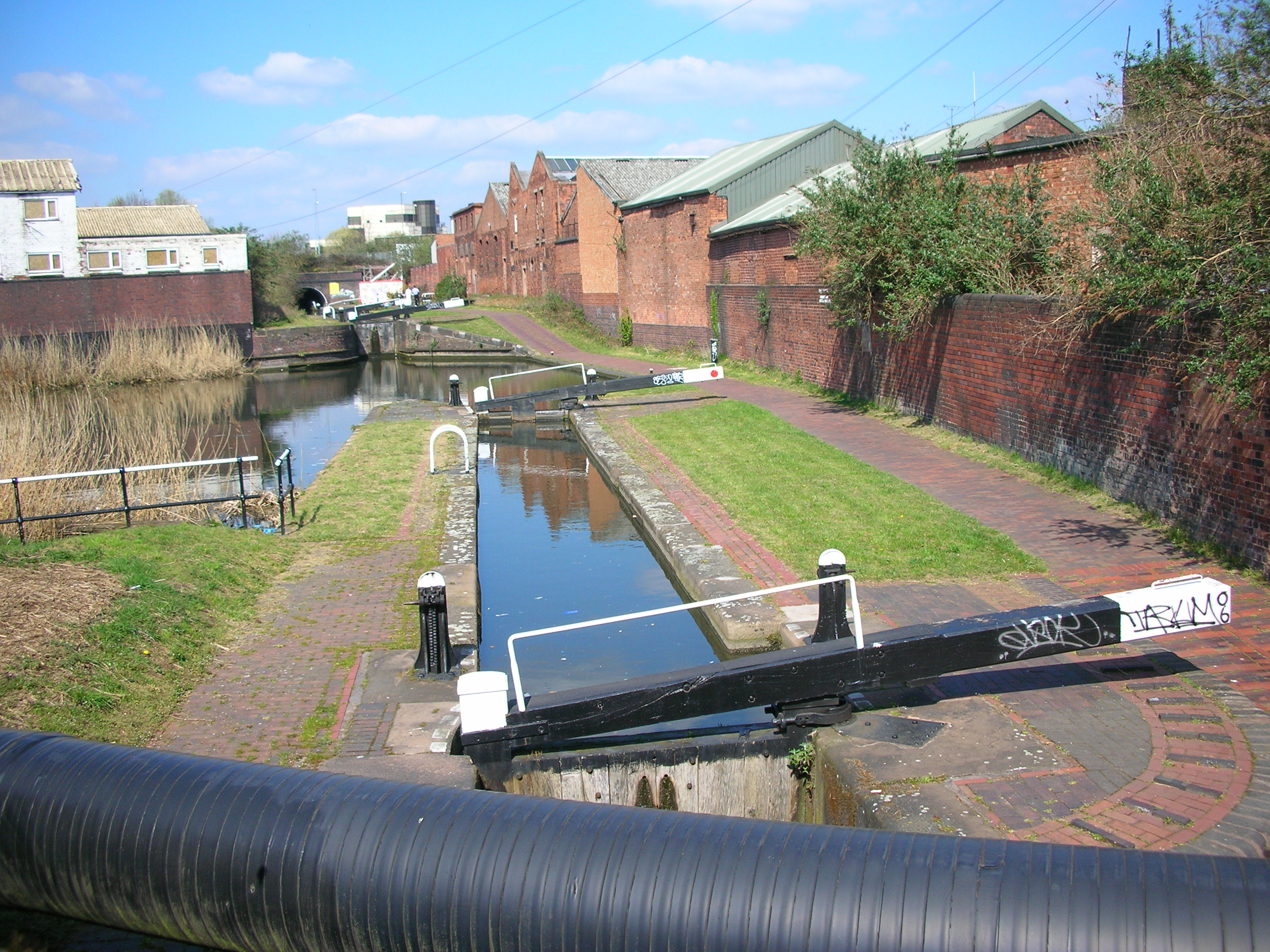
Ashtead Top Lock 
Ashtead Tunnel, A47 road (Jennens Road) Belmont Row 
Curzon Street Ashtead Bottom Lock 
Tunnel 

Curzon Street railway station, dismantled railway line 


West Coast Main Railway Line (Proof House Rail Junction) 

Birmingham Proof House 

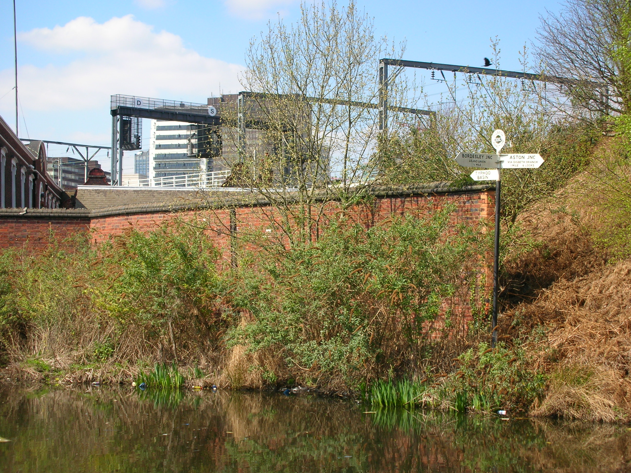
Typhoo Basin, Digbeth (Proof House) Junction 
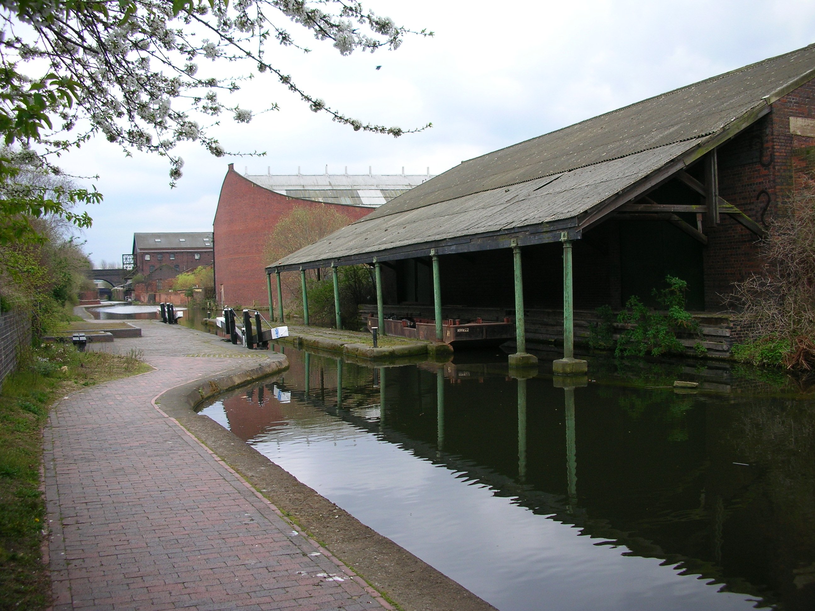
Banana warehouse, Warwick Bar stop lock 
Fellows Moreton Clayton warehouse 
Granville Wharf (The Bond, Ice House) 
Aqueduct over River Rea Disused railway viaduct Great Barr Street End of Digbeth Branch Canal 
Bordesley Junction, Grand Union Canal (to Salford Junction) 
Grand Union Canal (to Warwick), Camp Hill Locks (6)  Aston Junction. The Digbeth Branch Canal begins, top right.
 Locks on the Digbeth Branch
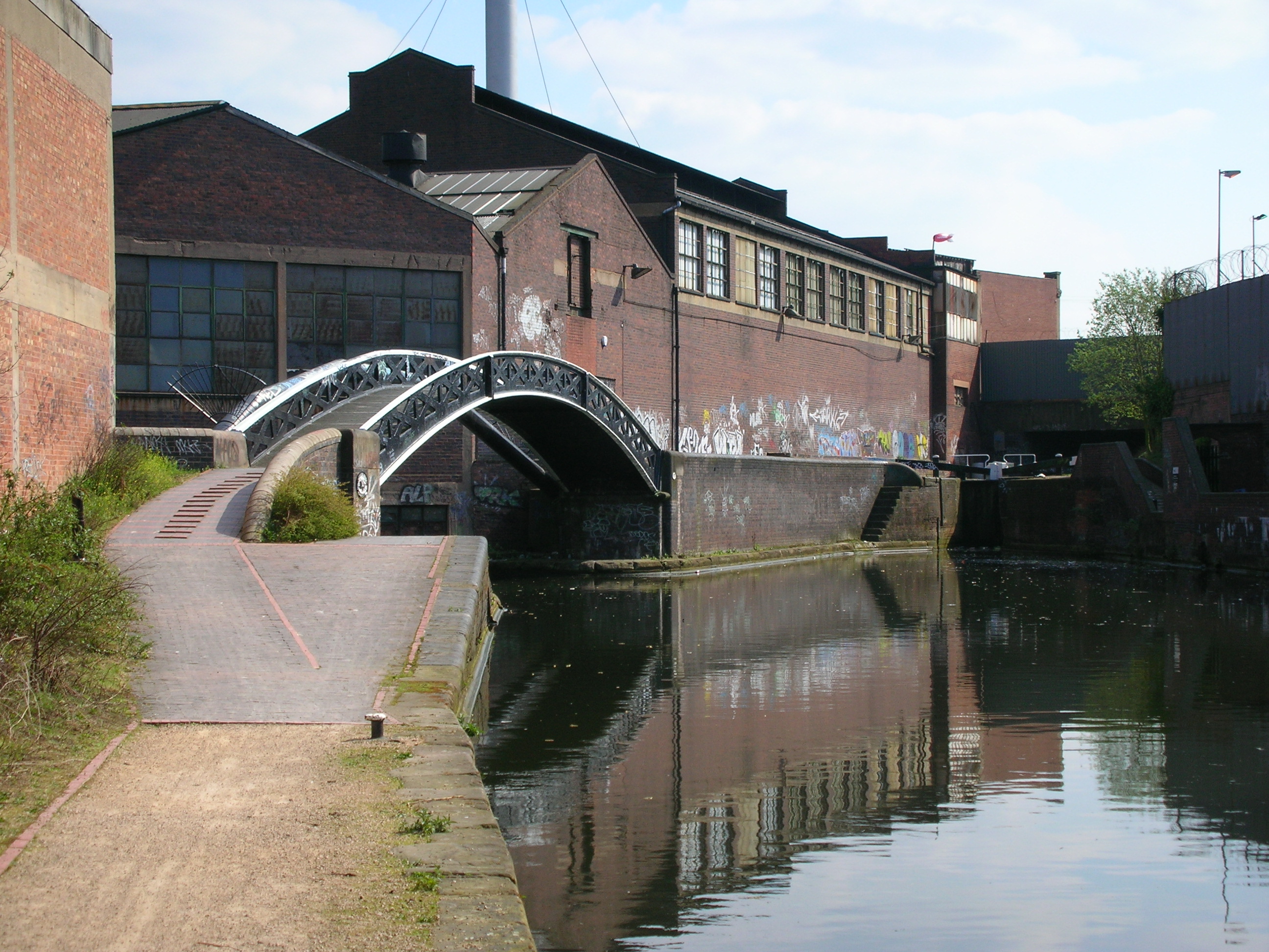
 Proof House Junction
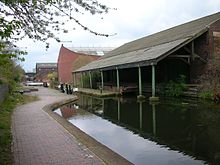 The Warwick Bar stop lock and Banana Warehouse
 Bordesley Junction
The Digbeth Branch Canal in Birmingham, England is a short canal which links the Birmingham and Fazeley Canal at Aston Junction and the Grand Union Canal at Digbeth Junction (or historically, at the adjacent Warwick Bar) in Digbeth.
Built under the Birmingham Canal Act 1768 and completed in 1799 the Digbeth Branch of the Birmingham Canal Navigations took traffic from the Birmingham and Warwick Junction Canal and the Warwick and Birmingham Canal (now both part of the Grand Union Canal) towards the Worcester and Birmingham Canal at the Worcester Bar (Gas Street Basin).
The 1¼ mile long canal canal has six locks leading down from Aston Junction. It passes through a grade II listed tunnel at the east of Curzon Street railway station (originally carrying the main lines from it) and under the viaduct of today's eastbound railway line from New Street station. It then originally met the Birmingham and Warwick Junction Canal at the Warwick Bar stop lock just to the rear of Birmingham Proof House, at which there is a short branch to the Typhoo Basin. The junction is called Digbeth Junction or Proof House Junction. It has a total fall of 40 feet.
All of the canal between Ashted Lock at Jennens Road (formerly the A47) and Great Barr Street (Bordesley) is within the Warwick Bar Conservation Area.
Contents
Features
Point Coordinates Aston Junction 52°29′25″N 1°53′19″W / 52.49020°N 1.88850°W Ashted Lock 52°29′11″N 1°53′02″W / 52.48625°N 1.88401°W Ashted tunnel North portal 52°28′55″N 1°52′55″W / 52.48187°N 1.88191°W Ashted tunnel South portal 52°28′51″N 1°52′59″W / 52.48080°N 1.88295°W Railway viaduct 52°28′51″N 1°53′04″W / 52.48082°N 1.88451°W Proof House Junction 52°28′49″N 1°53′03″W / 52.48028°N 1.88411°W Warwick Bar 52°28′47″N 1°53′00″W / 52.47985°N 1.88338°W River Rea 52°28′44″N 1°52′55″W / 52.47897°N 1.88192°W Great Barr Street 52°28′40″N 1°52′48″W / 52.47783°N 1.87996°W Bordesley Junction 52°28′32″N 1°52′38″W / 52.47565°N 1.87719°W References
- Perrott,David; Mosse,Jonathan (2006). Nicholson Waterways Guide 3 - Birmingham & the Heart of England. Collins. ISBN 978-0-00-721111-1.
- Priestly, Joseph (1831). Historical Account of the Navigable Rivers, Canals, and Railways, Throughout Great Britain. Longman, Rees, Orme, Brown and Green.
See also
- Canals of Great Britain
- History of the British canal system
External links
Categories:- Transport in Birmingham, West Midlands
- Visitor attractions in Birmingham, West Midlands
- Birmingham Canal Navigations
- West Midlands (county) geography stubs

Wikimedia Foundation. 2010.